Tuesday, 25 November 2025
Returning to walk the Hai Ya District of Chiang Mai
The Hai Ya district of Chiang Mai lies south of the old walled city. This is an area where many silversmiths settled and still work. Since the cold I have had is easing, and the day is warm but not hot, I went for a walk to the Hai Ya district. Part of my motivation was to see the progress on the reclamation and improvement of the Klong Mae Kha, the canal/creek outside the Kamphaengdin. The Kamphaengdin is a second wall, made of earth and clay, that was built in the 1400s or early 1500s to protect the population that had grown beyond the walled city to the south and east.
I’ll take photos of various temples and landmarks as I pass, but I won’t go onto the temple grounds, and thus, will not go into much detail about the temples in this post. Many of these temples I have covered in detail in past blog posts and will probably do so in future blog posts when I stop to visit the temples.
Wat Chang Taem
I’m walking south down Prapokkloa Road, and the first landmark I pass is See You Soon, the restaurant/shop owned by Ice and has husband, Ball. Ice, Poppy, and Uhey are the three sisters of the “The 3-Sis” guesthouse name where I stay every winter. And there are 6 rooms above See You soon, so I’ll stay with them for the last two weeks of my winter here. I think all the properties are owned by the family. Having been a guest for 13 years, I know the whole family. I see the parents almost every day at 3-Sis. They do not speak English, but they know me; they are very nice people.
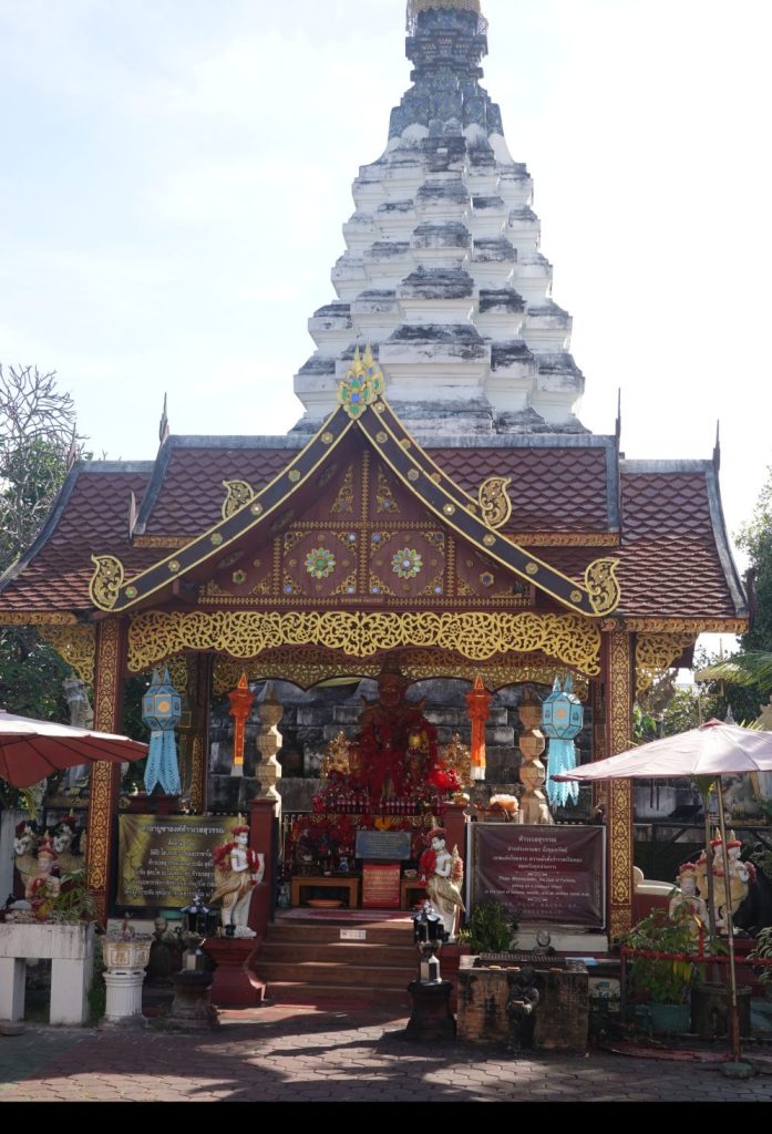
Right by See You Soon is Wat Chang Taem, a small but important temple. Its name means “10,000 drops of rain,” and it is where the Fon Saen Ha Buddha resides. Wat Chang Taem plays a central role in the annual Lak Mueang festival or Inthakhin Festival, when the Chiang Mai city pillar, which is kept in Wat Chei Luang, is venerated. This festival takes place in May or June each year and includes the Fon Saen Ha Buddha.
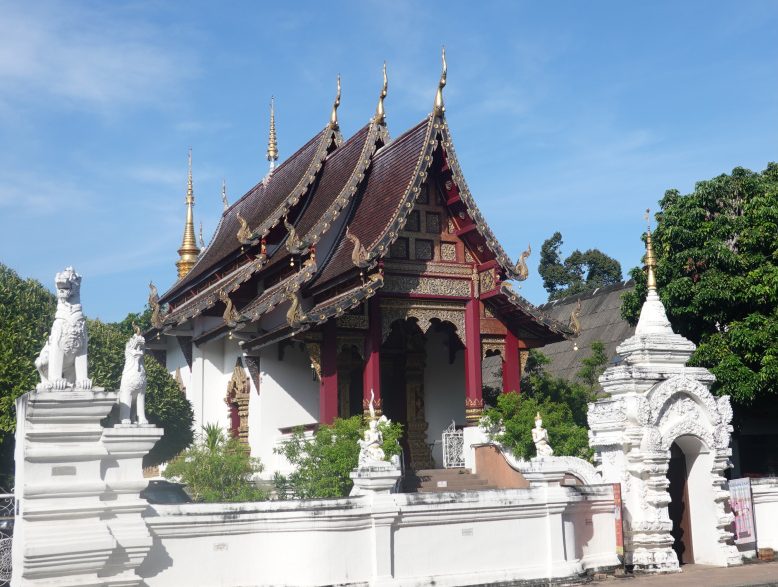
Wat Muen Tum
A little further down the street is Wat Muen Tum. This is a very typical Lanna-style temple with a viharn (assembly or worship hall), a ubosot (ordination hall), a ho rakang (bell tower), and a chedi. From Prapokkloa Road, looking in through the recently enhanced entrance, the chedi is first seen. Buddhist temples are almost always built to a set of religious and cultural standards. The viharn is oriented east-west with the entrance doors opening to the east to greet the rising sun. The west side, on the setting sun side, is where the chedi is located. During the rebuilding of the entrance, a worship area was added by the chedi, so that is what is seen through the new entrance.
Wat Chet Lin
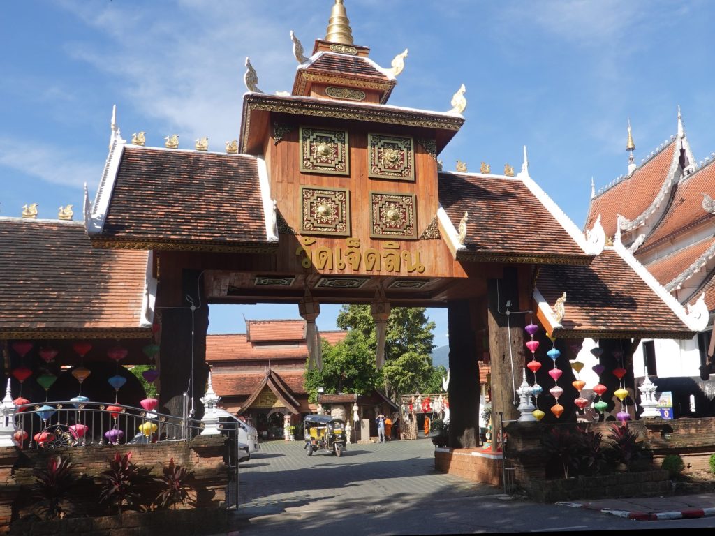
Further down Prapokkloa Road is Wat Chet Lin (or Wat Jed Lin or Wat Nong Chalin) is a beautiful, serene temple beside a lake with lotus flowers and lily pads. Once inside the temple grounds and by the lake, it’s hard to imagine you’re in the middle of Chiang Mai. The entrance was rebuilt three years ago and is now very large and dramatic. For the end-of-year holidays, a labyrinth is often constructed in the parking lot, different every year.
Wat Fon Soi
Finally getting close to leaving old Chiang Mai city, but there is one more temple, Wat Fon Soi. The old walled city of Chiang Mai is about 1550 by 1600 meters, almost square (close to 1 mile square), and in that relatively small area are at least 50 temples. I have probably visited all of them over the many winters I have been here; I am not even sure of that.
Wat Fon Soi is a small temple, with a viharn, a chedi, and a bell tower. I have not found any indication of how old this temple is. Recently, it has undergone a makeover as the viharn and chedi now very clean and white. The doors to the viharn are always closed, so I have never seen the inside. Right behind Wat Fon Soi (to the west) is Wild Rose Yoga, where I practice yoga when I am here in Chiang Mai. For some reason, I did not take a photo of Wat Fon Soi today.
Continuing south, through Chiang Mai gate, across the busy outer-moat road, and into the Hai Ya district.
Motorcycles, motorcycles, motorcycles
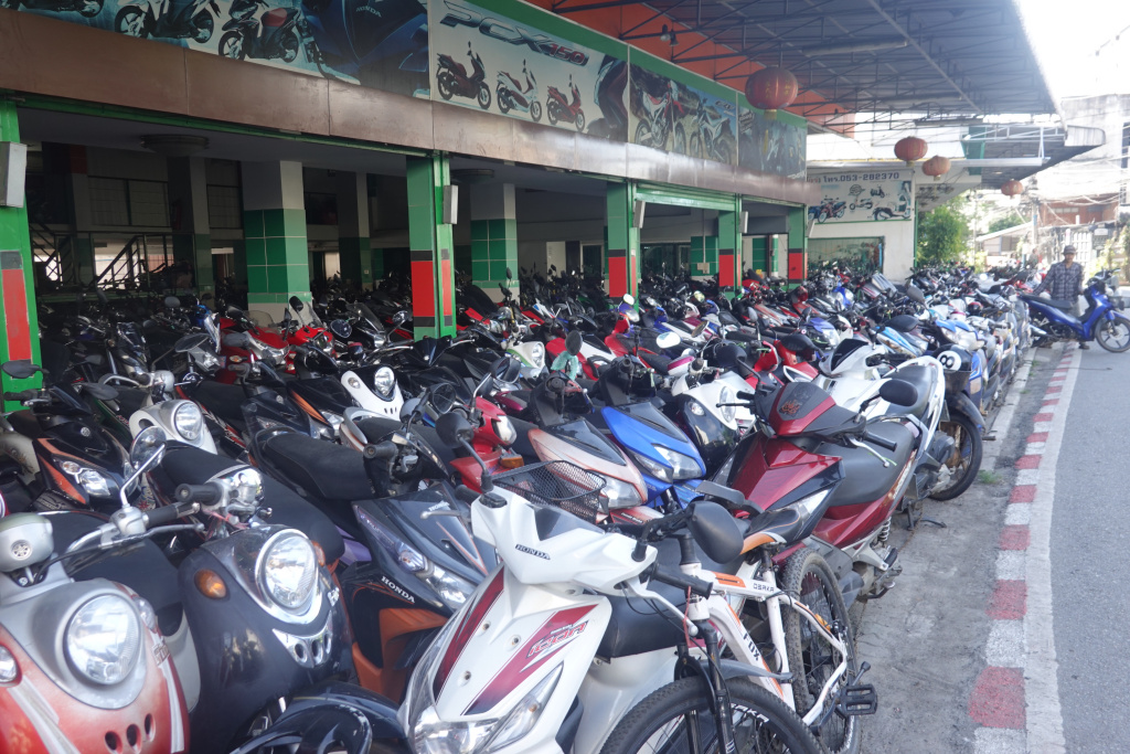
For this walk, I’ll continue straight south on a road named Suriyawong Alley. Perhaps it was once an alley, now it is a moderately busy road. The first landmark I pass is a medium-sized motorcycle shop. There are many motorbikes here, and there are many of these around town. Over the years, I have not seen even one car dealership, not surprising, this is a motorcycle culture.
Further down the “alley” is an unnamed, standalone chedi, larger than many. There are many of these around Chiang Mai, both inside the old city and outside. When a temple is abandoned for whatever reason, the chedi is left as it contains the ashes of someone, likely someone important at the time. It would be disrespectful to take down the chedi. I have searched for information about this chedi to no avail. I love the style of this chedi and its rustic look.
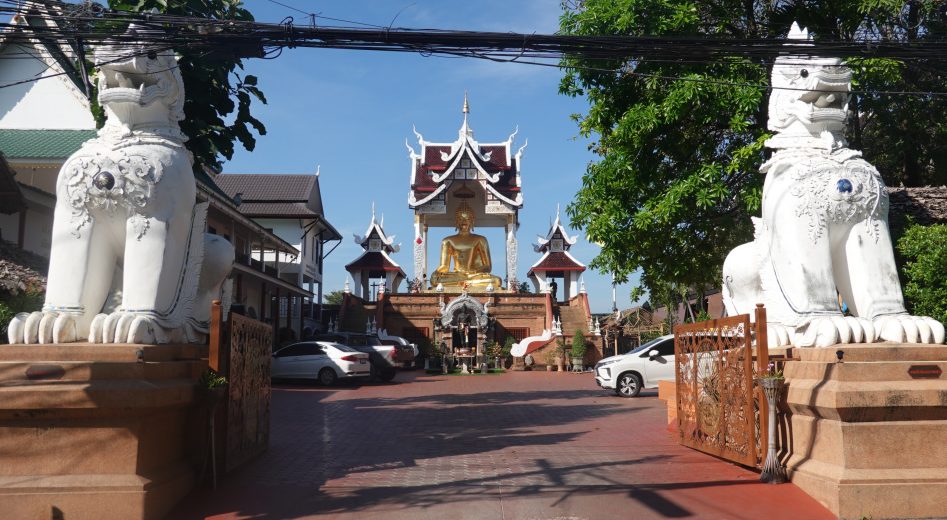
Wat Thatkam
Across the “alley” and just a little further is Wat Thatkam. At this temple is the ancient “Silver Buddha” image, housed in a special small pavilion. In all the years I have stopped at this temple, that pavilion holding the Silver Buddha has been closed. Some day I’ll see it. Not today – I’m not stopping except to take a photo from the outside. And today, the pedestrian doors are also closed.
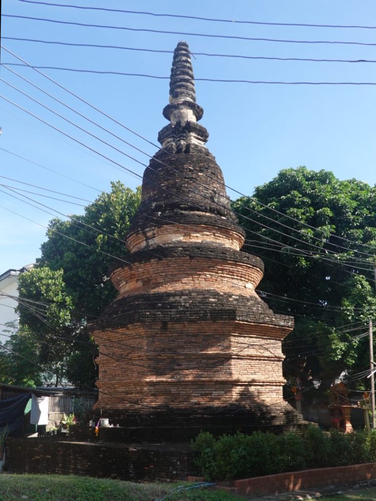
Wat That Klang
A little farther south from Wat Thatkam is another standalone chedi, but this one has a sign and a name, Wat That Klang. “That” is a type of chedi or stuppa, and “Klang” means “middle.” Wat That Klang is not in the middle of Chiang Mai, but it is midway between Chiang Mai Gate and “Pratu Khudkum,” which translates to “small bridge gate.” (“Pratu” translates to “gate” as Pratu Chiang Mai is what the Thais call Chiang Mai Gate.) Khudkum Gate was a gate in the Kamphaengdin the earth and clay second wall, built in the late 1400s or early 1500s to protect the people living outside the original walled city. No other information has been found about the original temple at this site in historical records.
Near the bottom of the sign reads, “At present there is only one Sukhotha chedi (of the Phum Khao Bin type) left in the area. The double [words unreadable] situated on a double rabbeted lotus base and features a bell shaped structure with a spire. It is the only remaining chedi dating after the 16th century that reflects the art and architecture of the Sukhothai artistic style in the Lanna area.
I love this chedi for its significance and its rustic look. (And as you can see, the sign on the lower right is very weathered and very difficult to read.

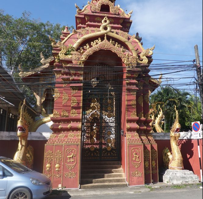
Wat Yang Guang
This temple has a similar history to that of others in the area. Historical records suggest that it was probably built in the King Mengrai era. King Mengrai, the founder of Chiang Mai, and the first king of the Mengrai Dynasty, ruled the Lanna kingdom from 1292 to 1311.
When the Burmese invaded the area, most of the Hai Ya area of Chiang Mai was abandoned, as well as the temples. From an article in the Chiang Mai City News in 2017, “In 1796 when King Kawila liberated Lanna kingdom, Tai Khun who immigrated from Kengtung and settled in around that area, rebuilt the temple and named it Yang Guang in remembrance of their hometown Ban Na Yang Guang of Kengtung.”
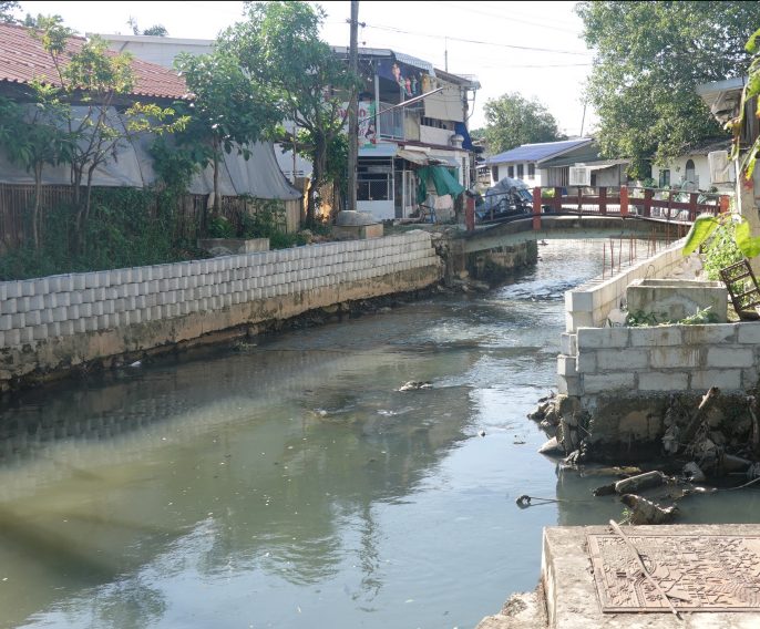
Klong Mae Kha
The Klong Mae Kha is a large creek draining much of the area of Chiang Mai east and south of the old walled city. When the second, earth and clay wall, the Kamphaengdin, was constructed, it was built just inside the Klong Mae Kha so the klong acted as a smaller moat. Over generations, the klong became dirty, filled with trash, and in parts, pretty ugly. It remains an important drainage creek in the rainy season.
Just before the pandemic, a section of the klong from about Rangang Road almost to Suriyawong Alley was cleaned up, sidewalks installed along the sides, lights installed and people living along the klong started selling crafts, and food. The Klong Mae Kha is now a very trendy spot for photographs for social media.
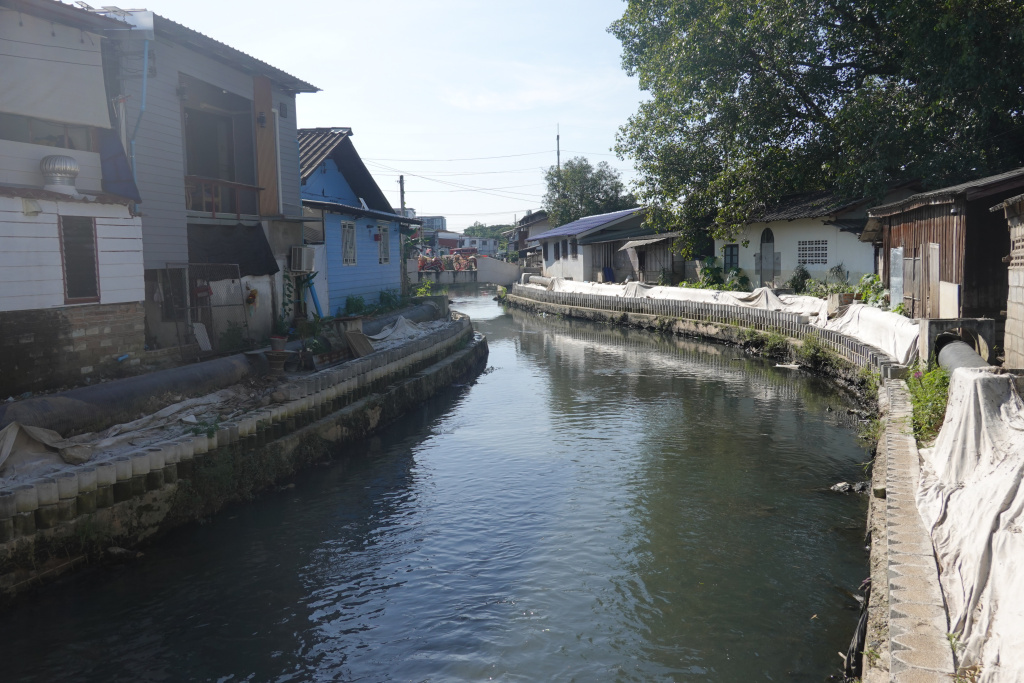
Last year as I walked further, exploring the Kamphaengdin, I saw that the cleanup and improvements of the Klong Mae Kha was being extended. A good part of my motivation for today’s walk was to see how far along that infrastructure improvement has come. Compared to last year, much work has been done, and much more is yet to be completed. I was told that the longer-than-normal rainy season slowed the project.
Here are two photos, the first looking from the end of the already-improved section, and the second looking from the same place to the section under renovation.

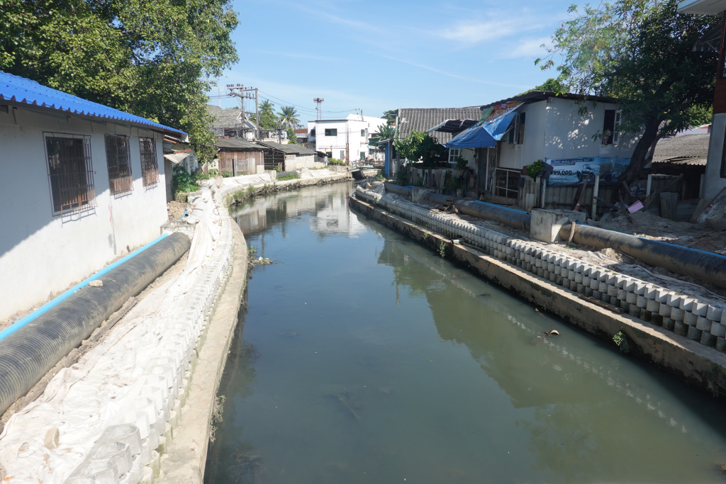
Walking farther south, here are two more photos of the project in progress. Pipes need to be buried, sidewalks installed, and more. But much progress has been made.
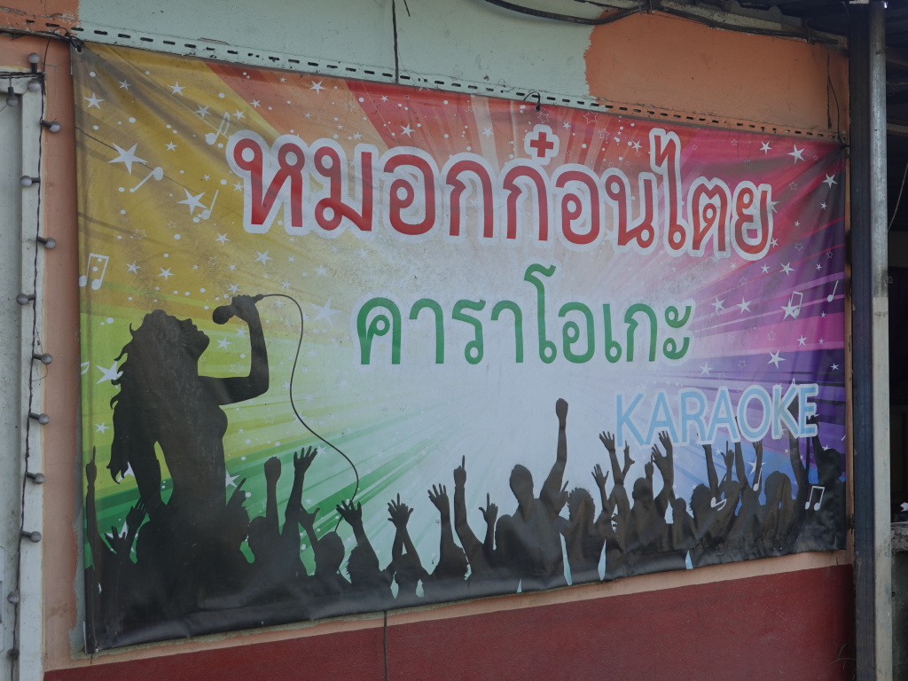
Si Ping Muang Road Soi 4
I have walked along this road before, but never at night. This is an area of many karaoke places popular with Thai men. They go there to drink with and hang out with Thai ladies. Similar karaoke places in the tourist area were notorious for dramatically over-charging foreigners. Most of those have been closed, but I have seen two new ones along the east side of the moat this year. I have heard that this area is all lit up and “hopping” at night. Someday I’ll take a ride through here just to see it. Here are two of the signs as I passed the now closed karaoke places:

With that, I continued walking west, then north along Wua Lai Road back to Chiang Mai Gate and “home” to The 3-Sis. A nice walk of about 6 kilometers (3.7 miles) in a beautiful Chiang Mai day.
Next: Wat Chedi Luang and Wat Pan Tao
