Monday, November 17, 2025
Walk Around the Moat 1: East and South
I am back in Chiang Mai for my 13th winter here. I arrived on Sunday, November 16, after leaving Bangkok without any emergency hospital visits, unlike last year. I am writing this entry on Wednesday. In my past 12 winters in Chiang Mai, I experienced exactly one day of rain…not 0, not 2 or more, but only one. Today is the third day of rain in a row, so the streak of one day of rain has ended. Monday, the rain came after I made a long walk around the circumference of the moat, and it rained off and on much of Tuesday, and so far, all of today. The weather forecast suggests that the rain will end by sunset, and the days ahead will be dry. After all, this is the dry season, so I am hopeful. I have come down with a cold, so the gray skies echo my mood as I have less-than-normal energy. This little dip in my health makes me very grateful for being generally healthy, fit, and energetic almost all the time.
I am separating this entry into three to keep the post short, at least shorter than it would otherwise have been. On this walk around the circumference of the moat, I photographed the infrastructure itself, and places I frequent or are well-known to me. I won’t go into the historical significance of everything, as I have covered much of that in previous entries over the years, but I will give an overview where appropriate.
Chiang Mai City Moat
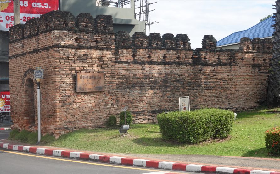
Chiang Mai was built by King Mengrai in 1296 as a walled city with a moat around the wall. The wall/moat is approximately 1550 by 1600 meters, almost square. Much of the wall was taken down by the Japanese when they occupied much of Thailand during World War II to use the bricks to pave the road north towards Pai to move military equipment. In the 1960s, the four corners and five gates were restored and refurbished again in the late 1980s and early 1990s using historical drawings and photographs. The wall and moat enclosed the city, and it gradually grew beyond the walled enclosure. In the 1400s or later, I have read that only monks and teachers lived inside the walled city, and the people lived outside. Here is a photograph of part of the wall and moat taken in the early 1900s, showing an almost fully intact, although deteriorating, wall. The map is from 1904, showing clearly the square of the wall/moat.


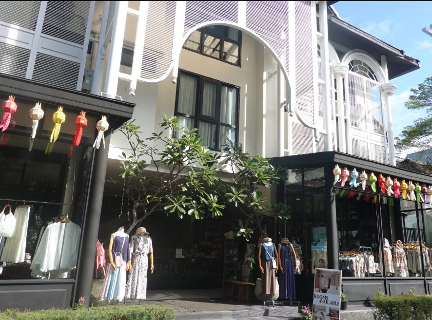
The 3-Sis Guest House (so named because it is owned by 3 sisters), where I stay every year, is practically right in the middle of the old city. Here is a map of my walk with the start and end points at The 3-Sis, and also a photo of the entrance to The 3-Sis. The green dot and checkered flag on the map indicate the start and end of my walk.

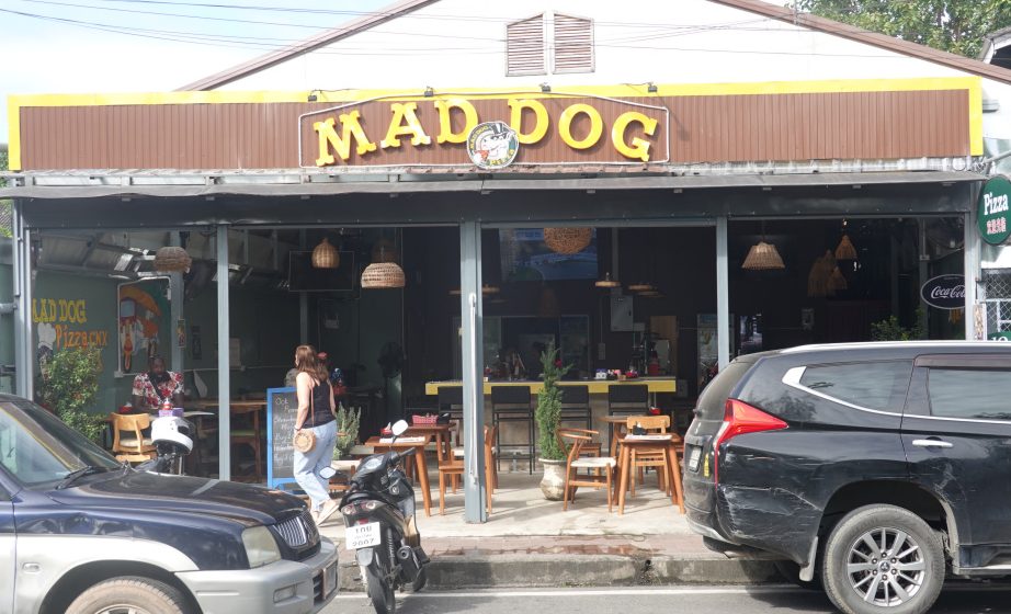
Mad Dog and Bear Wash
Mad Dog, formerly called Mad Dog Farang Food (“farang” is a Thai term for a European or American foreigner) is said to be the first place in Chiang Mai where expats (or anyone) could get familiar, western-style food, like hamburgers, ham & cheese sandwiches, pizza, and many other things. I eat there occasionally, and the servers remember me. Last January, a fire completely destroyed Mad Dog. I had heard that they had rebuilt and was happy to see them open when I walked by.
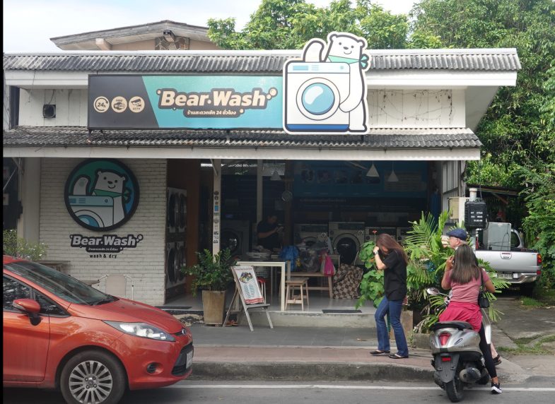
Almost next door to Mad Dog is Bear Wash, a laundromat. When I first started coming to Chiang Mai, there were only one or two laundromats in the old city. Since then, many have sprung up. Better yet, I can leave a bag of clothes with the lady who works there, and for 100 baht (about $3), they will be washed, dried, and folded for me in two or three hours. I could leave my clothes at The 3-Sis, but they are not always ready at the end of the day. Bear Wash is easy to get to, reliable, and the ladies who work there remember me.
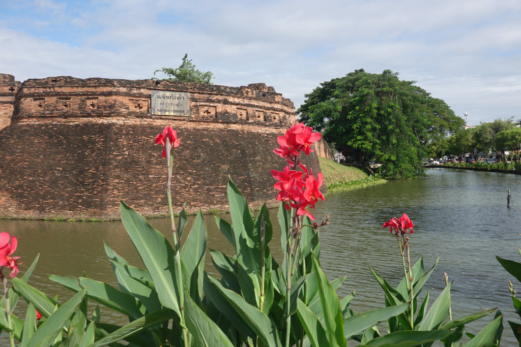
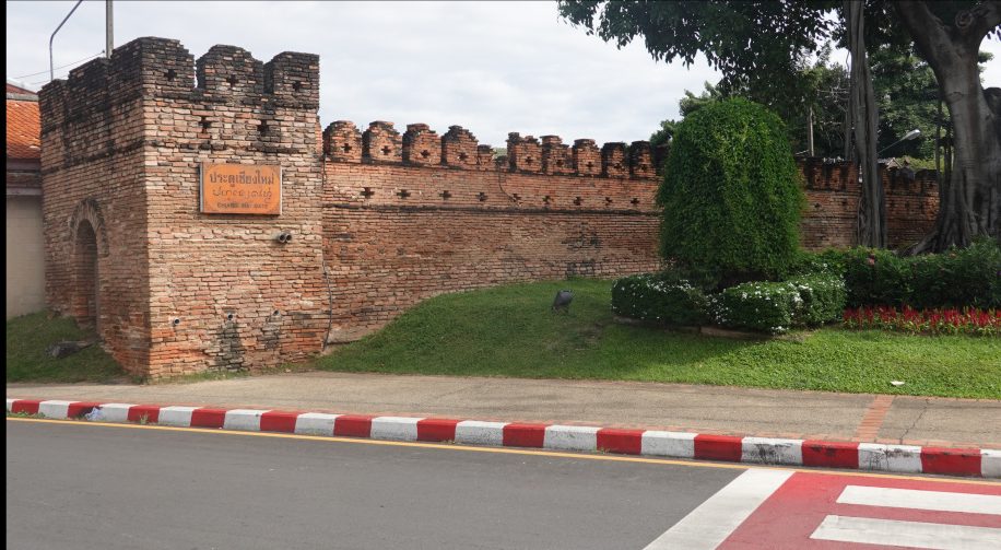
Katum Corner
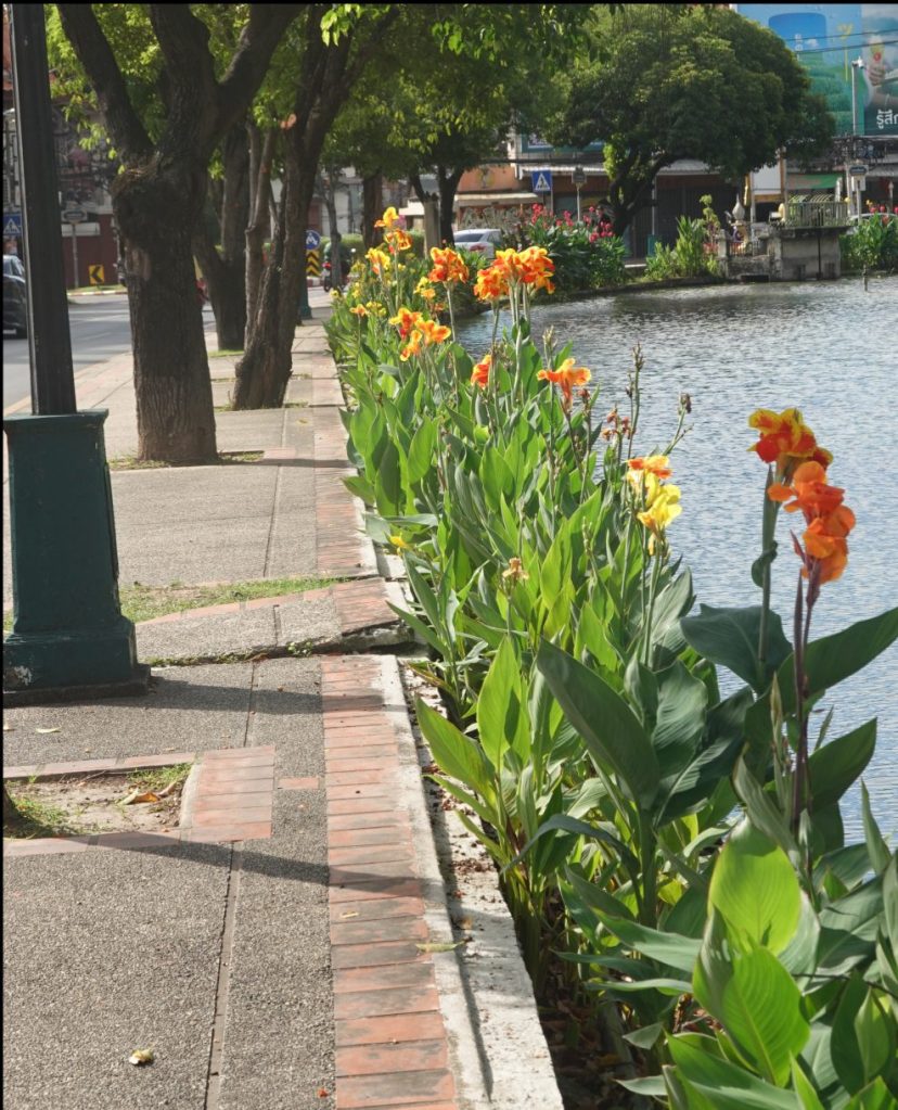
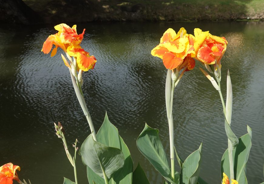
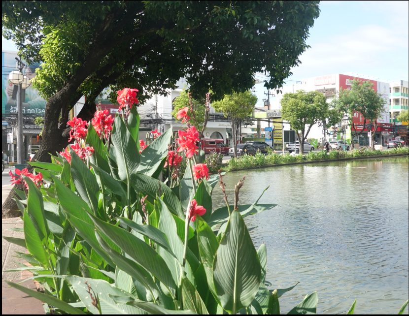
Water does flow through the moat. It enters at the northwest corner and exits at the southeast corner. Today, the entrance and exits are underground, but long ago, the exit was into a creek. People would catch fish there using a bamboo trap called a “katum,” giving Katum Corner its name. As I approached Katum Corner, I took a few photos of the flowers along the moat.
And then there is Katum Corner itself, and a photo of the moat looking west from the corner.
Chiang Mai Gate
There were two gates on the south side of the wall. Chiang Mai gate was the main gate for people who lived outside the walled city. Here is a photo of part of Chiang Mai Gate as I passed by.
Walking westward along the south side of the moat, I passed Pump Fitness, where I will be doing strength training twice a week with my trainer, Ning.

Walking further to the west, I passed the second gate on the south side, Saen Pung Gate. This gate was added in the 1500s by the queen at the time, who had a residence outside the wall. She wanted a direct route into the city to supervise the completion of the large chedi at Wat Chedi Luang. Much later, this was the gate from which cadavers were moved out of the walled city for cremation. Today, some Thai people think there are bad spirits at Sean Pung Gate and avoid it.
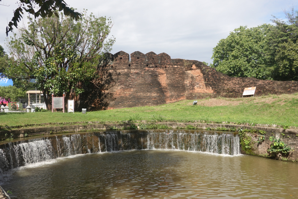
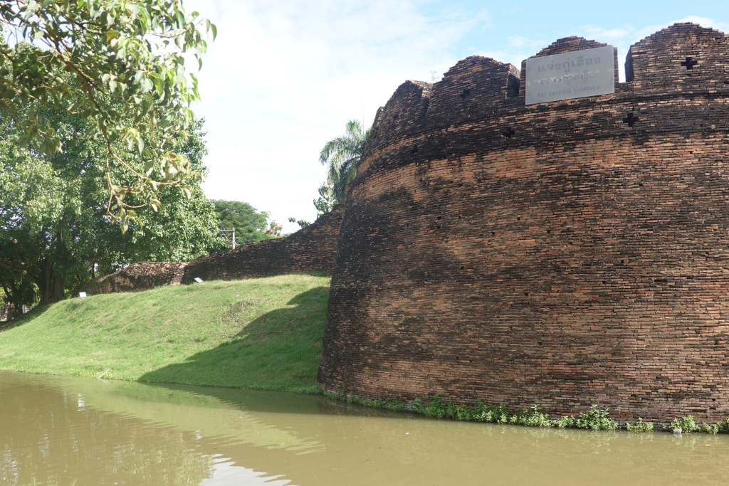
Approaching Ku Huang Corner, the southwest corner of the old city wall, the structure is large, unlike the much smaller Katum Corner.
And a view of Ku Huang Corner facing it directly.
Next: Around the Moat 2: West
