Thursday 9 January 2025
Revisiting a large remaining part of the Kamphaengdin
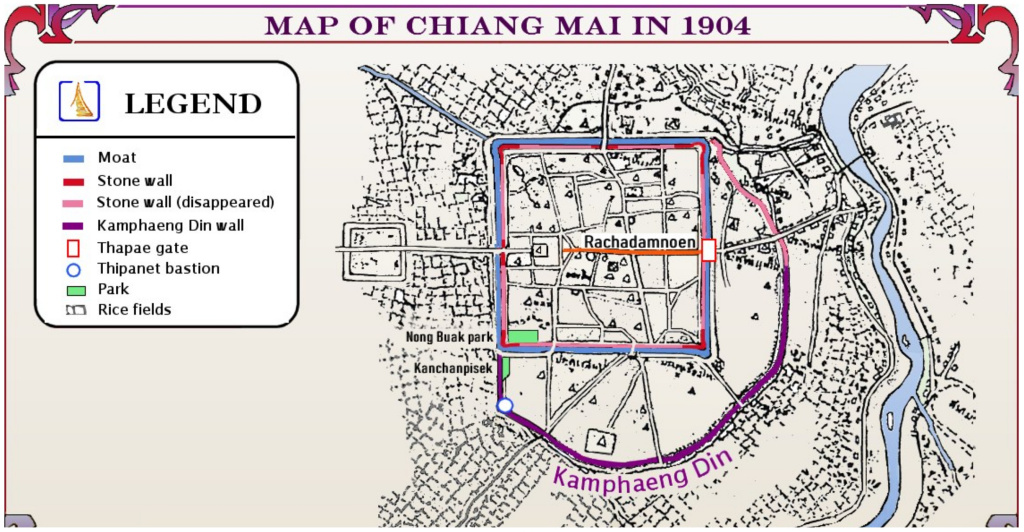
I have been fascinated with the Kamphaengdin ever since I learned about it. The Kamphaengdin was a second wall made of earth and clay built in the late 1500s to protect the expanded parts of Chiang Mai to the east and south of the square, walled city. The Kamphaengdin was built inside the Klong Mae Kha so that the klong (small river or creek) acted as a small moat and facilitated drainage. The Kamphaengdin can be seen in this map of Chiang Mai from 1904 as the purple arc. This is an updated version of the map I found, showing the Kamphaengdin and Kanchanaphisek Park south of Ku Huang Corner, the southwest corner of the old city.
Today I was not too busy. Chiang Mai is a little cooler than normal for this time of year, so after breakfast and a strength training session with Khun Ning at Pump Fitness, I decided to go for an exploratory walk. I had a few goals: first, have another look at Wat Phuak Hong (sometimes spelled Phuak Hom), an old temple with a chedi that is similar in style to that at Wat Chiang Chom; second, walk to the southwest corner of the moat, down into Kanchanaphisek Park to see the largest remaining section of the Kamphaengdin; third, walk to the part of the Klong Mae Kha under renovation to see if obvious progress has been made. A big agenda for a mellow day
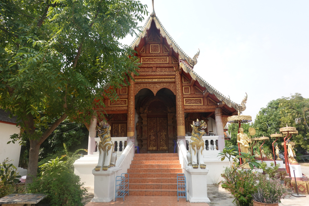
Wat Phuak Hong
I first saw this temple while waiting for a haircut at the Samlaan Barber when he was in the soi connecting this temple to Samlarn Road. It is a very old temple at which I have seen no people other than a tourist or two – no monks, no groundskeeper. The temple grounds are clean and obviously not abandoned. A very quiet and almost eerie place.
The viharn (worship or assembly hall) is always closed. It is built in a definite Lanna style, with multiple overlapping roof tiers sweeping low on the sides. The entrance stairway is guarded by two Singha lion-like creatures.
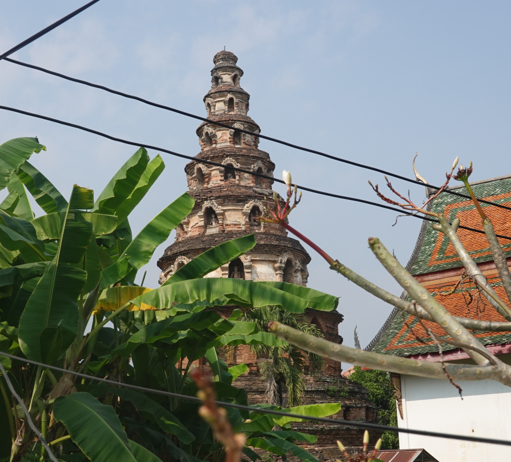
The near-crumbling chedi is fairly unique, and much like the chedi at Wat Chiang Chom which I visited recently https://james-intrepid-pilgrim.blog/2025/01/10/three-northern-temples-1-wat-chiang-chom/. The shape of the chedi with its eight circular levels rising in diminishing size like a wedding cake is of a unique style in Chiang Mai. Each of the levels has niches around its perimeter for housing Buddha images although only a few contain them. Some of the niches show signs of ancient, now decayed decorative work around their borders. Altogether the chedi is an elegant structure with its eight circular layers perfectly proportioned, rising in diminishing size, a gradually tapering tower.

I made my way through the sois to Nong Buak Park, then to Ku Huang Corner, the southwest corner of the old city wall.
Ku Huang Corner
The four corners of the wall were reconstructed several times in modern history, deliberately attempting to make them look rustic and original. I always love the look of the corners, almost majestic and strong.
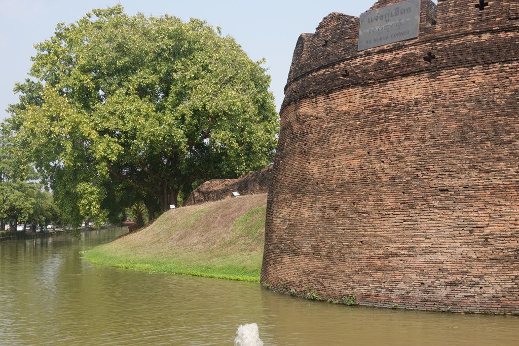
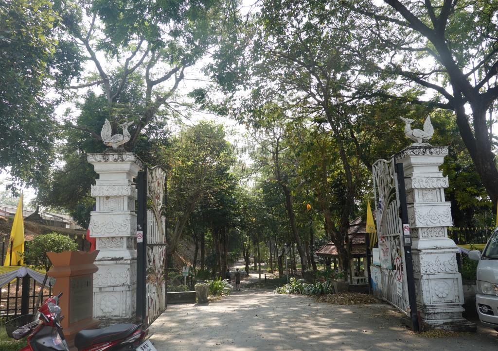
The road adjacent to Ku Huang corner goes to the Chiang Mai Airport, so is always very busy. I crossed the road and came to the entrance of Kanchanaphisek Park, a very quiet park along the last large section of the Kamphaengdin.
Kanchanaphisek Park
The entrance of Kanchanaphisek Park is seen right by the busy outer-moat road.
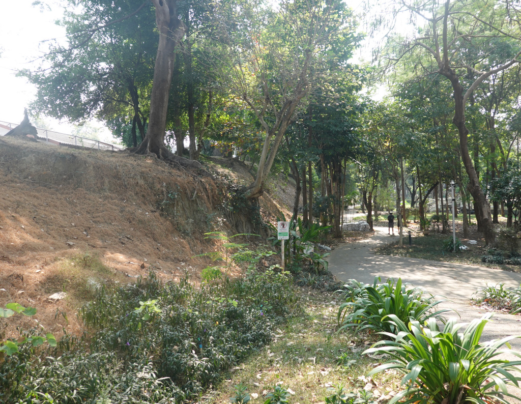
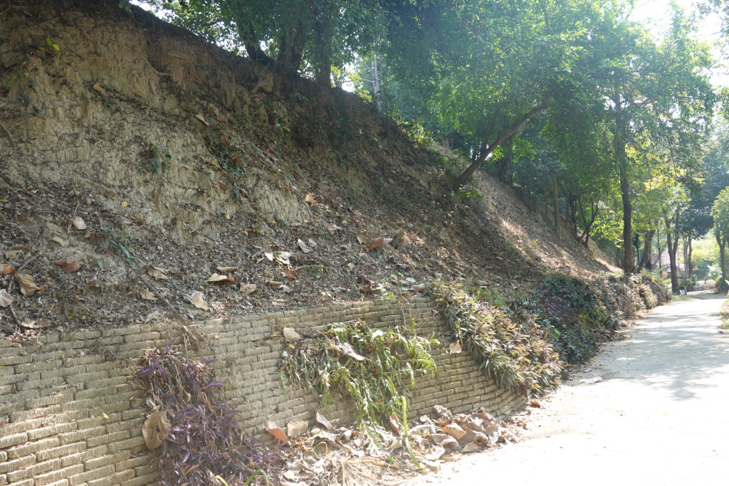
The park is below street level by about 2 or 3 meters, so once inside, it is very quiet despite its being adjacent to a busy road. There are always a few people in the park, walking, jogging, or working out, but the park is never busy. Walking into the park, the Kamphaengdin earth and clay wall can be seen on the left. This section of the Kamphaengdin is at least 400 meters long.
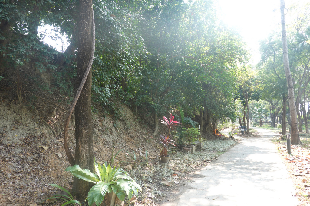
A view of some of the park itself.
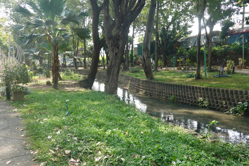
The creek running through is of some significance since the Kamphaengdin was built just inside the existing Klong Mae Kha and this other tributary.
As I proceeded south there was more of the Kamphaengdin to be seen, parts with a brick foundation at the bottom.

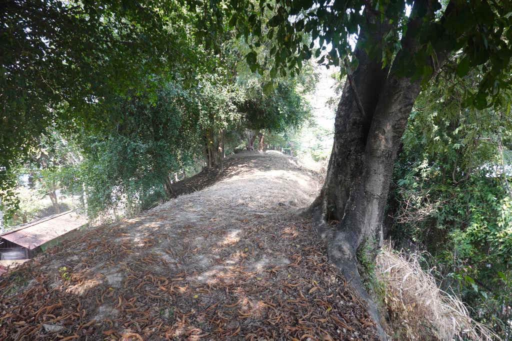
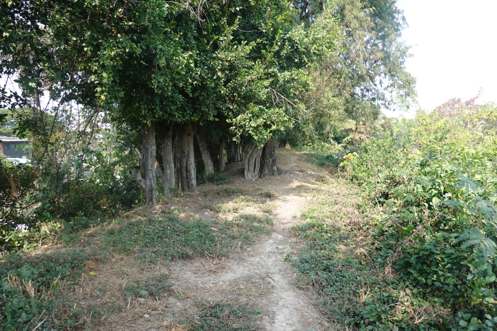
At the south end of the park, I found an ill-defined path up the Kamphaendgin behind an area where hoses and other park maintenance supplies are kept (I probably was not supposed to be there). I climbed up and there I was, on the Kamphaengdin. I walked a little north and then south. Being up there I was aware of just how high this wall was, at least 4 meters, possibly 5.
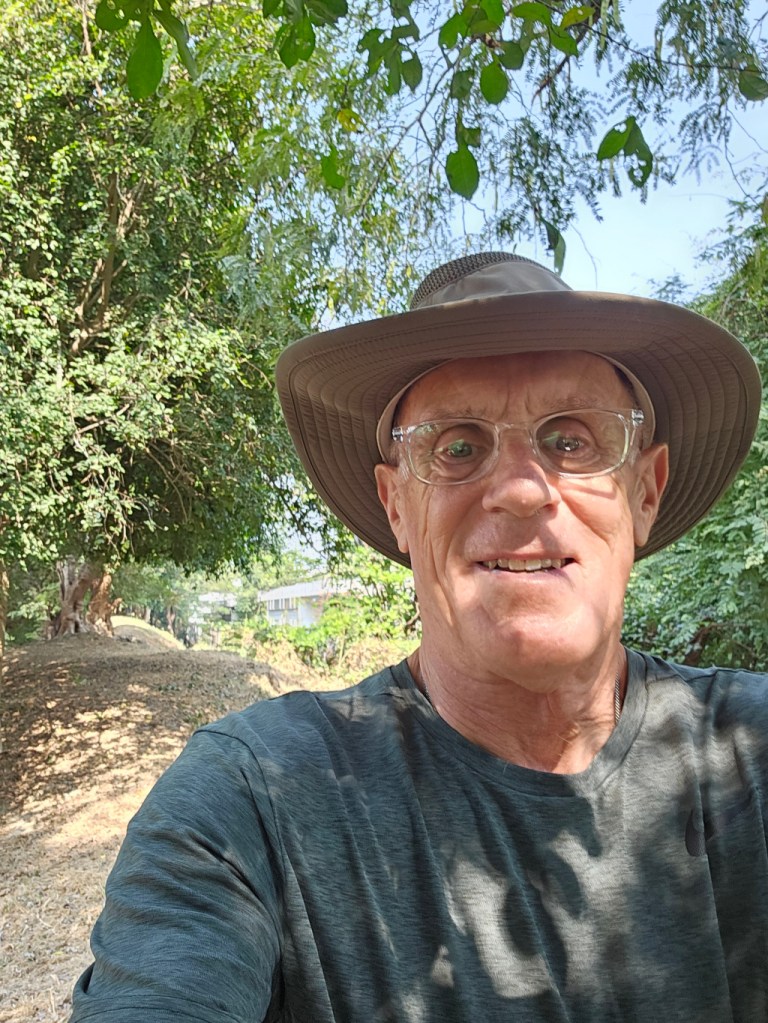
And I got a selfie proving that I really was there. Someday I’ll get better at taking selfies.
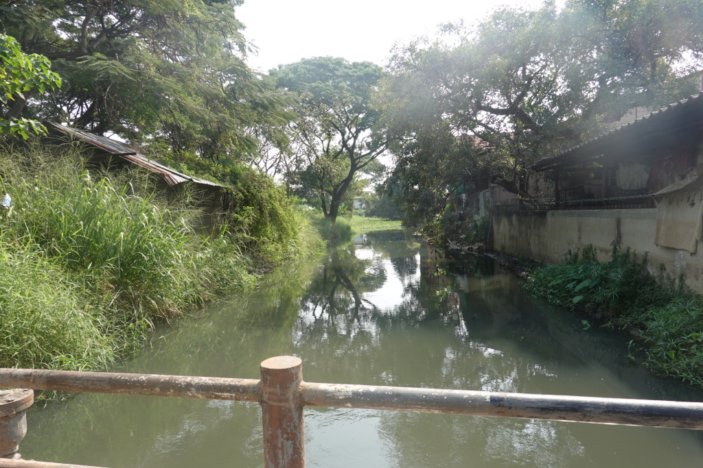
After climbing off the Kamphaengdin, I headed south then east to where the extension to the renovated part of the Klong Mae Kha is under construction. I came upon this construction almost accidentally and posted several photos almost a month ago, https://james-intrepid-pilgrim.blog/2024/12/23/hai-ya-sub-district-of-chiang-mai-3/. Approaching the construction area, I got these two photos as the road I was on crossed the tributary klong to the Klong Mae Kha. This is the klong along which the Kamphaengdin was built. Right here, there is no obvious evidence of the Kamphaengdin, just the klong in a natural state.

When I got to the construction area, no clear evidence of progress had been made. Given the scale of this project, it will take some time. I am looking forward to seeing this area when I return in November.
