Tuesday 16 December 2024
Walking east to see flood damage
Walking away from the railroad I was going west towards the road to the Iron Bridge to get back to a more familiar part of Chiang Mai. I forgot to mention in my post about the Railway Station that the State Railways of Thailand is facing a challenge with the railroads regarding gauge. Railroad gauge is the distance between the insides of the two rails. All of the Thai intercity rail lines are meter-gauge, with the rails 1 meter (39.37 inches) apart. Standard gauge, also known as Stephenson gauge or international gauge is 4 feet 8-1/2 inches (56.5 inches, 1435 millimeters) between the rails.
Worldwide, all high-speed rail lines use standard gauge except those in Russia, Finland, Uzbekistan, and some line sections in Spain. So as Thailand adopts high-speed rail, it will be standard gauge. This is incompatible with meter gauge, forcing a much larger infrastructure investment. The BTS Skytrain, MRT Subway, and Airport Rail Link systems in Bangkok are also a mixture of gauges, further complicating things.
There is much more to this subject, for example, the extension of the Airport Rail Link to Don Mueang Airport (DMK) and also to Utapao Airport (UTP) near Pattaya (originally built by the United States to accommodate B-52 bombers for missions in Vietnam, Laos, and Cambodia during the Vietnam conflict). But back to my walk today.
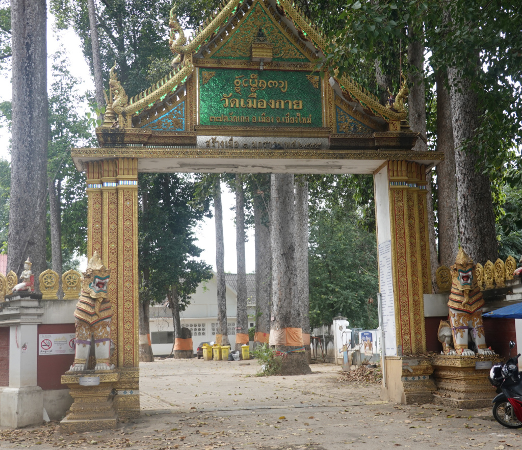
Wat Mueang Kai
I am walking in an area where tourists and foreigners are seldom seen. I get a few second looks, and since I am holding a camera, I am left alone. I did pass an area with large mounds of what looked like debris gathered from the flooded areas. People were meticulously going through the debris and separating recyclables and other things. There were large loaders loading the [apparently] garbage into very large trucks to be hauled away. This was a large operation, still completing almost two months since the last flood.
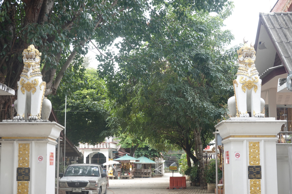
I arrived at Wat Mueang Kai, a local temple on a fairly large plot of land. There are two entrances, one from the road to an area where cars park, and a second into the temple itself. The car park area is lined with very tall trees making for a peaceful setting. Both entrances are guarded by Singha lion-like creatures
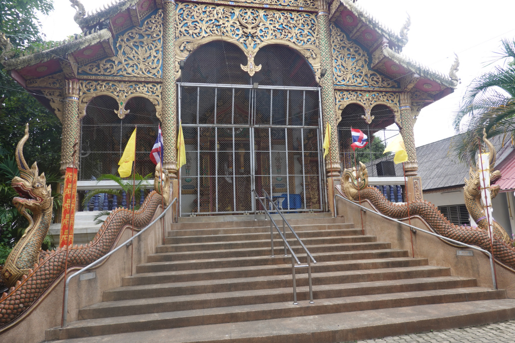
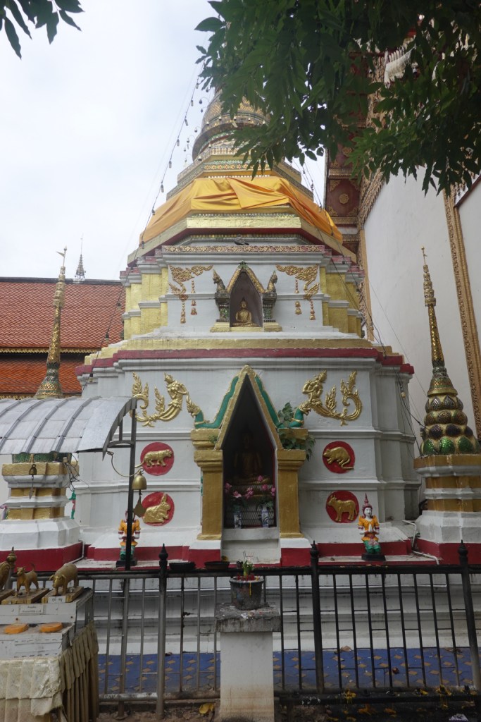
Once inside the main temple area, it was very quiet. A few ladies were setting up for some event, but other than those ladies, I saw no other people. I took a few photos. The Lanna-style viharn, and the nicely-decorated chedi.
Other than that, there was not much of interest. At times, this must be a busy temple. Today, it was very quiet.
My target is to get to the Iron Bridge, cross the Mae Ping River, and back into the old city. To get to the road to take me back to the Iron Bridge, I passed a golf course that was being re-sculpted. I’ve seen this last year and it was an active golf course. Now there is heavy machinery re-working part of it, while other parts are untouched. It was very difficult to get a photo because the fence was too high, and I needed to be very mindful of traffic. There is not a good place to walk along this part of the road except on the edge of the road itself.
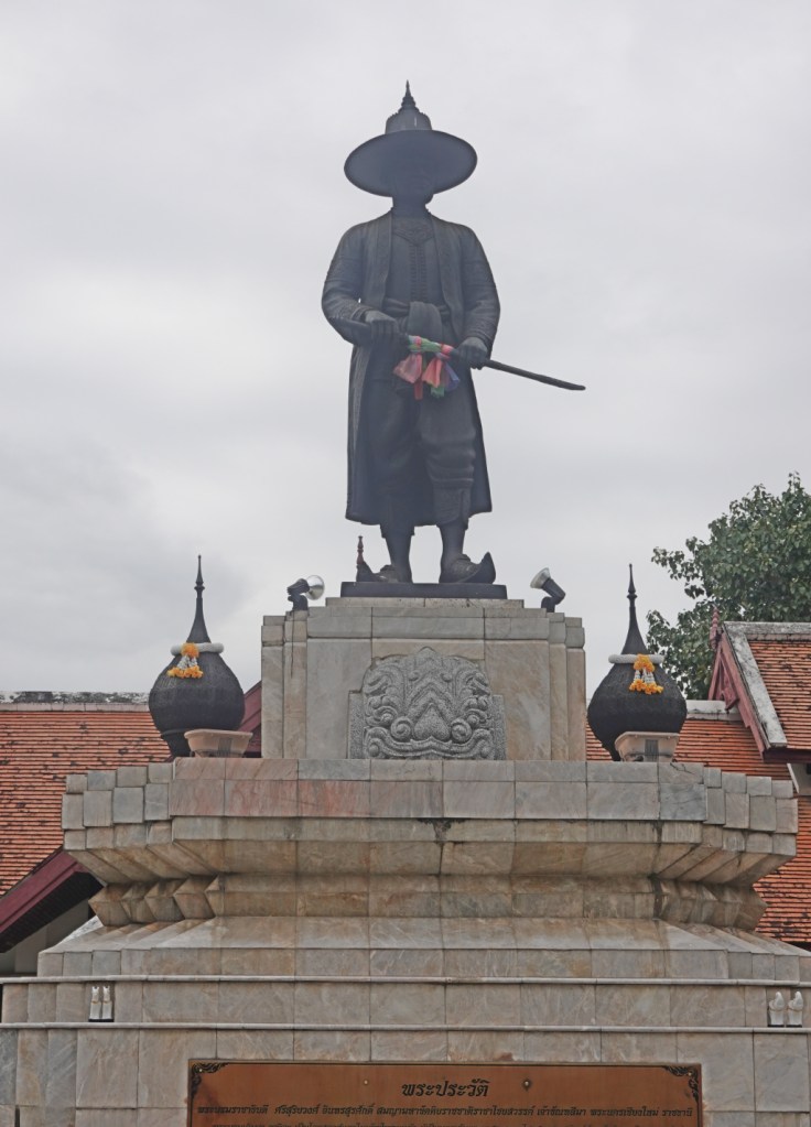
King Kawila Monument
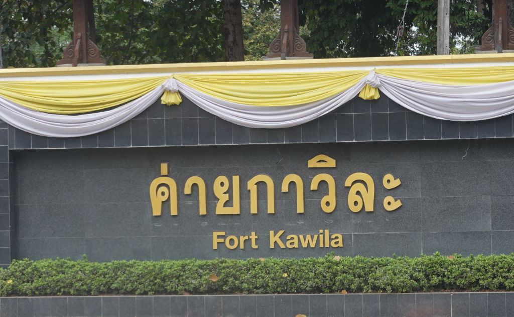
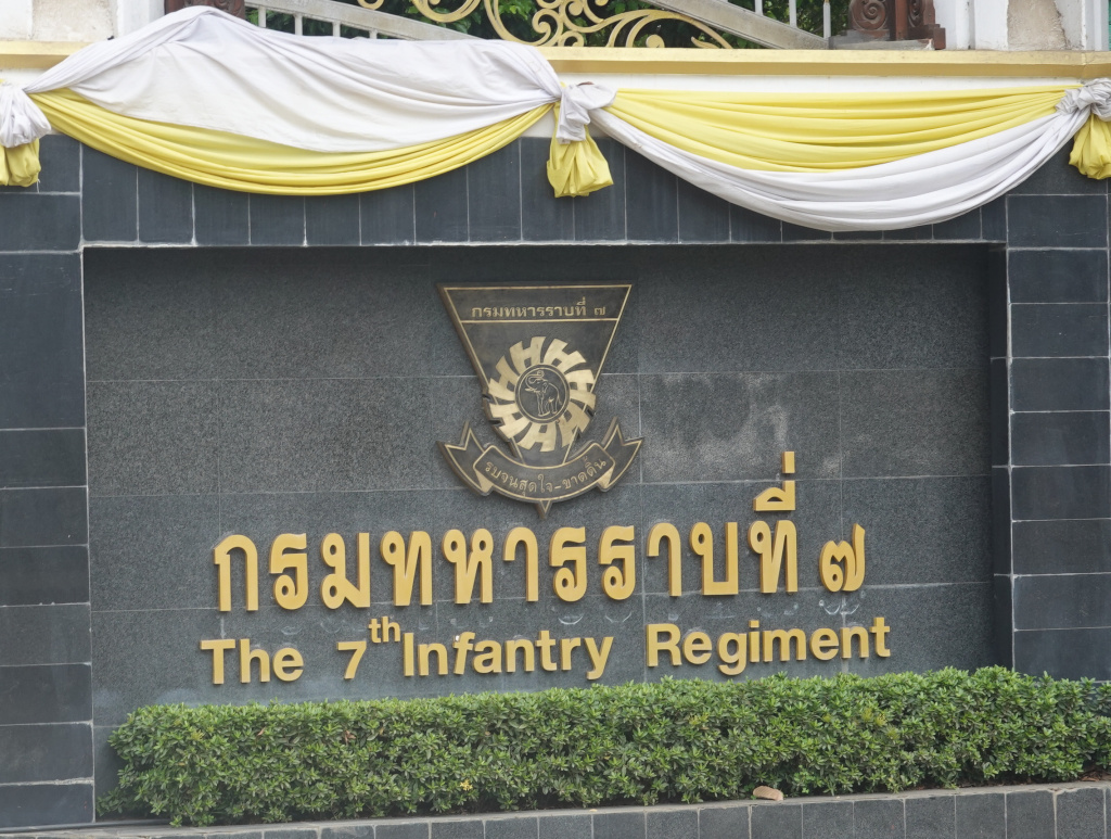
Finally I got to the Chiang Mai-Lamphun Road and was walking north towards the Iron Bridge. This is also a very busy road, but there is more of a safe shoulder on which to walk. I came to the monument to King Kawila. Across the road is Fort Kawila, the 7th Infantry Regiment of the 33rd Army District.
King Kawila, also known as Phra Boromrachathibodi, was the ruler of the Chiang Mai Kingdom when northern Thailand, then called Lanna, was still separate from Siam. Although he was from Lampang, Kawila rose in stature and was appointed to become the ruler of Chiang Mai by King Rama I (of Siam) as a tributary ruler. King Kawila was instrumental in the reclamation of Chiang Mai from the Burmese after the 200-year occupation ended in 1774. Under King Kawila the city started the recovery to its former glory. Many parts of Chiang Mai were restored or rebuilt, including many temples that had become abandoned during the Burmese occupation. King Kawila was important to Chiang Mai’s history, and it is fitting that he has a monument. (It was difficult to get a good photo looking almost directly into the sun.)
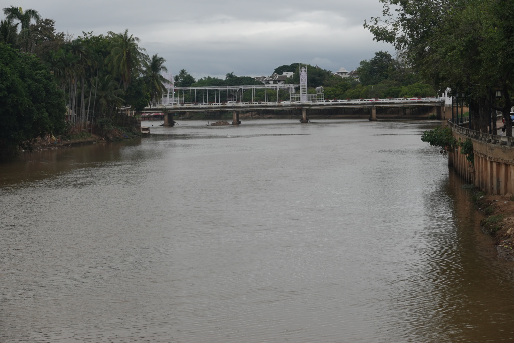
I continued north and made it to the Iron Bridge. Yay! Familiar territory!
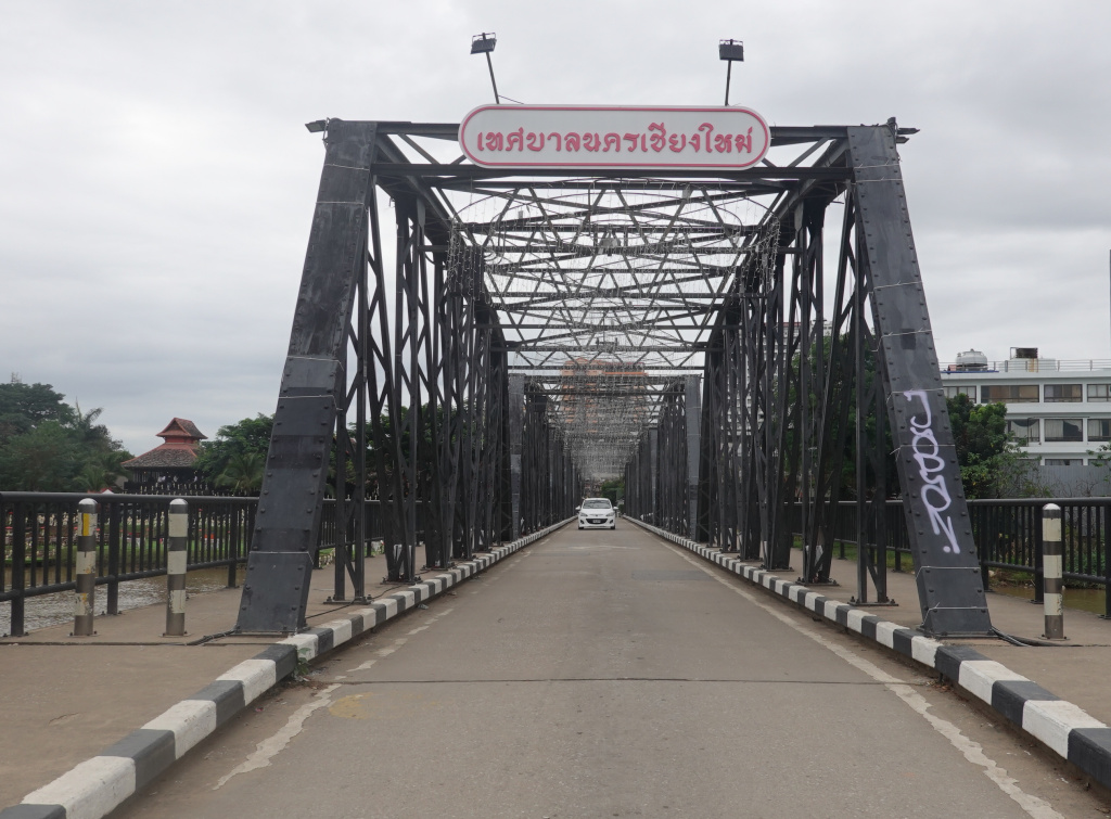
From the Iron Bridge I looked upstream to the Nawarat Bridge where the significant part of this long walk started. In just a couple of weeks, the New Year 2025 celebration will be on that bridge while I’m [hopefully] sleeping.
Next: Trip to Mae Rim, Wat Pa Daraphirom and the Daraphirom Palace Museum
(and someday I’ll get caught up with this blog…but I’m busy enjoying my time in Chiang Mai)
