Saturday 21 December 2024
Revisiting the Klong Mae Kha in the evening
When I first visited the renovated part of the Klong Mae Kha back in late November, I said I would return at night to get a few photos of how it looks with the decorations lit. Today, four days before Christmas, on my sister Carol’s birthday (she was a Christmas “Carol”), I took an evening walk down to Kamphaengdin Road, then onto Ragang Road where the newly renovated section of the Klong Mae Kha starts.
Brief Klong Mae Kha History
As those who have followed my blog know, I have a continual fascination is with the Kamphaengdin, the second wall around the eastern and southern parts of the original Chiang Mai walled city. As Chiang Mai grew and expanded outside what we now call “the old city,” to protect the expanded part of the city from flooding, an earth, brick, and clay wall (the Kamphaengdin) was built along the inside of an existing klong, the Klong Mae Kha. A “klong” is a small river or a canal.
In about 1292, King Mengrai wanted to move the seat of his kingdom from Chiang Rai because of constant battles with the Burmese. He started building a city at a location about 7 kilometers south and west of Chiang Mai along the Mae Ping River, an area now known as Wiang Kum Kam. That city under construction was flooded twice, the second time covered in at least 3 or 4 meters of mud as the Mae Ping River changed its course. So King Mengrai decided to abandon that site and find a better location. It is said he used Klong Mae Kah to search for a higher location for the new city, what was to become Chiang Mai. When he found what he thought was a good site, he conferred with his neighboring kings, the King of Phayao (north and east of Chiang Mai) and the King of Sukhothia. The three kings decided the site was auspicious, and Chiang Mai was built. Thus, the rationale for the Monument to the Three Kings in the middle of Chiang Mai.

When the Kamphaengdin earth and clay wall was built in the 16th century, it was built along the Klong Mae Kha. The klong would provide drainage, and also act as a small moat.
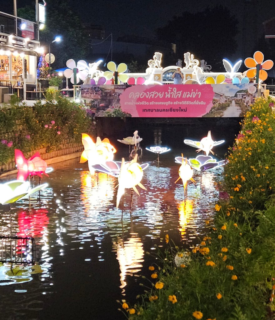
Klong Mae Kha Today
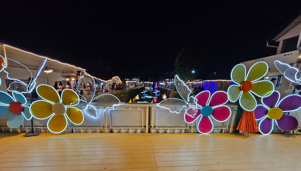
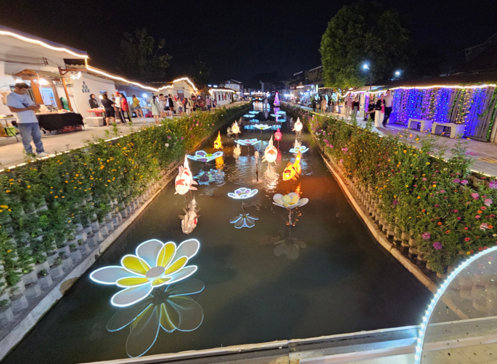
The part of the Klong Mae Kha from Ragang Road south about 200-250 meters was improved about 3 or 4 years ago. The channel was deepened to improve flow, sidewalks made along the sides, and crossover bridges added. The people living by the klong started opening small shops selling crafts, souveniers, and food. Soon, the Klong Mae Kha became a very trendy place for photos for social media. Even today, many people visit, especially at night when the decorations are lit. So I went there at night to check it out and found many people and a festive atmosphere. Here are a few photos. First, at the bridge at Ragang Road, then looking down the klong from the bridge.
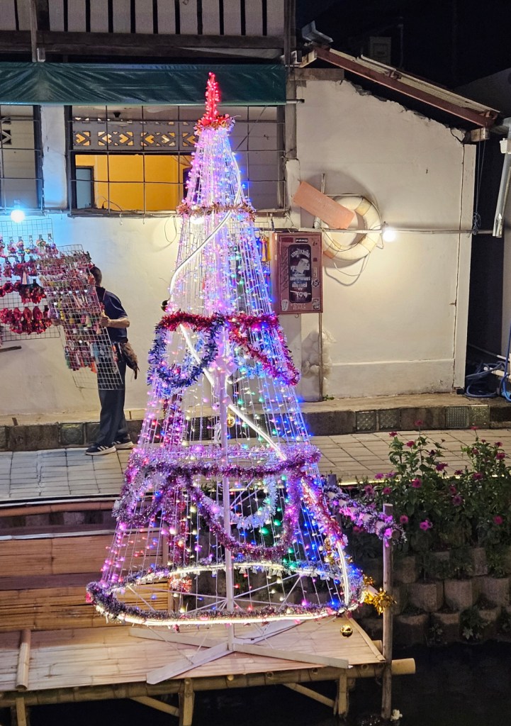
Then, from the sidewalk along the klong, and since Christmas is upon us, a Christmas tree.
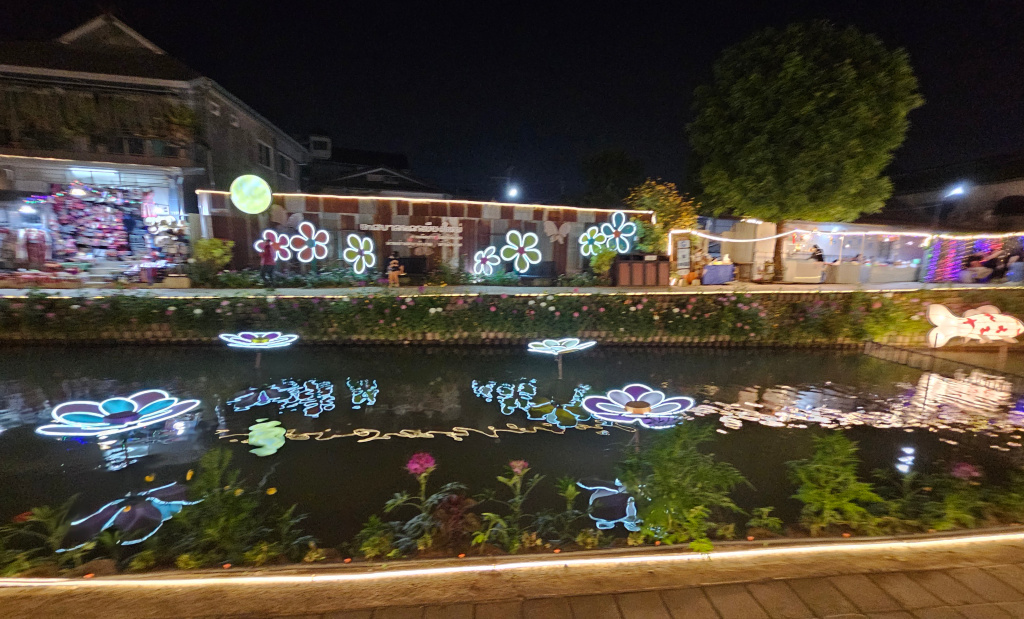
Finally, a look back towards the bridge over the klong at Ragang Road.
The renovated section of the Klong Mae Kha is still very trendy and attracting many tourists. My hope is this will continue and even increase as the renovation north to Sridonchai Road and south to Suriyawong Road is completed. When that will be is not known, it is a large project and well underway as I showed in a posting from December 12 https://james-intrepid-pilgrim.blog/2024/12/23/hai-ya-sub-district-of-chiang-mai-3/ I am eager to see the progress before I leave in early February and then again in November.
Next: Maybe I’ll get the posting finished for my visit to the Princess Dararasmee Palace Museum, and associated temple, Wat Pa Daraphirom. Or maybe I’ll share photos of my hike up to Wat Phalad and then further up the mountain to Wat Phra That Doi Suthep.
(And I am feeling the urge to do more exploring.)
