Thursday 12 December 2024
South of Chiang Mai Old City and Klong Mae Kha construction.
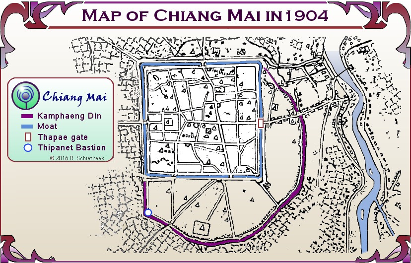
I am fascinated with the Kamphaengdin (as long-time blog followers already know). This was a second wall made of earth, clay, and some bricks added in the 16th century to protect the parts of Chiang Mai that had expanded beyond the square, fortified city from flooding. The Kamphaendin was built just inside the Klong Mae Kha. A “klong” is a small river, large creek, or canal. The Klong Mae Kha was a small river, a tributary connecting to the Mae Ping River south of what is now the main part of Chiang Mai. Over decades, even centuries, the Klong Mae Kha has deteriorated into a drainage canal with homes and other structures along the sides. The following picture is a map of Chiang Mai from 1904 showing the square, fortified city, and the Kamphaengdin as a purple arc on the east and southern sides. The Klong Mae Kha is not specifically shown but is outside and along the Kamphaengdin.
After leaving Wat Yang Kuang, I continued south on Suriyawong Alley, to where it crosses the Klong Mae Kha to see if there has been any change. About three years ago, a stretch of the Klong Mae Kha from Ragang Road ending close to Suriyawong Alley had been completely renovated. This 200-250 meter stretch was improved with the channel deepened to facilitate better water flow and new sidewalks along the klong. Residents along the klong have created small shops selling crafts, souveniers, and food. This is now a busy place in the evenings and a very trendy place for photos to share on social media. Here is a recent photo of the renovated section of the Klong Mae Kha at night.

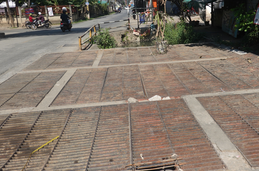
I crossed a grated section of the road or sidewalk (sidewalks are an ambiguous concept in Chiang Mai) where the Klong Mae Kha is under the road, and where the klong splits. Part of the Klong Mae Kha goes more directly southeast and part goes more west, along the southern part of the Kamphaengdin.
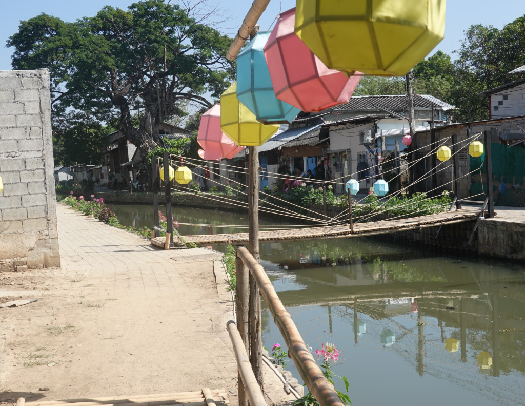
There was a small walkway to the left from which I could see the southern end of the renovated section of the Klong Mae Kha.
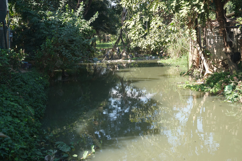
Turning to the right to the western part of the klong, it has a very natural appearance.
The scene in the southwest part of Klong Mae Kha is dramatically different. And what a surprise! A pleasant surprise. It is evident that the renovation project is continuing farther down the klong. Here are some photographs as I continued walking south to Wiang Ping Road.

And further down, more photos of the renovation. I’m impressed at the scope of this project. I am very curious to see what progress will have been made by the time I leave in early February, and then how this looks next winter.
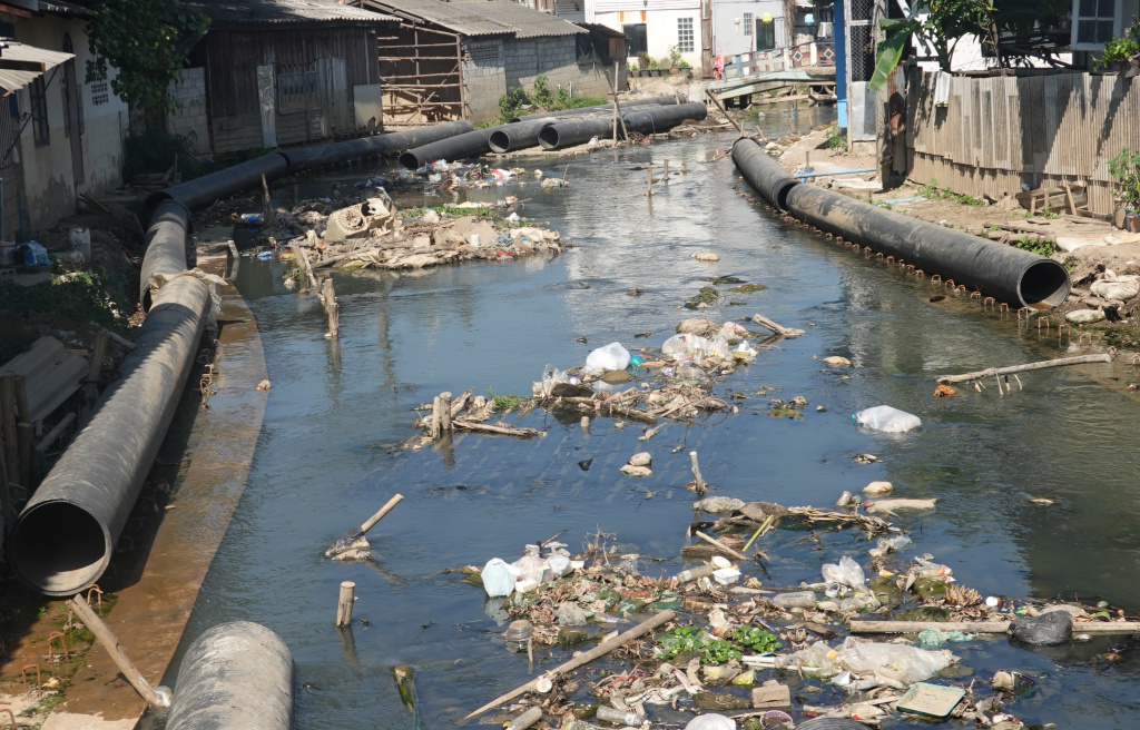
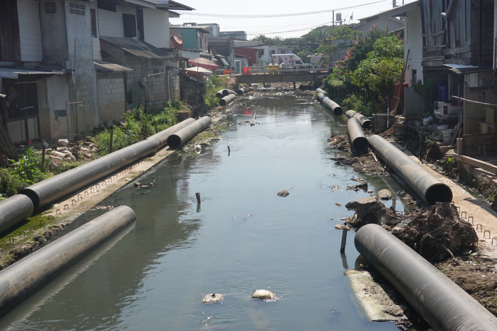
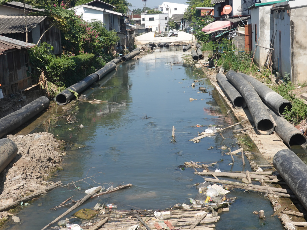
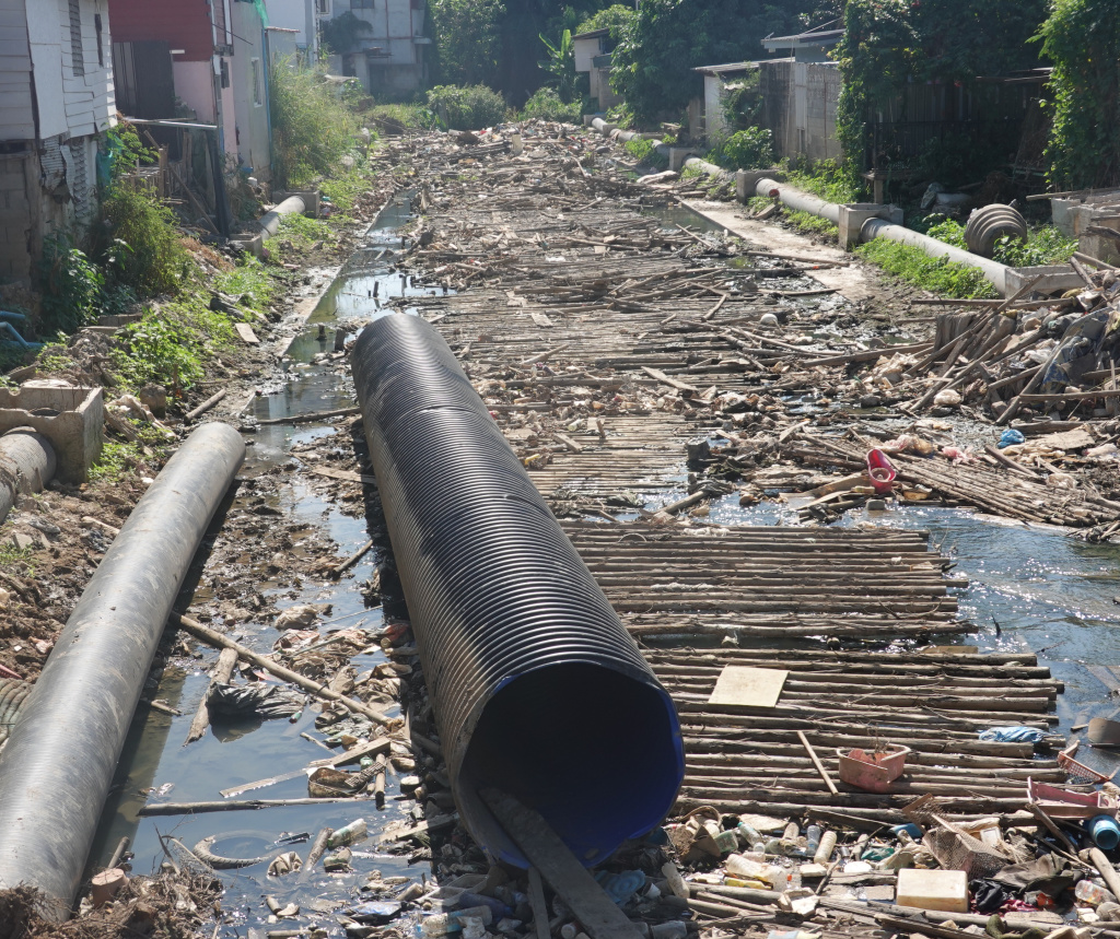
This is a large construction project and will more than double the length of the renovated section of the Klong Mae Kha. So much more for those wanting to share on social media.

that’s a serious project
LikeLike