Wednesday 27 November 2024
Walking along the Ping River
I wanted to walk along the Ping River to see evidence of the recent floods in Chiang Mai. The floods resulting from heavy storms in late September and early October were the worst in at least 50 years and affected 30 provinces in northern Thailand. As the flood waters receded, the national, provincial, and local governments launched massive cleanup efforts. By October 22, the mayor of the Chiang Mai District reported that 90% of the affected streets had been cleaned of the leftover mud, and more than 40% of the waste removed. The cleanup effort continued well into November.
I spend most of my time in the old city or nearby, typically not that close to the Ping River. I started my walk in the center of the old city at the Monument to the Three Kings. When King Mengrai was looking for a good location to build his new city, he sought the advice of two neighboring kings, the King of Sukhothai and the King of Payao. The monument pays tribute to their partnership in selecting the site for what would become Chiang Mai.

From the Three Kings monument, I walked east to the moat. As I crossed the inner moat road, I saw repaving underway. Almost two years ago, a lengthy project started to put all of the power and communication cables in the old city underground. This involved many streets being dug up, cables and conduits laid, buried, and then the road patched. The result is that many of the roads are quite bumpy. I noticed this while I was in an Airport Taxi the evening I arrived; the drive along part of the moat was quite jarring. So part of the project is to re-pave the roads. Instead of laying new asphalt over the roads, they are digging up the old asphalt to a depth of about 8 cm (3 inches) and recycling the old asphalt. I saw part of the project in progress on the inner moat road just north of Tha Phae Gate:
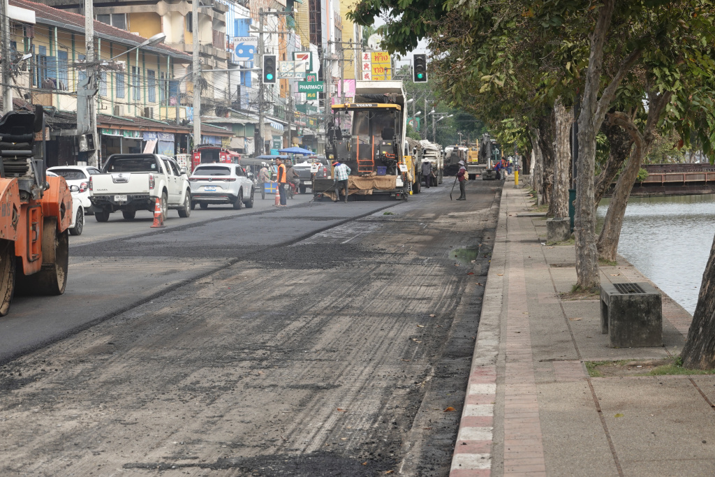
While disruptive to traffic, the disruption is short and the end result is a very smooth road.
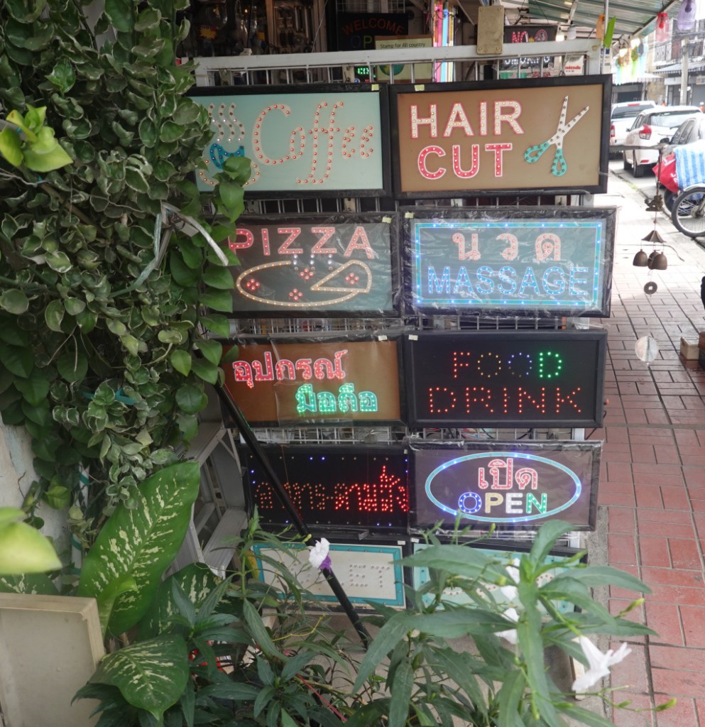
I headed east down Chang Moi Road towards Warorot Market by the Ping River. Along the way I passed a shop selling lights, light bulbs of all kinds, and electric signs. I have seen this before and always get a little kick out of it. If I started a coffee shop, barber shop, or massage shop, I know where I can get a sign.
I got to Warorot Market. It had been flooded chest-deep in water and is now back in full, energetic action. I crossed the river on the main highway bridge so I could look downstream to see any damage to the walking bridge about 150 meters downstream. The damage was evident. Even with the Ping River seeing record high water, the water did not get all the way up to the bridge. But at every bridge, trees, limbs, and other debris would pile up at the bridge piers and that debris could damage the bridge itself, and also act as a dam to slow the water from draining. During and after the flood, removing the debris from under the bridges required a continual effort. This photo shows the walking bridge from the highway bridge. The walking bridge was completed fairly recently in 2017 and still looked very new last year. Now, there is clear evidence of the damage from the recent floods.

As I walk over the bridge (and thankfully, there is a separate walkway for pedestrians), at about the middle, I turn to my left, and see in the distance the American Flag at the U.S. Consulate. I always love seeing that. I was told that there is a new, larger U.S. Consulate building under construction in Chiang Mai, but I do not know where. Regardless, I got to see the American Flag today:

Just over the bridge, I turned right on the Chiang Mai-Lamphun Road, the main road along the river that farther south becomes the highway from Chiang Mai to Lamphun. For the most part, the cleanup of the road and buildings has been well done, there is little obvious evidence of the flood. I passed Elephant Parade and stopped to look inside and chat. They told me the water in the store had been about knee-deep, and they felt lucky it had not been worse.
Elephant Parade is a foundation for elephant protection. They sponsor exhibitions of painted and decorated elephant statues created by local artists, public figures, and celebrities. These statues are auctioned with the proceeds going to efforts to protect and raise awareness of the endangered Asian elephants. The statues are about 1-1/2 meters high (5 feet) and those not auctioned are for sale. They also sell smaller statues. Here are the two large statues in front of the Chiang Mai store:

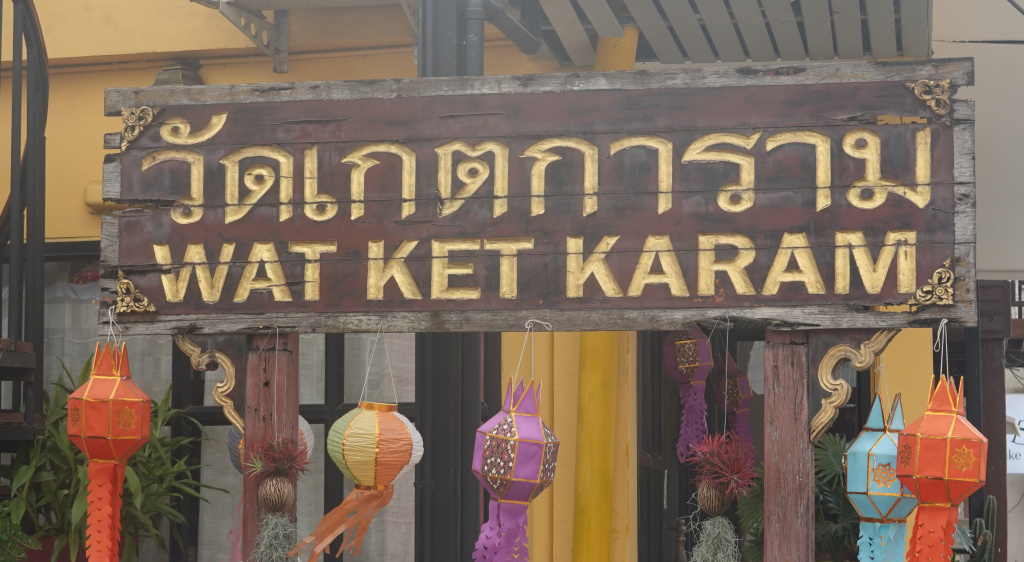
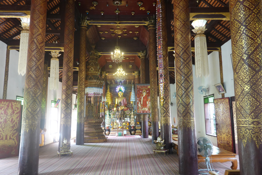
Just down the street is one of my favorite temples, Wat Ket Karam. The name is one of the examples where the actual sound cannot be depicted accurately in English. The Thai language has 44 constants and 22 vowel forms, so some of the sounds can be challenging to write in English. At Wat Ket Karam, there are three signs with English, Wat Ket Karam, Wat Kate Karam, and Wat Gate Karam. The sound is not “kuh” or “guh”, it is a sound in between those sounds. Nevertheless, I like this temple. The entrance sign:
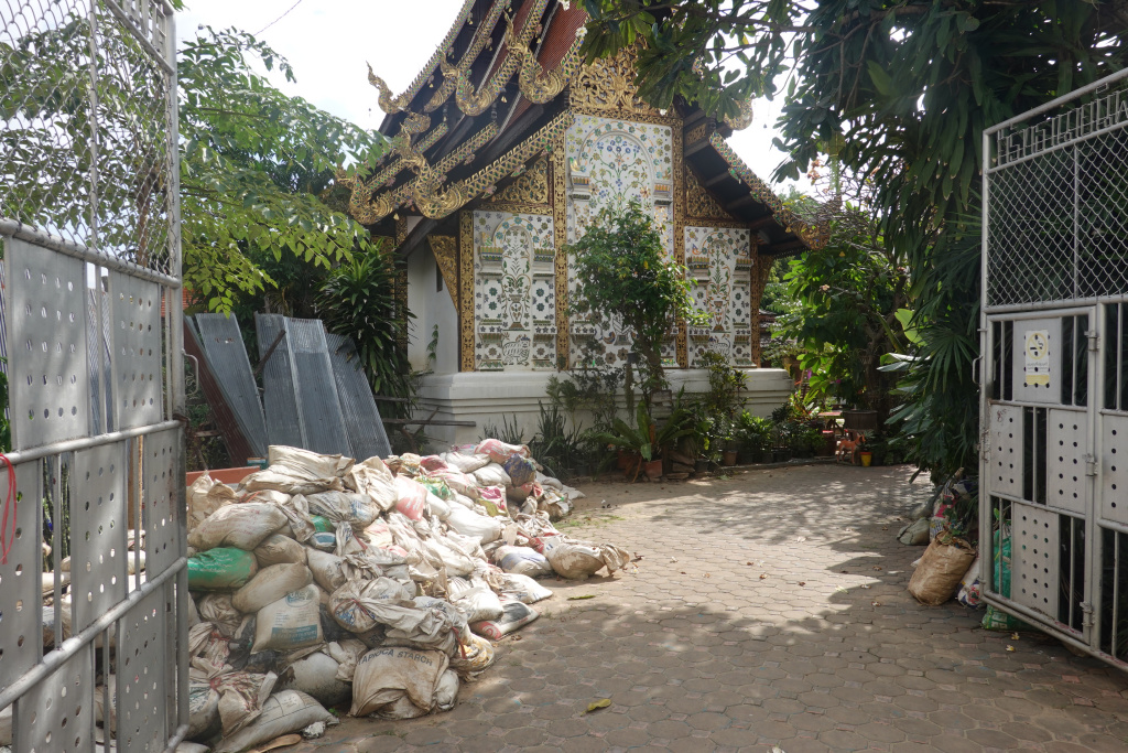
Entering here the piles of sandbags are still at the back of the viharn (worship hall). Also, the old wooden museum was flooded, severely damaged, and had to be demolished. It seems to be under reconstruction behind the fencing to the left of the viharn.
At the front of the viharn, the damage to the naga (serpent or dragon) on the stairway banister is evident. Looks like the water was about 7 or 8 steps deep:

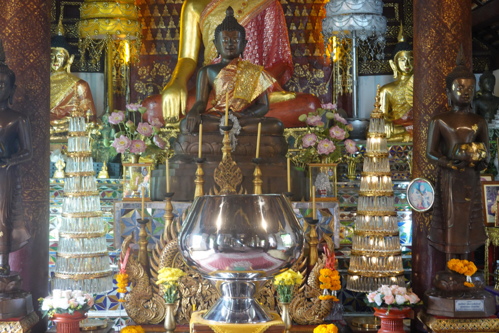
The inside of the viharn has been a favorite of mine. It is not large, but is all teak and has a nice quiet, reflective ambience. The unfortunate change is the LED colored lights over the larger gold Buddha head. Looks too garish and not at all what I liked about this temple. So the second photo is of the smaller, more appealing (to me) Buddha statue.
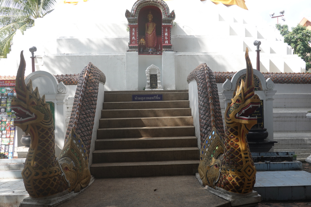
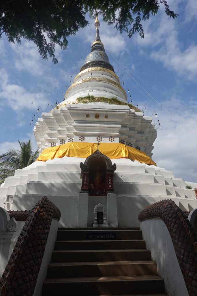
At the chedi, it appears that there has been recent re-painting or careful cleaning of the base and the naga where the flood waters were.
A nice surprise was that at Wat Ket Karam, there is a brand-new toilet structure. I’m happy to donate 10 baht to support the new facility and the cleaning.
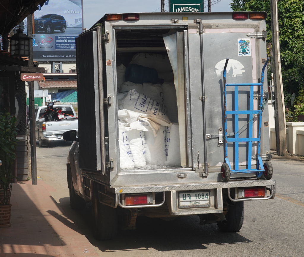
Walking south along the river past several restaurants, I saw the same ice truck and young men who deliver ice to The 3-Sis every morning while I am at breakfast. They recognized me and made a small wave. Almost all restaurants get their ice delivered from a few places where the ice is made using filtered, purified water. Thus while I am a little reluctant to drink the tap water, the ice in drinks is considered safe. A shot of the back of the ice delivery truck. I think each bag of ice is 35 kilograms (77 pounds).
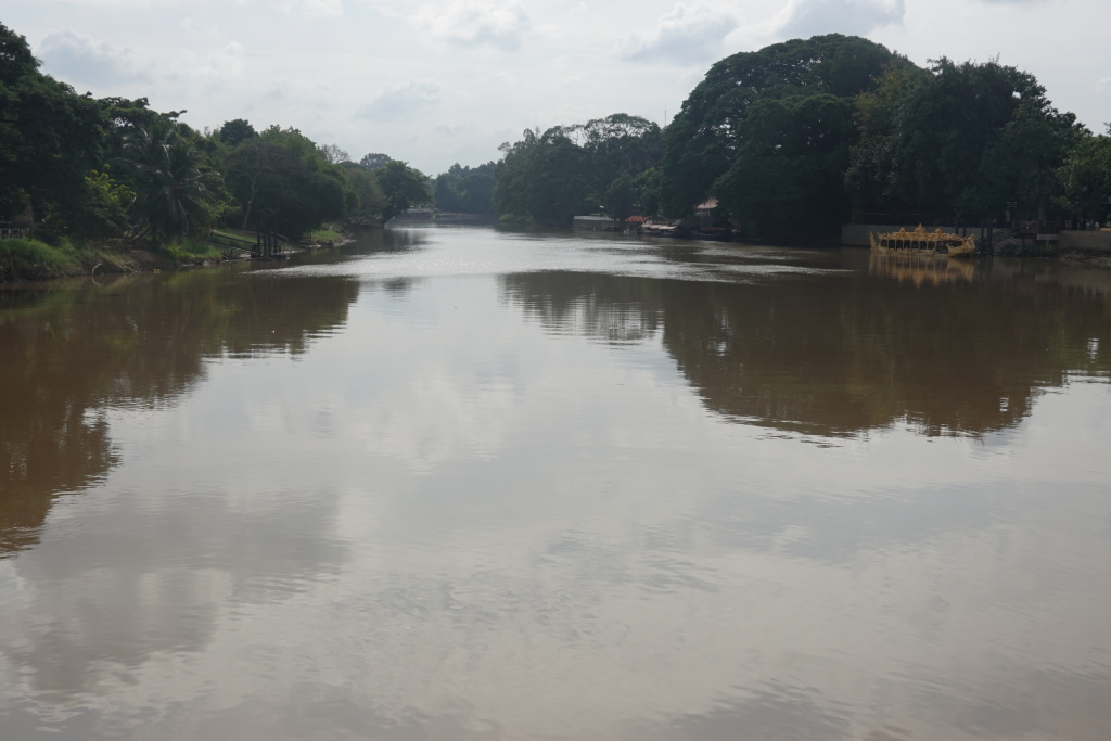
The river is wide and expansive along here. It is still very brown with silt and mud. Here is a view north towards the walking bridge and also south towards the Narawat Bridge:

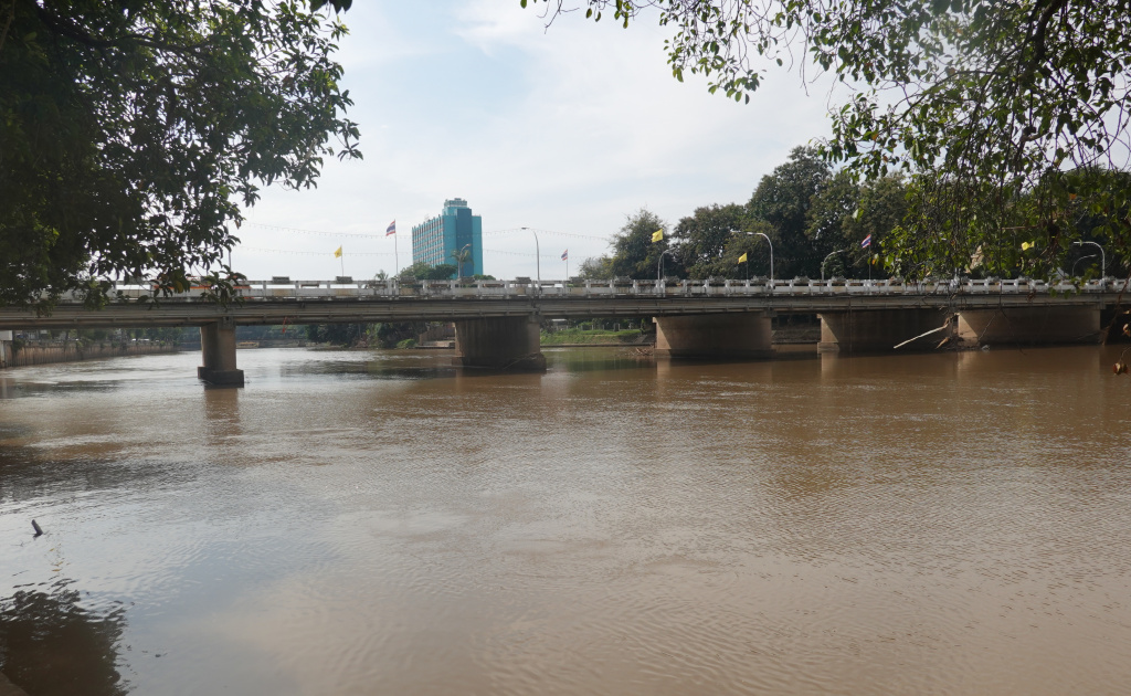
The river appears to be calm, but looking closer, I can see that it is very fast-moving. There is still much water heading south eventually to the Gulf of Thailand.
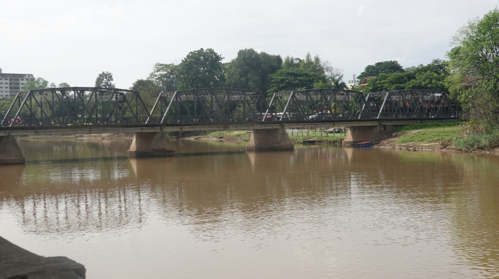
I crossed over the intersection at the Narawat Bridge and along a section of the Chiang Mai-Lampun Road where the floodwater had been at least chest-deep. This section has been cleaned so well that it is as if no flood has occurred. Here is a view of the river from just north of the Iron Bridge (Saphan Khua Lek). I have been here many times. While not nearly at flood levels, the water is higher than normal:
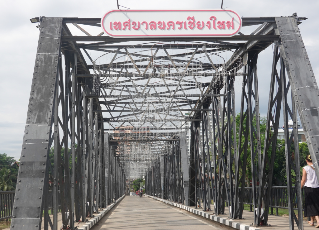
And a view of the decorations on the bridge – the Iron Bridge is always decorated for the holidays, Loy Kratong (two weeks ago) and Christmas/New Year. I’ll have to get a photo of this at night when it is lit. Traffic is one-way on the Iron Bridge with pedestrian walkways on both sides. Traffic was very light today, so I stepped into the road to get this photo. I highly doubt that I’ll be so lucky in the evening. The sign at the top translates to “Chiang Mai Municipality” and there are strings of lights hanging down all along the bridge.
From the middle of the bridge, the river is broad, expansive, and very brown as is makes its way down toward Wiang Kum Kam.
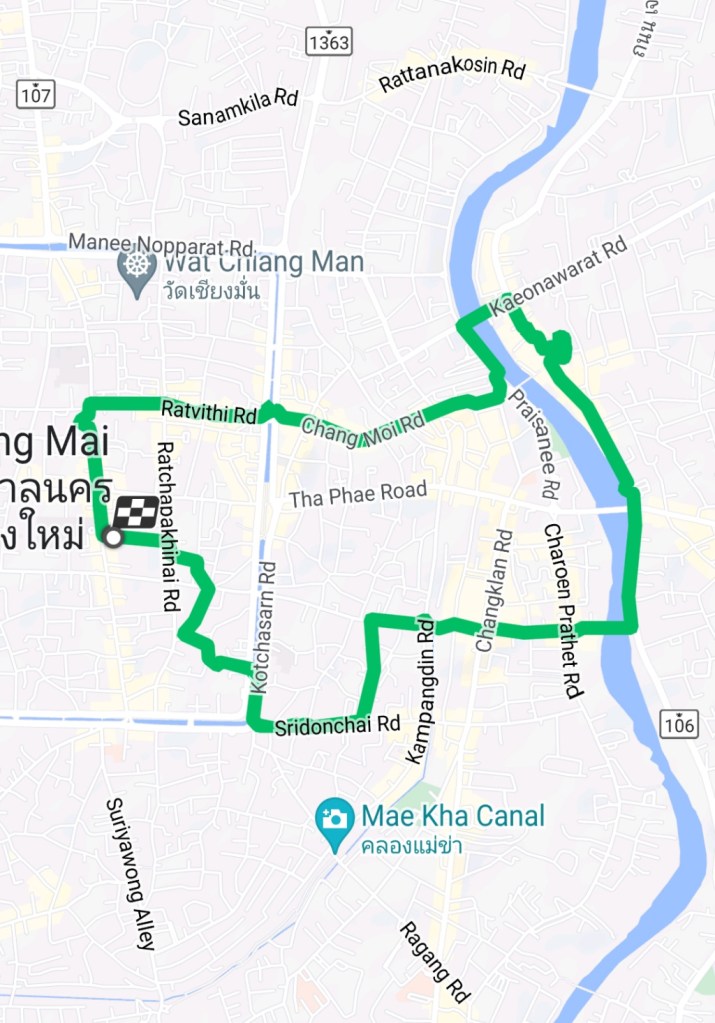
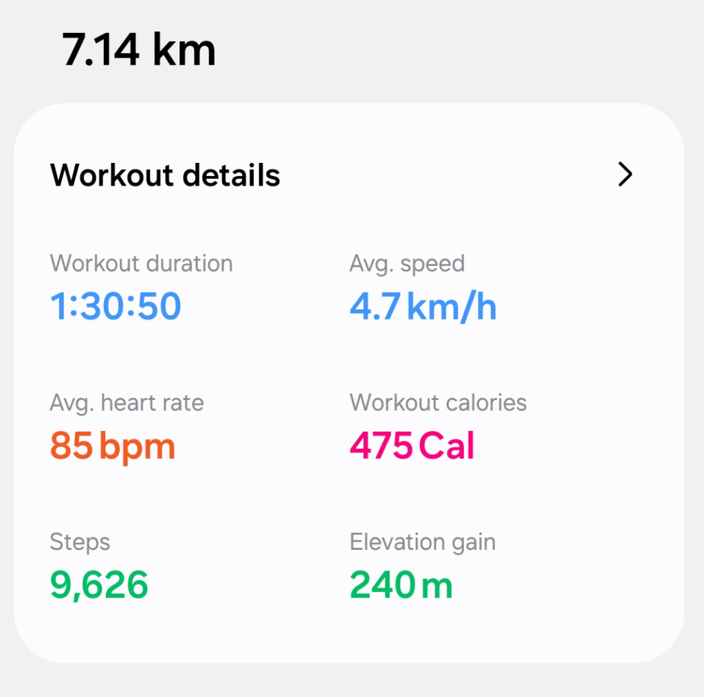
Being close to “home,” I made my way up Loi Kroh, then Sridonchai and into the old city and back to The 3-Sis. The walk was good, about 7.14 kilometers (4.44 miles) at a decent pace, considering I stopped often.
A good walk along the river. I’m happy for the businesses that they were able to recover so well from the floods. I’ll return to support a couple of good restaurants close to the Iron Bridge.
Next: Walk to Klong Mae Kha

seventy seven pound bags of ice. Young man’s work.
LikeLike