Sunday, December 3, 2023
Walking to and along the Mae Ping River
Mornings are cool, suggesting that winter is coming. By late morning, the heat is back, continuing well into the evening and making my usual after-dinner walks less comfortable than I remember. I wanted to get out for a walk today, having been reminded of a quote from John Muir (American Naturalist, Writer, Founder of the Sierra Club 1838 -1914)
“I only went out for a walk and finally concluded to stay out till sundown, for going out, I found, was really going in.”
I won’t stay out “till sundown,” but I will not hurry and enjoy the walk. Much has been written about walking and its value. I experienced much of the “going in” while walking each time in Spain on the Camino de Santiago routes. And about walking, the philosopher Kierkegaard said:
“Above all, do not lose your desire to walk: Every day I walk myself into a state of well-being and walk away from every illness; I have walked myself into my best thoughts.”
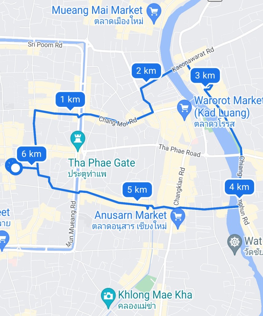
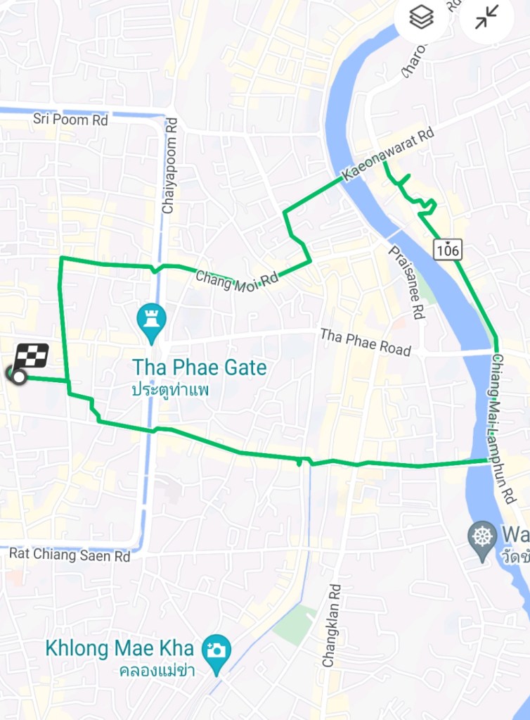
So on with today’s walk. I decided to go east down to the Mae Ping River, cross the river, walk south to the Iron Bridge, back up Loi Kroh Road, and finally back to The 3-Sis. This is a little over 6 kilometers, and though I have made this walk many times, I’ll see what has changed and what is familiar.
I think I have figured out how to get the maps from the Samsung Health and Google Fit apps on my phone, so for now, I’ll post both until I decide which I prefer. I’m leaning toward the Samsung Health map because I do not like the markers every kilometer on the Google Fit map. I’ll continue investigating to determine whether those markers can be turned off. The Google Fit map does show more significant places, like Mueang Mai Market, Warorot Market, etc.
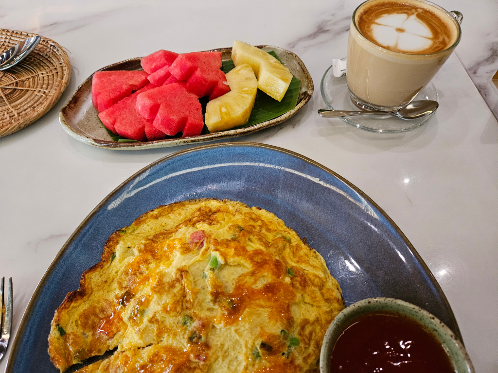
Many routes to take to walk to the Mae Ping River. But before I started this walk, I had breakfast at The 3-Sis. Not a large breakfast, but just right. Today a Thai omelette on top of a mound of rice (which cannot be seen), some fruit, and a cafe latte.
After breakfast and getting my hat and camera, I walked north to Ratvithi Road where I passed La Casita, a Mexican-style restaurant and one of the very few places where black beans are available.

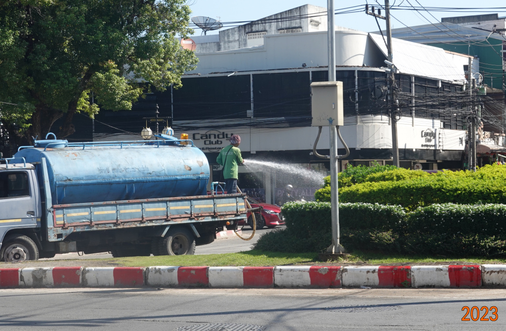
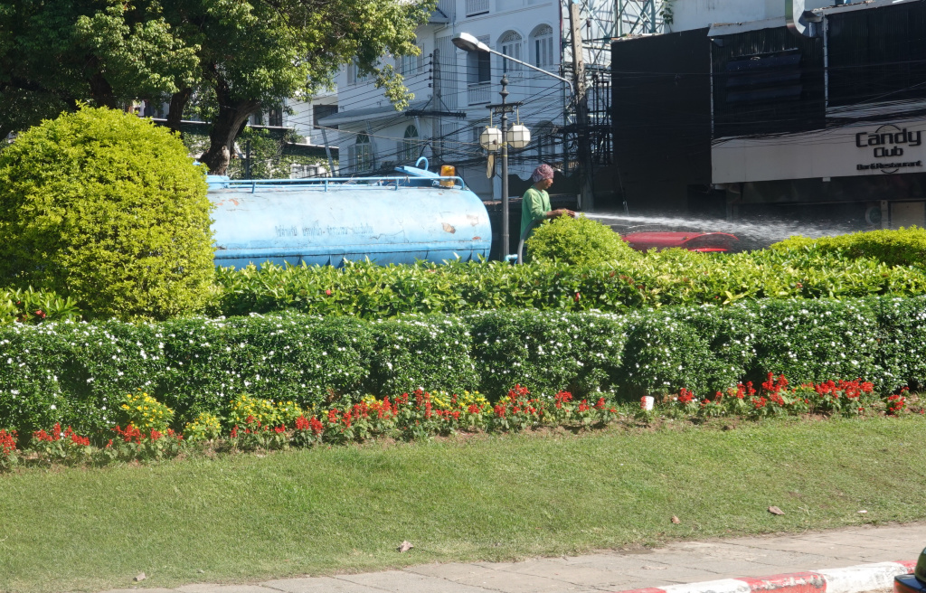
At the cross-over across the moat where Ratvithi Road connects to Chang Moi Road, I saw men watering the plants in the median. This is something I have heard about but had never seen until today.
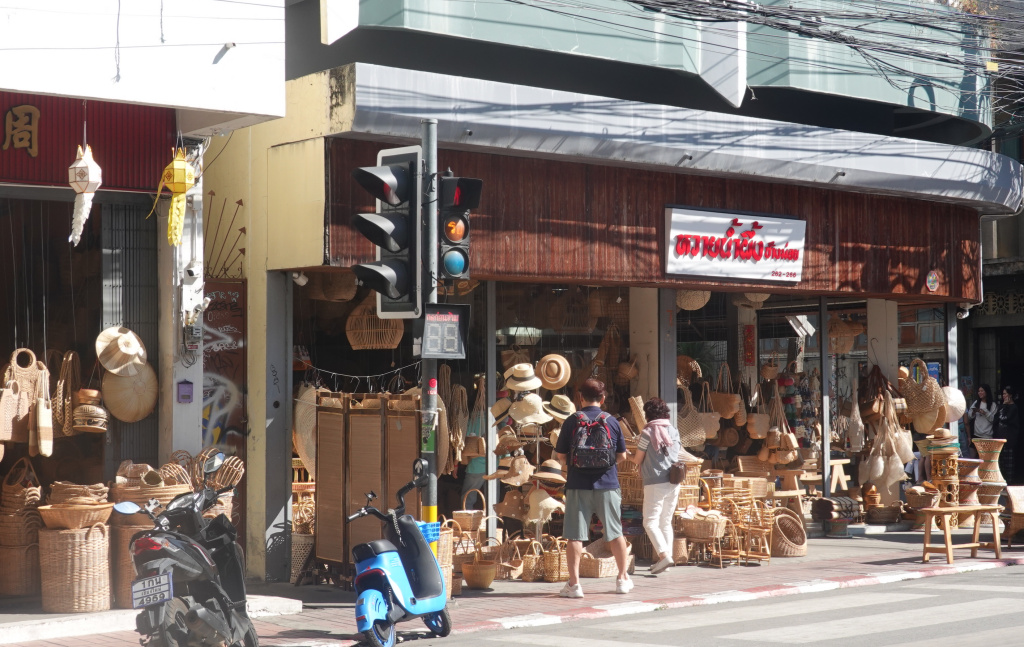
I passed them with no fear of getting wet and proceeded down Chang Moi Road. I passed the two rattan shops, side-by-side, both open and seemingly doing a brisk business. These two rattan shops have existed at least since I have been visiting Chiang Mai over the last 12 years.
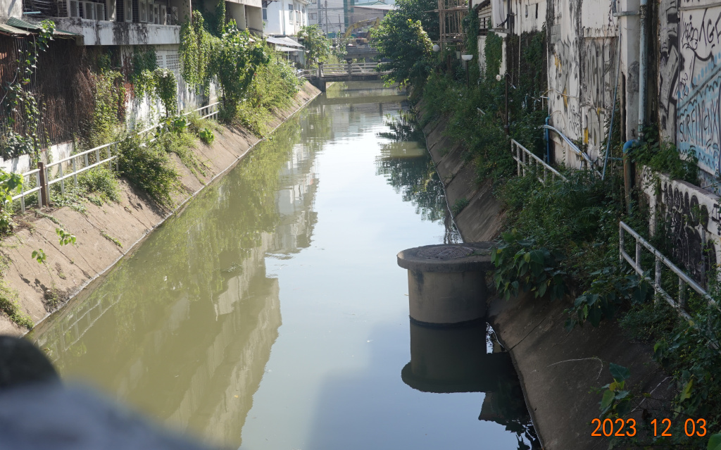
Klong Mae Kha
Farther down Chang Moi, the road crosses over the Klong Mae Kha. As those of you who have been reading my blog postings in previous visits to Chiang Mai know, I have a fascination with the Kamphaengdin, the second wall made of earth and clay that was around the western and southern parts of the old Chiang Mai city. The Klong Mae Kha is significant for two reasons. First, it is said that King Mengrai used the Klong Mae Kha in his search for a new location for the seat of his kingdom, after being dissatisfied with the repeated flooding of the Wiang Kum Kam location. Second, when the Kamphaengdin was built, the Klong Mae Kha was just outside the earth/clay wall, like a small moat. Here is a view of the Klong Mae Kha from where Chang Moi Road crosses. The guardrails suggest that there was a walkway along the klong, but they are now overgrown and impassible:
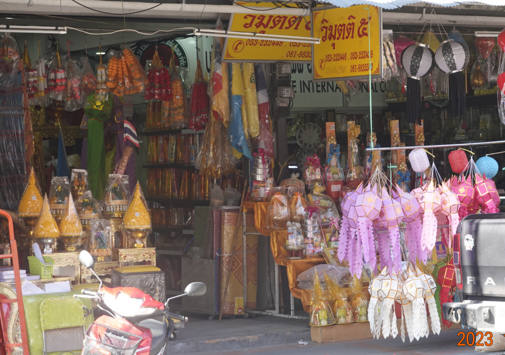
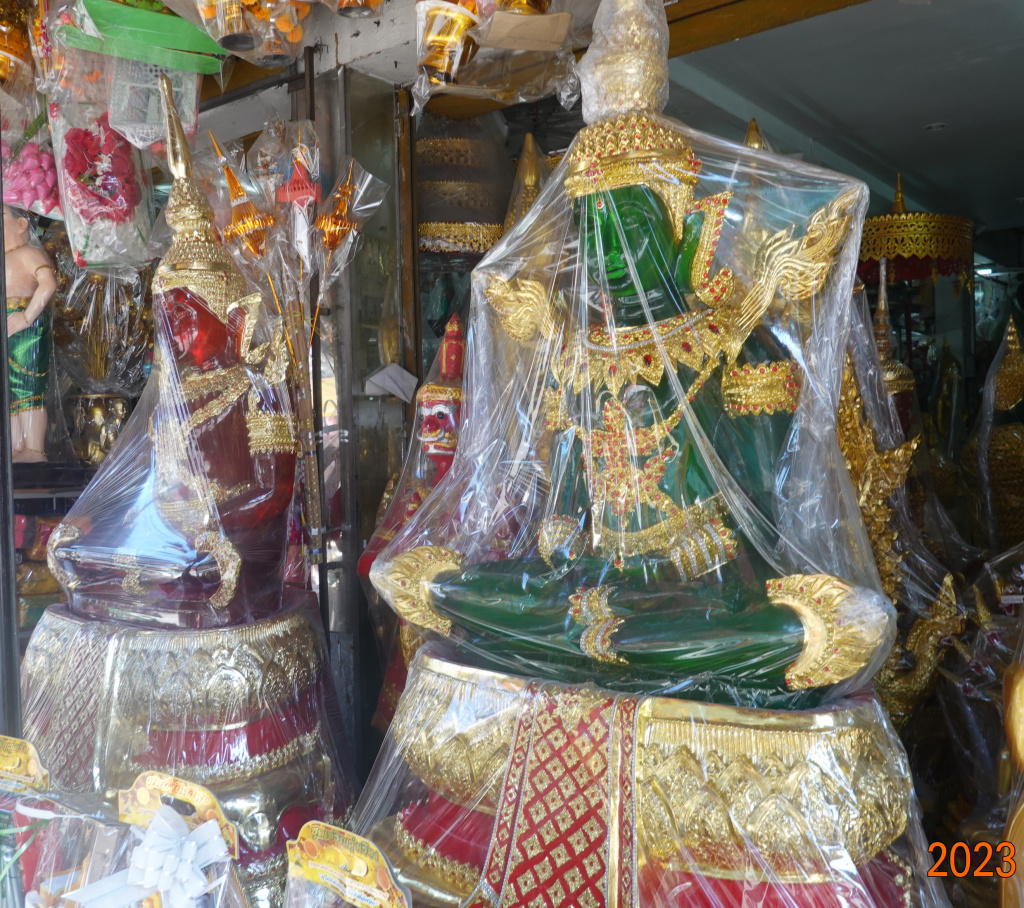
Shortly after crossing the Klong Mae Kha, I turned left to avoid the crowded Warorot Market area. I passed two interesting shops, one across the street always selling decorations, and another selling Buddha statues. The red and green statues are about 1-1/3 times lifesize, very large, and likely very heavy.
Then I make a right turn onto the road that crosses the river over the Nakhon Ping Bridge. This is a main bridge over the Mae Ping River, and always busy. Further on, this road becomes the highway to Doi Saket. Fortunately, there is a separate lane for motorbikes, and another separate lane for pedestrians which can be seen on the right.

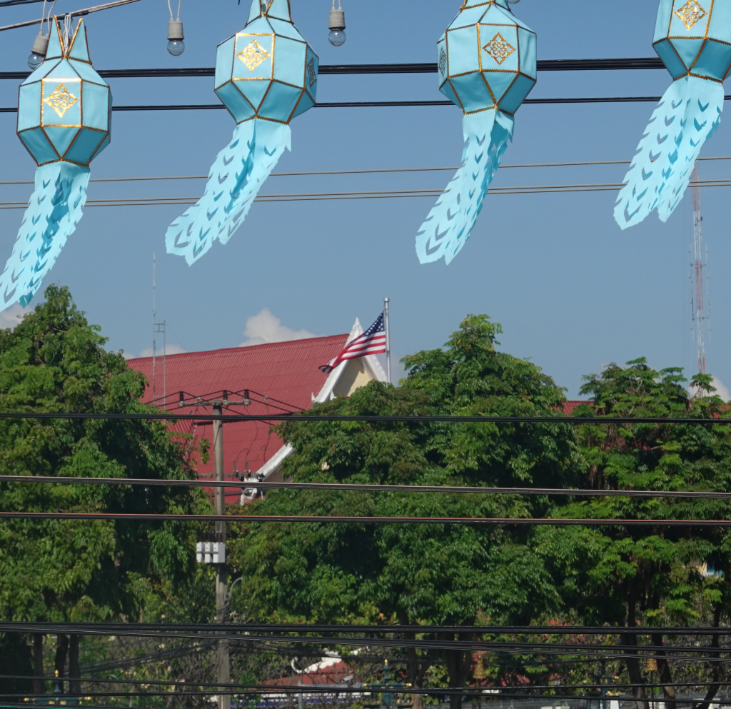
Looking back while crossing the bridge, I can see the American flag flying at the U.S. Consulate. I love seeing that flag. It is a good distance away, I used the extent of my camera’s zoom lens to get the photo. I have never been to the U.S. Consulate because I have no reason or need for their assistance. Always nice to know they are there.
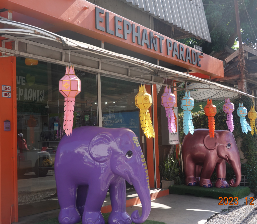
After crossing the bridge, I turned right onto Charoen Rajd Road that parallels the river. The first part of this road is busy with no sidewalks, so a little precarious and slow to negotiate. Very soon I see that Elephant Parade is still here. I love this organization. They have artists paint small elephant statues and display and/or auction them to raise awareness and money for elephant conservation. From their web site: “Elephant Parade® is a social enterprise and runs the world’s largest art exhibition of decorated elephant statues. Created by artists and celebrities, each Elephant Parade statue is a unique art piece. The life-size, baby elephant statues are exhibited in international cities and raise awareness for the need of elephant conservation.”
I passed Wat Ket Karam (also known as Wat Kate Karam or Wat Gate Karam, difficult to translate the sounds properly into English where there are only 1/2 the consonants. This is a charming temple, a favorite of mine (one of many), and I’ll be here again, so I’ll skip covering it for now.
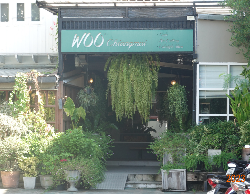
Further down the road, I passed the Woo Cafe – they are still in business. After a very poor experience there last year in which I received the worst service of any restaurant ever (in Thailand, Spain, or the United States), and what was only mediocre food, I’ll not return. (I should not even have given them this publicity.)
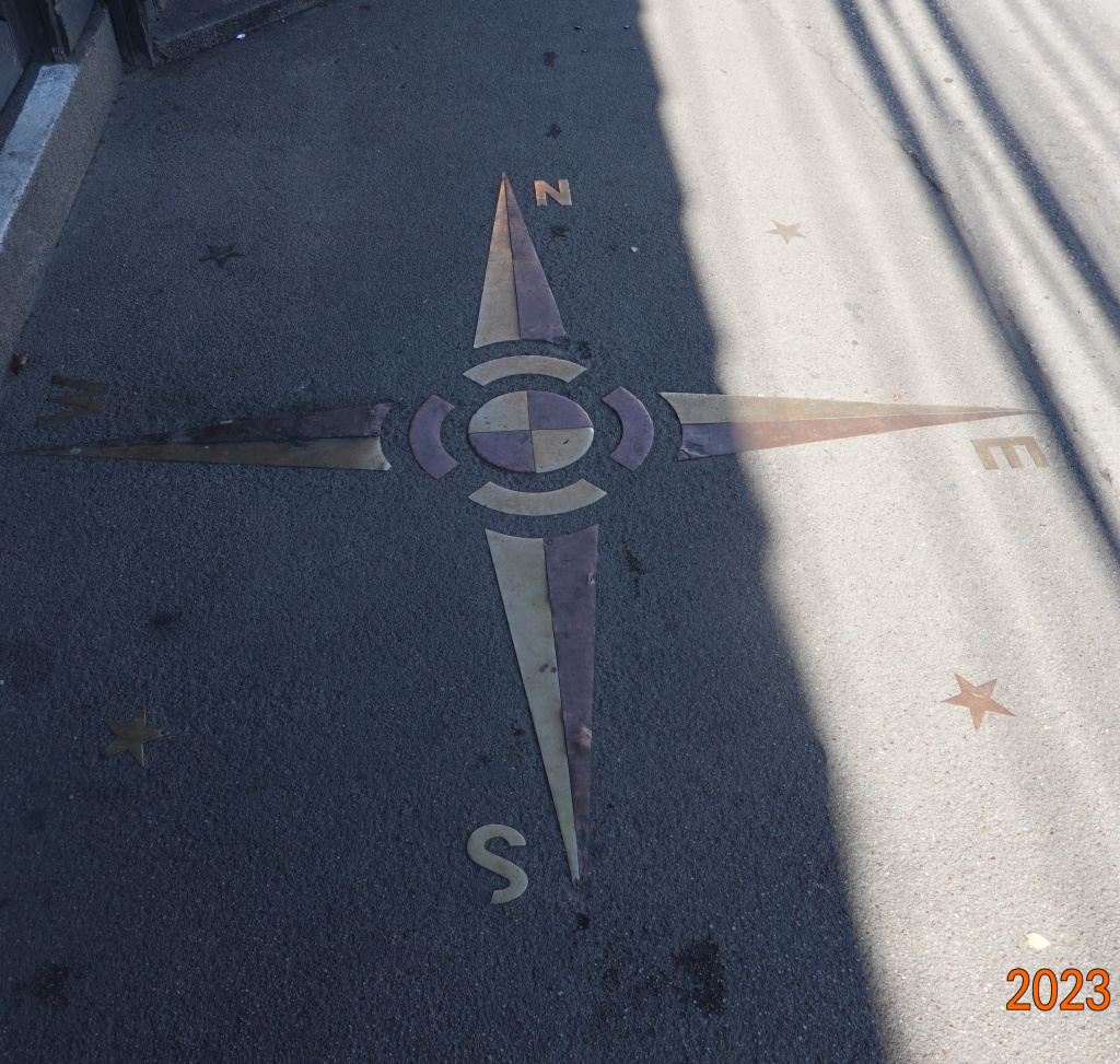
A little farther south, I saw this large compass in the sidewalk (there is actually a sidewalk on part of this road), something unexpected and interesting. I wonder why it is here. The orientation matches exactly with the compass app on my phone.
Nawarat Bridge
I came to the approach to the Nawarat Bridge, known as Saphan Nawarat. This bridge is much busier than the Nakhon Ping Bridge, with long traffic light waits to get across. Here are two photos of the bridge from a little down river, always decorated for whatever season, and always lined with flowers.
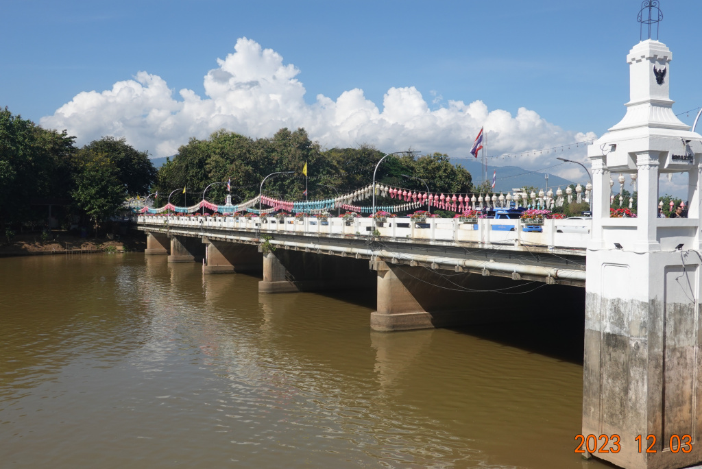
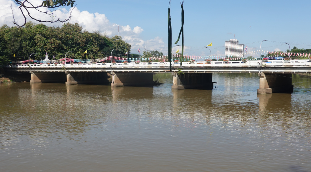
I discussed the history of this bridge previously. The bridge was the first bridge over the Mae Ping River, originally designed and built in 1920 by an Italian engineer. It was built using 600 teak logs, and then was destroyed by a fire. In 1923 a replacement was built of steel. The steel was not of the best quality, deteriorated faster than expected, and was replaced with the current concrete structure in 1965.
Iron Bridge
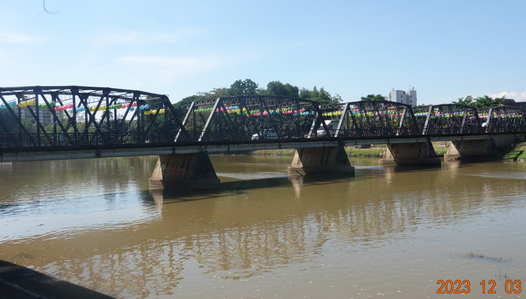
Another half kilometer south and I was near the Iron Bridge, known in Thai as Saphan Lek or Saphan Khua Lek, or just Khua Lek. [“Lek” means steel or iron. I thought “Saphan” meant bridge, and “Khua” meant connector, so having both seems redundant.] The Iron Bridge is a one-lane, one-way outbound bridge with fairly wide sidewalks on both sides. Oddly, the western 40-50 meter approach to the bridge has no sidewalks, and there often seems to be a stream of vans on the road as I am walking there.
The Iron Bridge is so named because it is constructed of steel. This is the so-called “new” bridge having been built about 50 years ago. It is said the Iron Bridge was built as an homage to the former steel Nawarat Bridge that was replaced in 1970. Here are two views of the bridge from the eastern side.

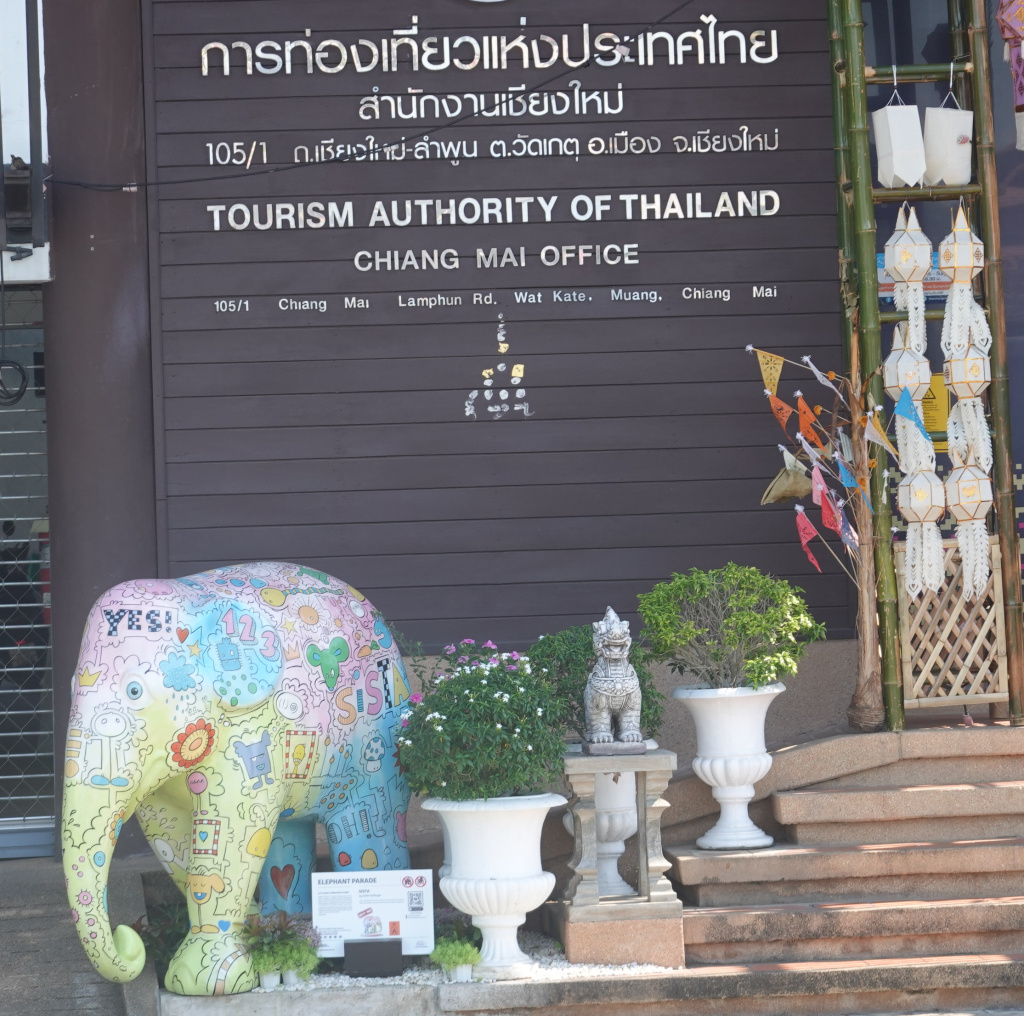
Tourism Authority of Thailand
As I was about to walk up onto the Iron Bridge, I looked to my left and saw the office of the Tourism Authority of Thailand, known as the TAT. I never noticed this before, and am happy to see that they have one of the Elephant Parade elephants outside their office:
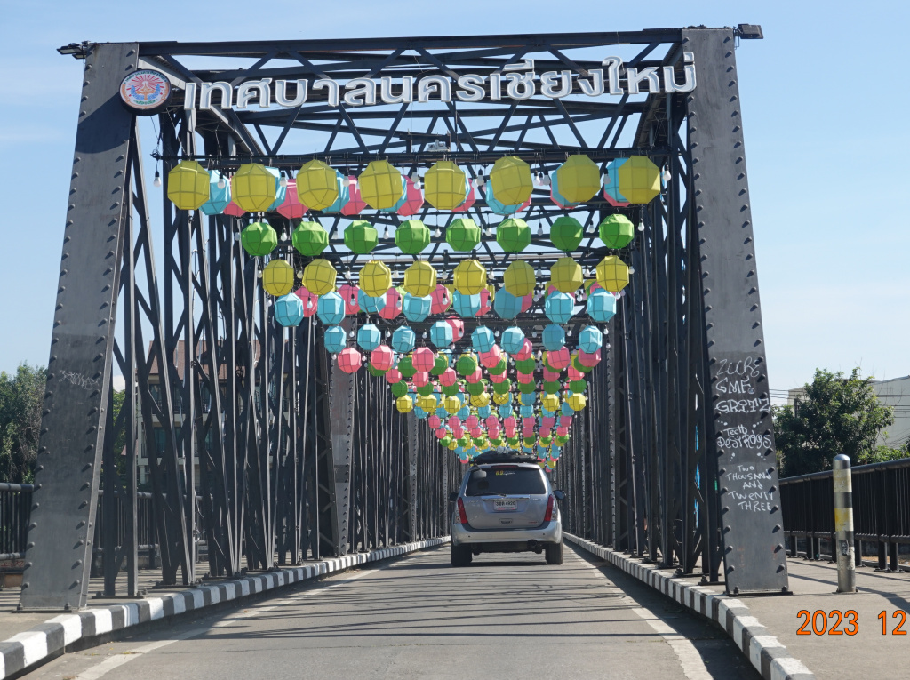
Iron Bridge (again)
I crossed the Iron Bridge. During Loy Kratong at the height of the celebrations, and last year at New Year’s Eve, this was so crowded with pedestrians that vehicles could not cross. Today there is almost no traffic. I stopped in the middle of the bridge and photographed the very peaceful river looking downstream.

At the west end of the bridge with almost no traffic, I photographed the bridge from the center of the road, still decorated. I expect the decoration to remain through New Year’s. The Thai writing translates to “Chiang Mai Municipality”:
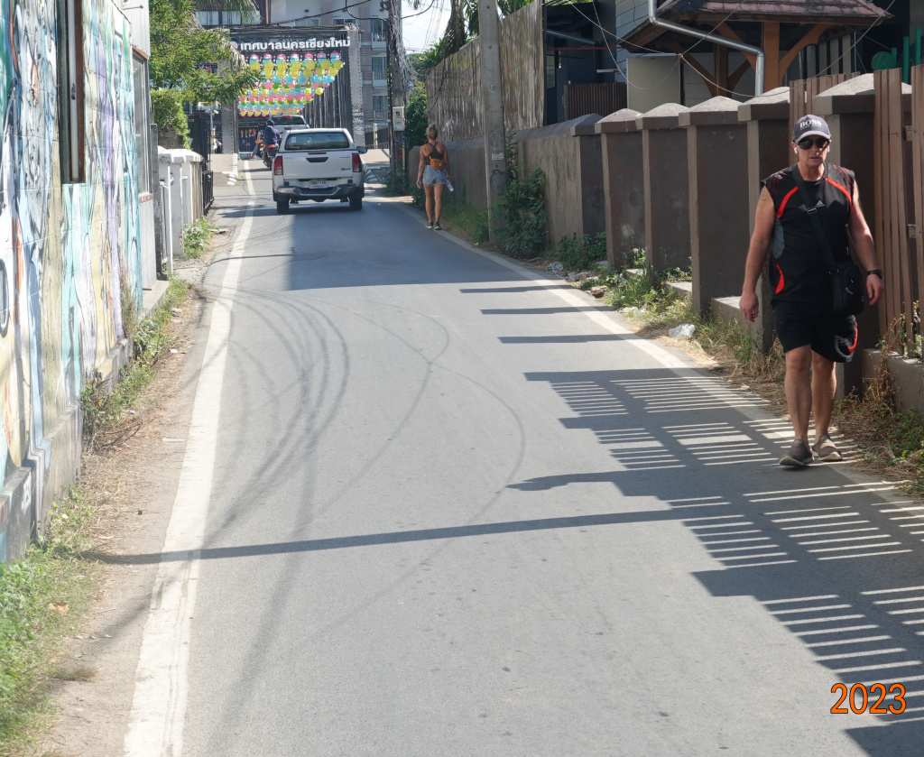
And here is a view looking back at the narrow approach to the bridge on the west with no sidewalks and a narrow traffic lane When a large truck or SUV is coming, it seems as if I will not fit.
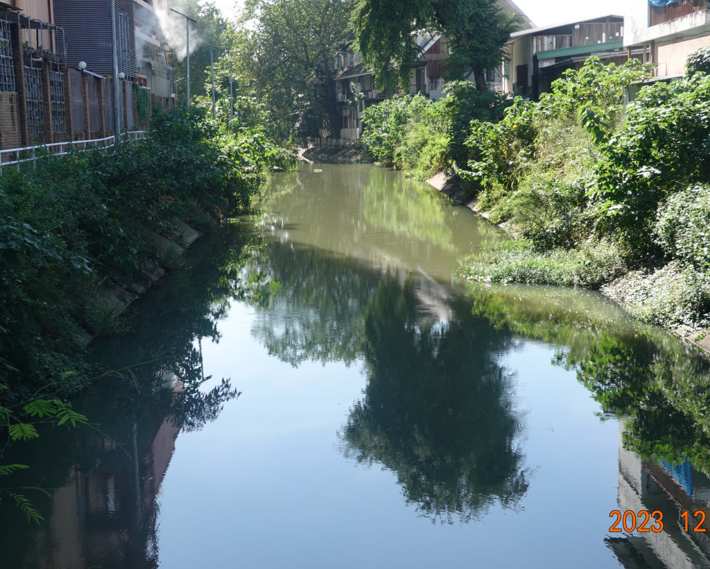
Klong Mae Kha
While walking up Loi Kroh Road, I crossed the Klong Mae Kha again. Here is a view from Loi Kroh Road.
I returned to The 3-Sis for a shower and a rest before dinner.
Next: Walking south of the old city
