Friday, November 24, 2023
Walking around the perimeter of Chiang Mai
The travel from home to Thailand, then a full, very busy day in the very hot and sweltering heat of Bangkok left me somewhat tired. I arrived in Chiang Mai on Wednesday afternoon, checked in to The 3-Sis, where I stay every year, then walked to Street Pizza for a large salad, a small pizza, and a watermelon smoothie. Street Pizza is a restaurant where they make their pizza sauce daily, excellent pizza, and is a favorite. On my return to The 3-Sis, I walked around a little seeing what has changed in the ten months I have been gone. Thursday was another low-key day. I went to Khun Kae’s Juice with John (husband of Rose, owner of Wild Rose Yoga) for a smoothie bowl, and time to catch-up. Made some progress on a blog post of my day in Bangkok, and hope to finish it soon. I have only been in Thailand for a few days and am already behind on posting!
So today I decided walk around the entire circumference of the old Chiang Mai city wall/moat focusing on the four corners.
Chiang Mai City Wall
Much has been written about the Chiang Mai walls and moat. Not all is entirely accurate, however, often not considering the history. Covering everything I have learned would take many pages of boring text, so here is something of a summary:
First, the word “Chiang” in the city name can be seen in many other cities in northern Thailand. Often people say it means “city,” but in Thai, “mueang” means “city.” Historically, and perhaps in the northern Thai dialect, “chiang” means “walled city” referring to a city surrounded by a wall. King Mengrai (1259-1317) first established Chiang Rai, but being fairly close to Burma, the Burmese battled with his people often. So he sought to establish a new capital of his kingdom of Lanna (kingdom of a million rice fields). In 1286, he founded the town of Wiang Kum Kam by the Mae Ping River. Due to regular and severe flooding, King Mengrai sought a better location for the capital.
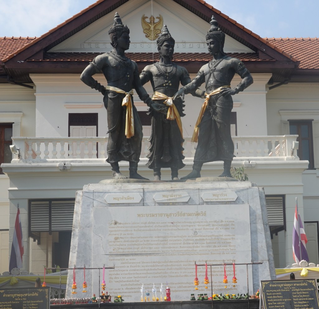
He found a new site north and a little west of Wiang Kum Kam and invited his two sworn brothers: King Ramkhamhaeng of Sukhothai and King Ngam Muang of Phayao, to visit the new site and consulted them on the suitability of the location and the city plan. It is said they observed seven good omens and so this was to be the site of the new capital. On April 12, 1296, the city was named Nophaburi Sri Nakhorn Ping Chiang Mai. To honor the alliance and work of these three kings, a bronze monument (2.70 meters tall), is now in the center of the city, the Monument to the Three Kings.
The Chiang Mai city layout was based on ancient military and astrological beliefs. King Mengrai wanted to protect his new city so, he ordered the construction of a perimeter wall and moat. I have seen it written that it is 1800 x 2000 meters and also 1500 x 1600 meters. Over 50,000 men were recruited to construct buildings inside the city: the royal residence, the throne hall, and store houses and stables for elephants and horses which were used in times of warfare. Another 40,000 men were engaged to construct the city walls, observation towers, city gates, and city moats. I have read that most of the work was completed in just four months (!). Each of the four walls had a gate named after its location or significance in daily life. Today, the restored gates are still visible, although most of the wall is gone. The gates and corners were reconstructed in the 1960s to 1980s. Here is a photo from 1916 showing a somewhat deteriorated but fairly complete wall.

Why are the walls almost completely gone? When the Japanese occupied Thailand in World War II, building supplies were in short supply, so they used the bricks from the Chiang Mai city wall to pave the road to Pai on which to move military equipment.
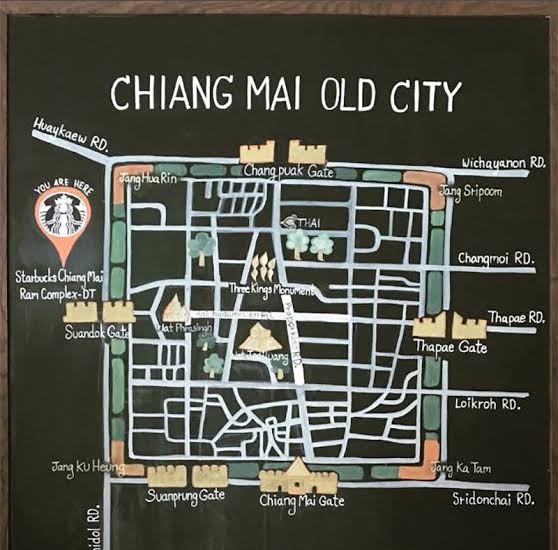
The Four Corners of the Chiang Mai City Wall
I plan to walk around the perimeter of the old city, focusing on the four corners, a walk of about 6 km or 4 miles. (And I have my hat, so no more sunburn.) Here is a map of the walls with the names of the gates and corners. Disregard the “You are here” – neither you nor I are there. Note that the corner names are prefixed with “Jang” which means “corner.” Getting the phonetic spelling close to accurate from a language with 44 constants, 12 vowels, and 8 diacritical marks is a challenge. The phonetic spelling of “corner” is typically spelled “jaeng” instead of “jang.”
Southeast Corner: Katam Corner
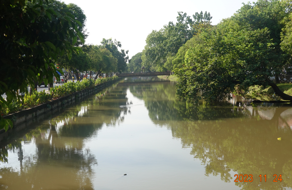
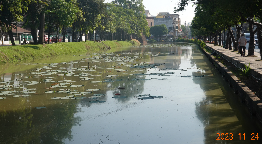
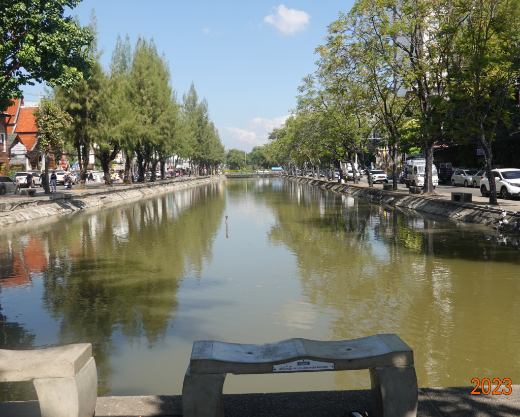
There is a road on either side of the moat. The inner moat road traffic goes counter-clockwise, and the outer moat road traffic runs clockwise. There are a reasonable number of cross-overs. I started the walk where on the map Loi Kroh Road crosses the moat. Actually, Loi Kroh Road stops at the outer moat road and Ratchmanka runs from the inner moat road across the old city. From the moat crossing, here are two views of the moat, the first looking north towards Thapae Gate and the second looking south towards Katam Corner:

Here I was walking on the inner moat road, and being that it is hot, I did not want to add a good distance to my walk, so here is the back of Katam Corner:
Water flows in the moat, entering at the northwest corner and exiting at the southeast corner, Katam Corner. Currently, water flows out of the moat through an underground channel under Sridonchai Road, but before the road, the water flowed into a creek. Fishermen caught fish there using bamboo traps called katam, thus emerged the name of the corner.
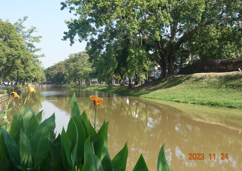
Walking west away from Katam Corner, I took a photo looking back with Katam Corner just barely visible in the upper center of the photo:
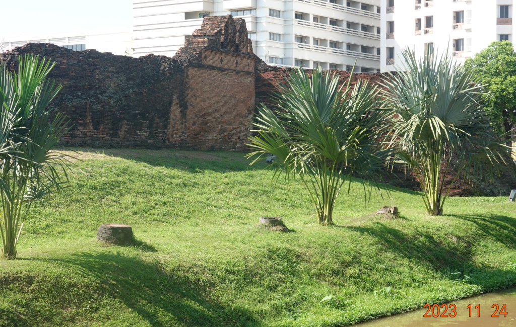
Ku Huang Corner
Continuing west, I came to Ku Huang Corner, the southwest corner of the old wall. This is a larger corner than Katam Corner, much like the corners on the northwest and northeast.
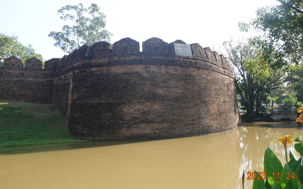
Looking north along the moat gives this view, with some of the wall intact on the right.
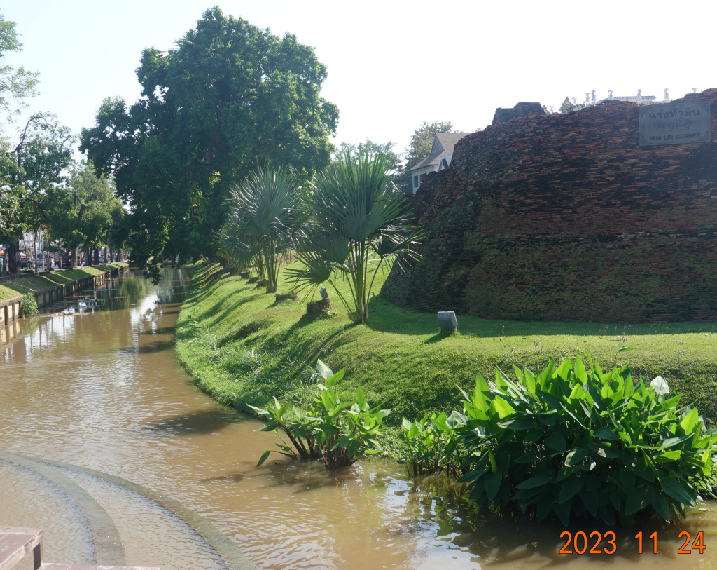
Hua Lin corner
I made it to the northwest corner, now more than half way complete with my perimeter walk. This is Hua Lin Corner. I have two photos of Hua Lin, because looking directly to the corner meant looking directly into the sun. The first photo looks more to the east, and the second photo looks back at the corner with Chiang Mai Ram hospital in the background (where a year ago I got five stitches closing a bad cut in my forehead).
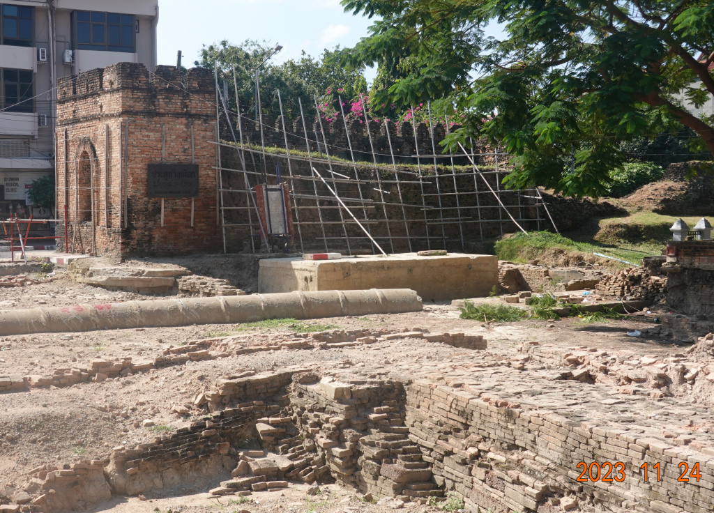
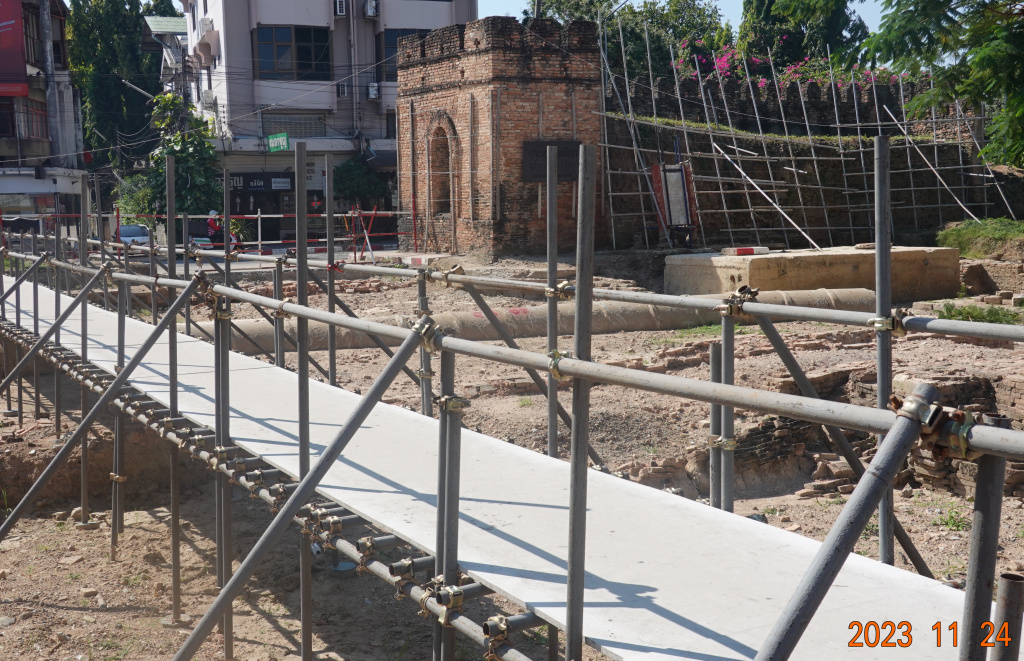
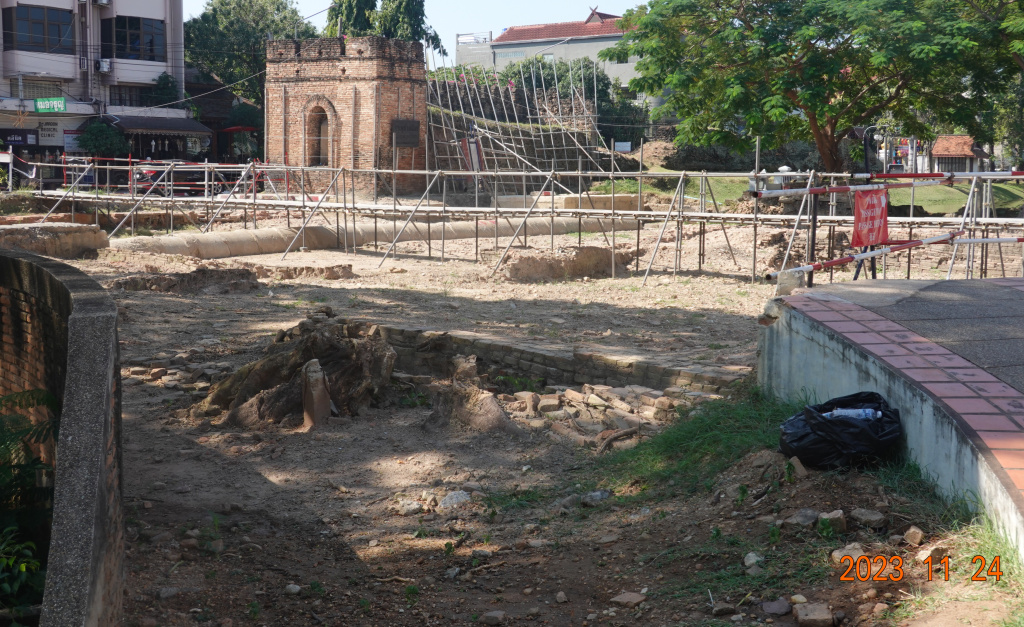
Chang Phuak Gate
I did not stop to photograph the other gates, but Chang Phuak Gate is undergoing restoration after partly collapsing during very heavy rains a little over a year ago. During the restoration, more and more of the road close by had been found to have been undermined, adding to what has become a very extensive repair/restoration. Here are a few views of the gate and the repair in progress:
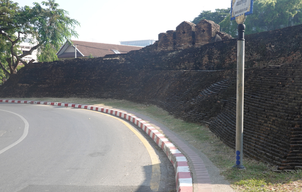
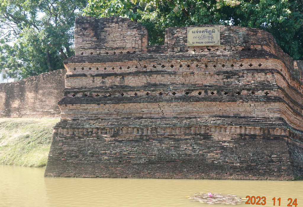
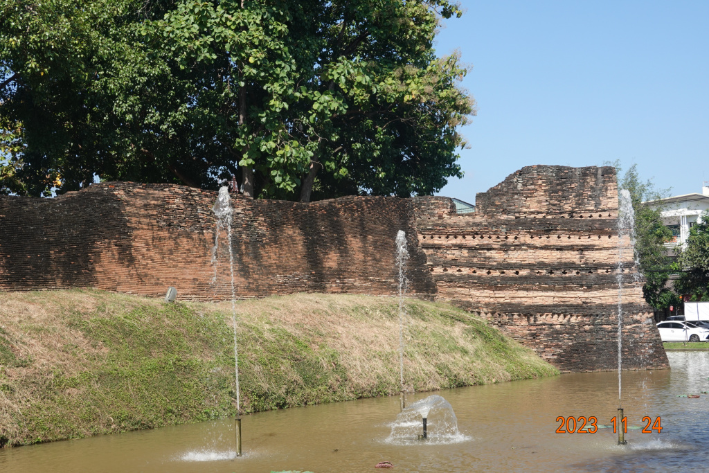
Sri Phum Corner
Sri Phum Corner is the northeast corner of the old Chiang Mai city wall. Here are two views of Sri Phum corner, the first showing the face at the corner, and the second looking back showing a good bit of the old wall still connected to the corner:
Last View of the Moat
Because of the preparations at Thapae Gate for the Loy Kratong festival this weekend and the many, many tourists present, I took no more photos today. It was a longer and hotter walk than I expected. I might be doing too much too soon, so I’ll rest another day or so and start yoga practice Monday and strength training Tuesday.
Next: Inside the Old Chiang Mai City
