Saturday, April 15, 2023
Walking from Monesterio to Fuente de Cantos
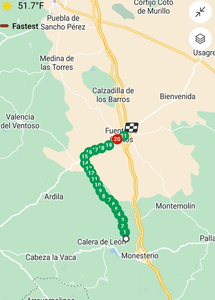
22.5 kilometers, 23,400 steps
The sixth day on the Via de la Plata route of the Camino de Santiago pilgrimage paths started in very cool, but clear weather promising being quite warm by midday. My foot is continuing to heal albeit slower than I had hoped. As yesterday, our Taiwanese friend Sharon and I are again having our backpacks taken by taxi to our ending point to lessen the weight we are carrying.
The route today is a little ambiguous because there are two older routes and a newer “official” route with the new granite way markers. While we do not know the reason for the change, a good amount of funding was required to place the granite markers along the route, so there must be a reason for the change. When we got to the split point, Tom and I took the newer “official” route, and Leonard and Javier took the older route marked with fading yellow arrows. My walk was from Monteserio 22.5 kilometers to Fuente de Cantos starting in a very cool, breezy morning and ending in the hot sun. Here is the map of my route today which is a little short because I did not start the walk on my phone app until we had been walking for about 2 kilometers.
Our Belgian friend Baudouin left almost an hour before us and got this photo of the early morning sun. Baudouin almost always starts the day’s walk early and walks very fast, so he is at our intended night’s accomodation well before us.

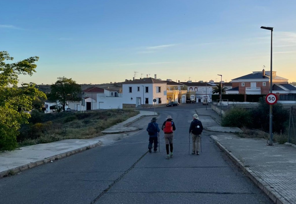
When we were leaving Monesterio, I got a shot of our group on the way out of town in the still fairly dark early morning.
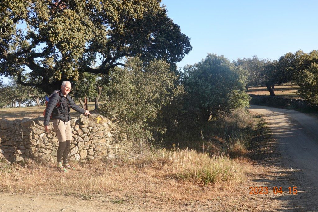
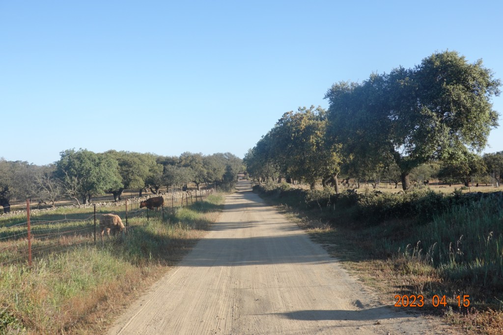
Soon we were off the main highway road and in secondary gravel farm roads. Most of the route today is expected to be on these gravel or even dirt roads through cattle and sheep grazing land. I caught Tom here pointing out a very subtle yellow arrow on the stone wall along the road. If you see the arrow, you know you are on the right Camino path. And when you do not see an arrow or other markers for a while, you start to wonder if you missed a turn. It is better to walk in a group and someone will likely see arrows others miss.
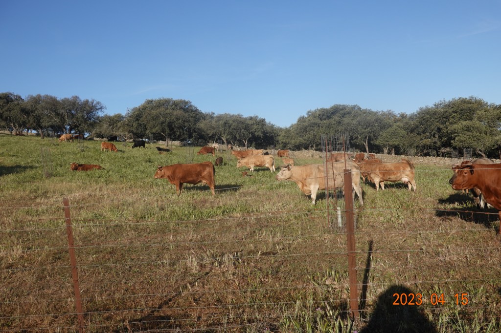
This is cattle country. We are seeing many, many more cattle today along the way.
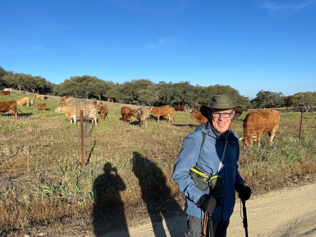
Javier got a photo of me in cattle country. I still have my jacket and gloves on. While using hiking poles, your hands are continually exposed, and my hands get cold easily, so the gloves really help.
And we continued down the road in cattle country.
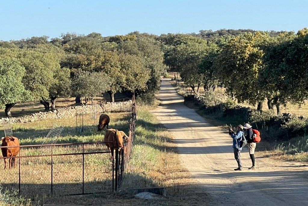
After a bit, while Tom and I stopped to photograph the cattle, Javier took this photo of us.
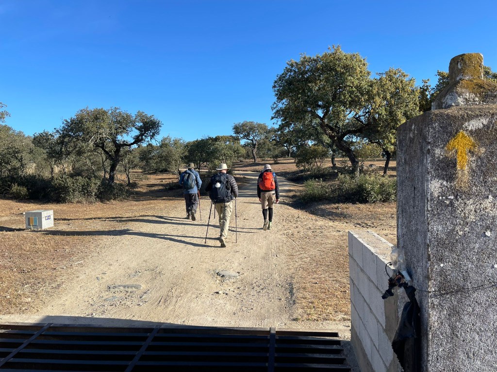
Gradually, the surrounding land is changing from that of primarily large trees to that of fewer trees and more pasture land. Javier took this photo of me, Leonard, and Tom as we lassed through a gate, clearly on the Camino path as indicated by the yellow arrow on the right of the photo.
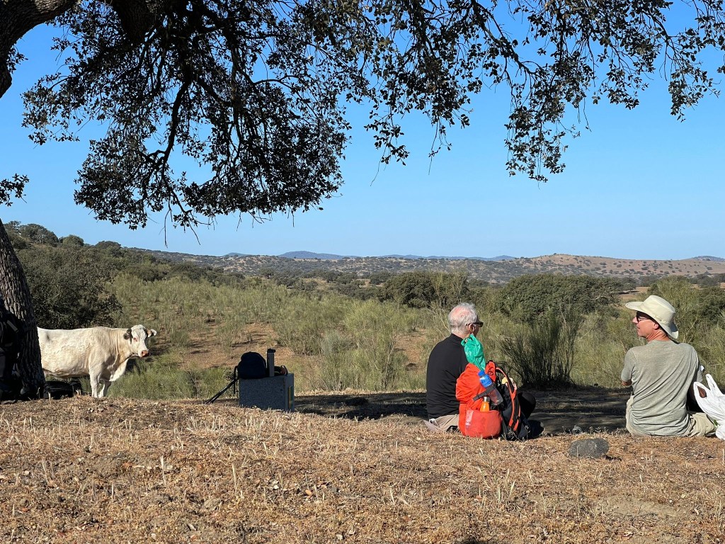
We rose up a couple of small hills, and found a tree under which to stop for a break, some food and water. We are now in an area in which we are with the cattle – no fence separating us. Here is a photo of a cow checking out Tom and Leonard as they ate.
It can also be seen that there are fewer trees and more pasture land along this section. We are in an area in which there are very few trees and a few cattle who eye us cautiously as we walk by.
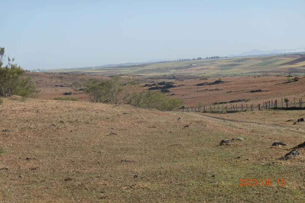
Continuing on, this is starting to feel like a long day in the fields. The temperature is still moderate, and walking through large expansive fields is somewhat tiresome – the surrounding country is beautiful, but every bend and every rise yields another stretch or another rise in front of us, almost taunting us. And the expansive land just continues, sometimes with more trees as shown in this photo:

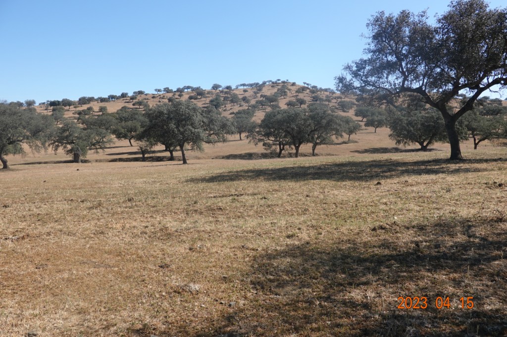
The fields are beautiful, as I said, but the day is getting longer and I am getting tired. Some of the fields have trees spaced too consistently to have been natural, suggesting deliberate planting and/or farming. Or maybe not. It is difficult to tell for sure.
After walking for about two hours after our mid-morning break, we came to a path split. I did not photograph this place, unfortunately. The older yellow arrows directed us to the right, and the newer granite Camino route markers directed us straight ahead. Javier and Leonard went on the older route. Tom and I headed straight on the newer marked route. Looking at Google Maps and comparing to routes indicated by other applications, the two routes are shown to get to the same place. The question was which was the shorter, which involved less stress on the feet, and which was safer (meaning away from vehicle traffic). All of those were unknown.
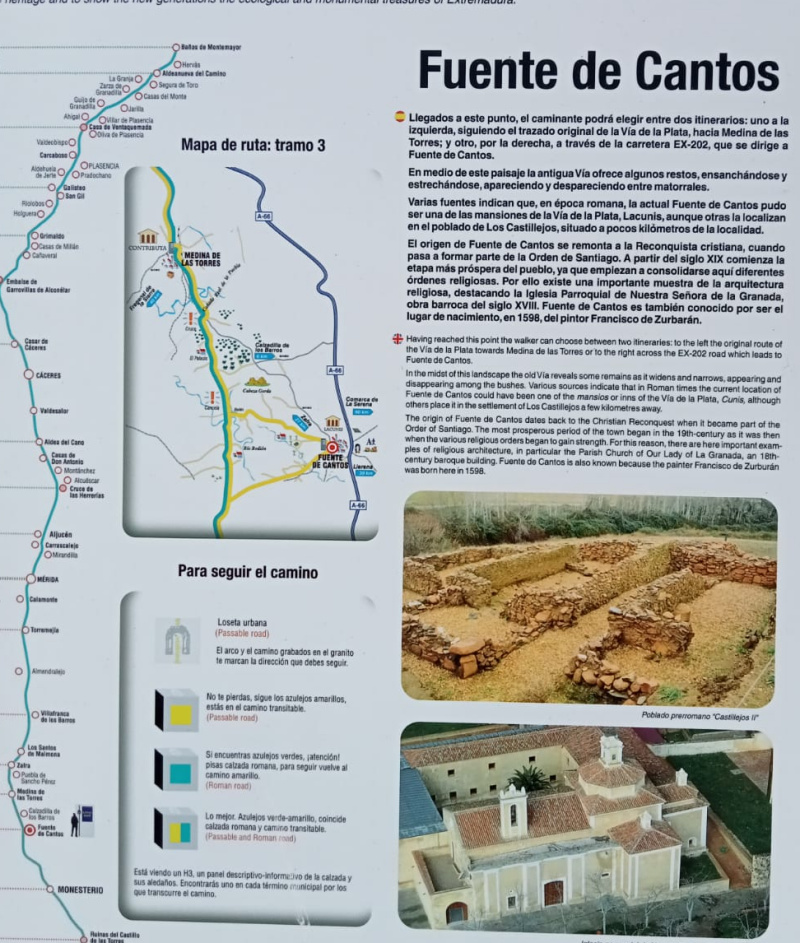
After almost an hour, Tom and I came upon this sign, placed by a govermental agency of Extremadura. This shows the tien between the Camino route and the older Roman roads. To the left of the larger title “Fuente de Cantos” the map shows that we were where the yellow line branches off to the right to Fuente de Cantos. The Yellow line represents a Camino route. The Green line represents the route paralleling old Roman roads. The Roman road continues straight north to Medina de las Torres, bypassing Fuente de Cantos. We, however, are going to Fuente de Cantos.
So Tom and I turned right and continued. The dirt/gravel road came upon a highway, and it became clear that we were to be walking on this highway for 90 minutes or more, 5-6 kilometers. And there was no path by the road, we had to walk on the edge of the road itself. Fortunately, there was little trafflc. After almost and hour, we flagged down a car (not as elegantly as Claudette Cobert in the 1934 film “It Happened One Night”) and got a ride for the last two kilometers into Fuente de Cantos. When everyone had arrived, we went to the restaurant downstairs for lunch. Here we are after a long, tiring day in beautiful rural southern Spain:
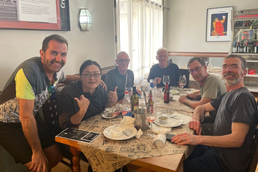
Javier from Spain, Sharon from Taiwan, me, Tom from Australia, Leonard from Tuscon and San diego, and Baudouin from Belgium.
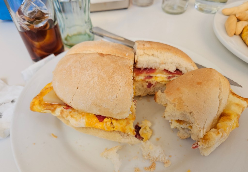
After a shower, change of clothes, and some rest, Leonard and I went out in search of more food. We found a bar, and although their kitchen was officially closed, they made a mushroom omlette for Leonard, and a ham, cheese, & omlette bocadillo for me (with my usual post-walk Coke).
A seemingly very long day, and we had a good walk. Tomorrow is a little longer walk, but almost all off main paved roads, and the temperature is to remain moderate – cool oin the morning, warmer in the afternoon. I am hopeful for another good day.
Next: Fuente de Cantos to Zafra

Sounds like a good walk so far! Interesting descriptions and pictures.
LikeLike