Tuesday, April 11, 2023
Walking from Guillena to Castilblanco de los Arroyos
18 kilometers, 20,600 steps
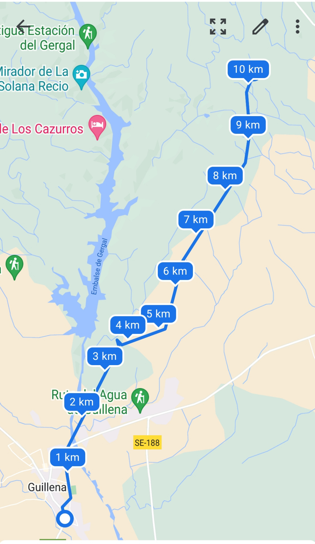
Today was a challenging day, not because of the difficulty, but because we are still finding our Camino fitness. And, somehow, when we took a break, both the Samsung Health and Google Fit applications reset. Samsung Health reported that I only walked 1.8 kilometers and I know the walk was much longer. Google Fit broke the walk into two sections where we took a break. Here are the two Google fit maps of today’s walk, and a Google Maps map of the whole of today’s route:


Since walking around Seville in new sandals that are to be for after walking each day, I noticed a hot spot developing under the ball of my right foot. And it is now developing into a blister. In Guillena, I got some tape at the pharmacy, and wrapped it around my foot to add some padding and ensure that further rubbing would not irritate the blister. I’m hopeful that this will work, because after wrapping my foot, walking is much, much less painful. I will have to be careful to not let this get worse.
We started walking out of Guillena early, at just after 7:00 AM in the dark to avoid walking in the heat of the afternoon. While much of today’s walk would be on gravel roads or dirt paths away from highways or roads, to get out of Guillena required negotiating a few busy streets in Guillena and a busy highway across a bridge in the dark. And, we were walking on a very narrow shoulder about 40 centimeters wide (15 inches) with the cars and trucks whizzing by closer than was comfortable. When each car approached, I stopped and leaned over to stay as far away as possible. Once we got over the bridge and up the hill, we turned right and started up a gravel & dirt road, thankfully away from the highway and the fast traffic. After a two or three kilometers walking along this road through olive trees, we came to a dead end. We realized that we had seen no Camino arrows since we left the highway. So we started walking back to the highway. Tom suggested after a lengthy consultation with Google Maps cutting across through the olive grove. so we did that. Even though the signs seemed to indicate “no trespassing” we were hoping that if caught they would be merciful to pilgrims. Here is a photo in the olive grove, peaceful in the early morning light:
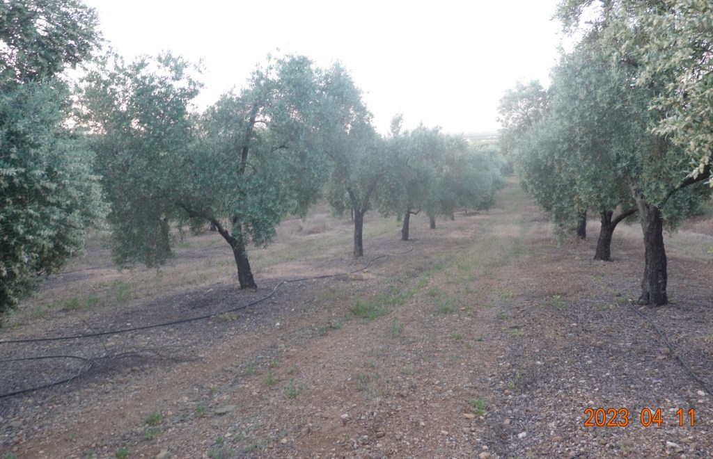
Tom took a photo of me in the olive grove. I have a backpack, and am carrying a second bag with “consumables,” energy bars and packets of hydration drink. The small green bag on my shoulder strap is my camera bag.

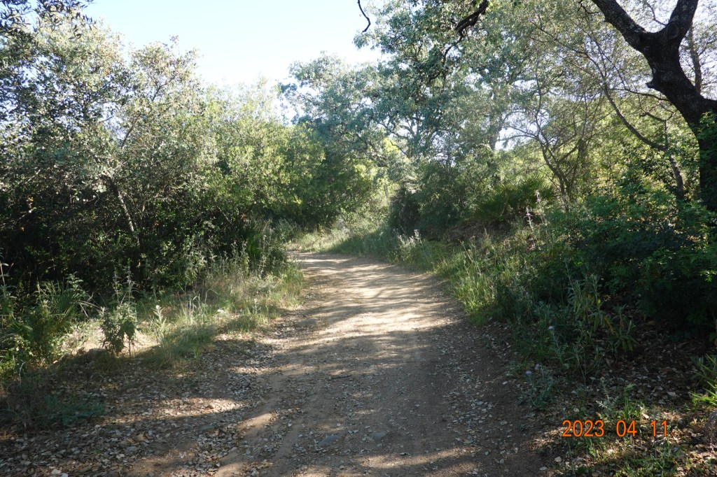
Finally we were back on the Camino path as indicated by an official Camino Via de la Plata way marker.

Now the path was by a stretch of wheat fields. The path seemed to be going uphill most of the morning.

On one side of the path were wheat fields, and on the other was a very long grove of something – unclear what exactly. Compared to the olive grove, these trees are smaller and much closer together.

Soon after the wheat fields and the unknown grove, the Camino path was back in what seemed to be rugged and undeveloped. Still the path is gradually uphill and a bit tiring. It is only day number 2 on this journey; we getting into shape, but it will take several days.

Then we came to this sign telling us of a water stop.

We followed the signs, and about 50 meters off the path was a hand-pumped water pump. It did work, but not knowing whether the water was potable, we did not drink toe water. We did take off our backpacks, sit down, take off our shoes to rest our feet, and have a small lunch.
Back on the path, we continued slightly uphill, crossed what appeared to be an access road, and saw this sign giving us a little encouragement to continue for the last 6.9 kilometers of the day’s stage.

The Camino path continued uphill. The grade is not really seen in the photos, but my legs definitely felt the continual uphill grade. Being away from the highway was good – quieter and much safer. We have been in a very natural scrub brush area, almost a forest, for some time now.
The path continued on, and we came to the highway to Castilblanco. The Camino path crosses the highway, then proceeds along the highway. This time, the path, while close, is completely separate fromt eh highway by 3 or 4 meters, giving us some sense of safety.
Soon we came to the entrance to a goat farm or ranch while the goats were being led from their grazing area to the milking building. By the time I had my camera out to take this photo, at least half the herd had passed. Seemed like a large herd of goats.

We followed the goats for a hundred meters or so until they turned off the path, then continued on. I’m getting tired, and hoping the ending point will appear soon. Sometimes wishes come true, for there appeared the sign announcing Castilblanco de los Arroyos:

The albuergue was very close, and I was so, so happy to stop for the day. My right foot has some pain when I walk, but better than yesterday. Time for a rest, and as little walking tonight as possible.
Next: Castilblanco de los Arroyos to Almadén de la Plata

I wonder if the smaller shrubs were pomegranate.
LikeLike