Sunday, January 1, 2023
Yoga with Annie, Kirtan at Wild Rose
The new year started with a yoga session with Annie, always invigorating and inspiring. Much of the rest of the day I spent working on my blog – researching temples and their history, editing photos (cropping and reducing size), and writing the text. At 6 PM at Wild Rose, there was a Kirtan.
A kirtan is from a Sanskrit word meaning “narrating, reciting, telling, describing.” In modern settings, this often takes the form of call-and-response chanting or singing. There were more than 40 people and two leaders, one playing guitar and one playing harmonium. The leaders were energetic and it was infectious, so there was a great deal of energy in the singing. This is not something I would normally gravitate to, and feeling like being open, I came and had a very good time. It was quite loud which can fatigue me, so I left after about 90 minutes. I am sure the group continued for much longer.
I was energized, and returned to Mad Dog for two reasons: first, to thank the staff for their having been so caring and helpful when I had my head injury; second to have a comfort-food meal: salad, cheeseburger, fries, and a soda water with lime. The cheeseburger at Mad Dog is one of the best in Chiang Mai, and the fries are pretty good, too. A nice ending to the first day of 2023.
Monday, January 2, 2023
Exploring the Klong Mae Kah and the Kamphaengdin
No yoga today, no gym – the O2 gym is closed, and Ning and Patrick are off camping somewhere. I set off to explore a temple Ning told me about on the Mae Ping River (a report in the next post), and more importantly (since many of you know I have a fascination with the Kamphaengdin) to explore the Klong Mae Kah along which the Kamphaengdin was built in the late 1300s or early 1400s. A “klong” is a typically defined as a fairly small creek or canal, and some waterways called klongs can be fairly large. The Klong Mae Kah was important historically.
Wiang Kum Kam
When King Mengrai first started building Chiang Mai, it was 6 or 7 kilometers south and east of the current old city and along the Mae Ping River at a place called Wiang Kum Kam. It was a good location with proximity to the river, but was very low and because of frequent flooding, King Mengrai abandoned the site at Wiang Kum Kam and it is said used Klong Mae Kah to search for a better, higher location for the new city. The new Chiang Mai city was located on higher ground north and west of Wiang Kum Kam in 1296.
Repeated flooding left the largely abandoned Wiang Kum Kam sites buried under 4 – 10 meters of mud (that is 15-60 feet! A LOT of mud). Wiang Kum Kam was rediscovered in 1984 when Thai authorities were alerted to the discovery of a number of ancient tablets found under Wat Chang Kam just 6 or 7 kilometers southeast of the Chiang Mai metropolitan area. Archaeologists from the university were contacted, quickly moved in and uncovered the remains of the ancient lost city of Wiang Kum Kam. Over the following 30 years, almost thirty archaeological sites including many ancient temples were found within the ancient rectangular shaped city wall and just beyond.
Klong Mae Kah
Having been exploring the remains of the Kamphaengdin (the second earth/clay wall around the east and south of the rectangular old city), I knew that there was a klong along the outside of the wall. I only recent learned that the klong, Klong Mae Kah pre-dates the Kamphaengdin wall by hundreds of years. In some places, there is a path beside the klong, and in many places, the houses or dense bushes make walking along the klong impossible. From Sridonchai Road, I crossed over the Klong Mae Kah, and there is a section here with a nicely improved walkway:

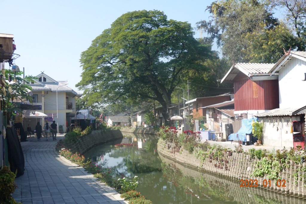
Continuing further, I am having hopes that this wide walkway will continue to Rangang Road, where the very recently improved section is. On the right of the photo is where the Kamphaengdin would have been. All I see along this section is houses/buildings, and nothing in between.

Unfortunately, I soon came to an end with no path through the jungle along the klong. Made my way through some sois and found Rangang Road. From the bridge over the klong looking back to the north from where I was, here is a view of the Klong Mae Kah. No means of walking along the klong here:

From the same bridge on the other side of Rangang Road looking south, this is the recently improved section. The klong itself has been cleaned up, the paths installed on either side, and a few bridges installed to allow people to move from side to side. The people living along here have created shops and sell coffee, drinks, trinkets, handicrafts, etc. This has become a very trendy place to visit, especially in the early evening.
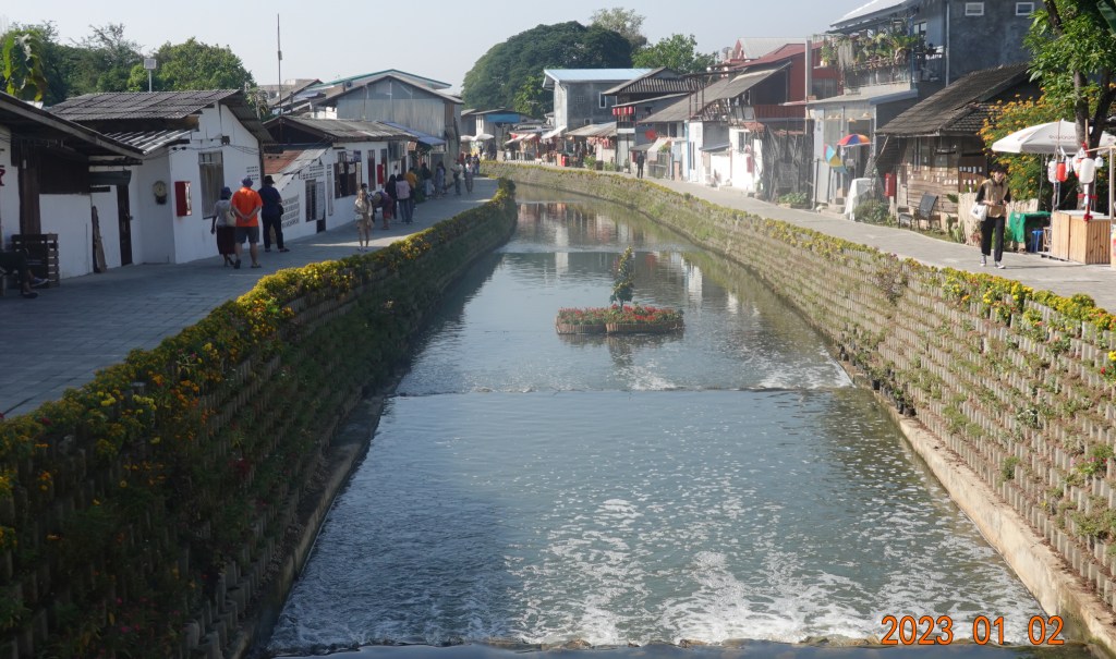
Further down, the improved section of the klong continues – probably 400 meters, maybe even a little more.
My interest is not in the trendiness or the shopping. I know that the Klong Mae Kae is along where the Kamphaengdin was. Looking between the houses, in some places I could see the Kamphaengdin. While not of interest to many, it is very exciting to me – I have never seen this section of the Kamphaengdin! In fact, I thought the Kamphaengdin to be completely gone in this area, so this find was exciting.

And further down, I saw even more of the Kamphaengdin between the houses:

I noticed a wider path between two houses to the Kamphaengdin, and what looked almost like steps in the dirt allowing one to climb onto the Kamphaengdin. A man saw me looking, and I said, “Kamphaengdin, very beautiful.” (In Thai). He responded that is was beautiful, and motioned me to follow him up onto the Kamphaengdin. We walked along the top and he was giving me a monologue in Thai, none of which I understood except an occasional word. He was very proud of the Kamphaengdin. Here are two photos I made while walking on the top of the Kampaengdin in a place I did not even know still existed:

The erosion over many centuries has left some bricks visible on the top and in some places on the sides. Makes me wonder if the Kamphaengdin was not only earth and clay, but reinforced in some places by brick.

He then led me to a pathway that was easier to climb down from the top. a very well-worn path.

I tried to tip the man for his tour, but he refused, instead motioning me to give the money to two girls who were selling trinkets (he clearly knew the girls). A very short walk between two houses, and there I was, back on the improved section along the Klong Mae Kah, looking at the bridge over the klong at Rangan Road where I began at the improved section of the Klong Mae Kha:

Thus came to an end to a part of the day in which I not only discovered a 200+ meter section of the Kamphaegdin I did not know existed, but I got to climb up and walk along the top of that section. Very exciting! I realize the remains of an ancient earth & clay wall is not for everyone, but it is exciting to me. The Kamphaengdin was an important part of Chiang Mai history, and is little known even by the Thai people living in Chiang Mai. This was a very exciting day.
Next: Wat Chai Mongkorn on the Mae Ping River
