Tuesday, December 20, 2022
Across the river to Wat Ket Karam
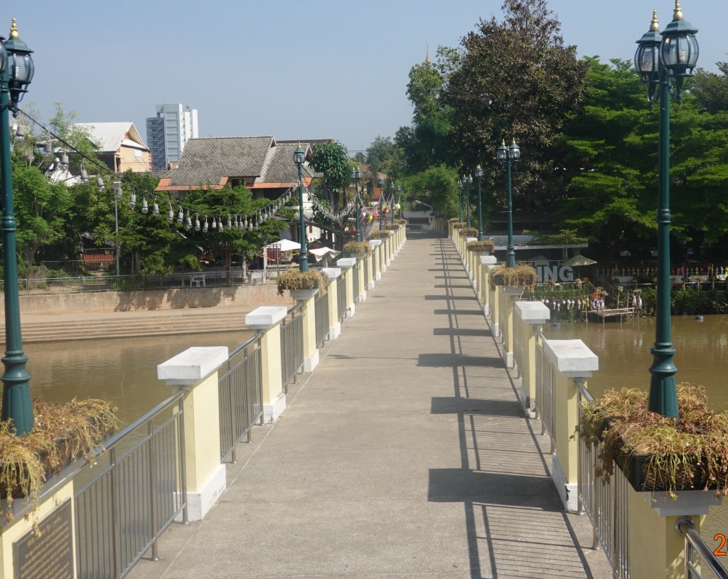
After visiting the flower market, I headed over the relatively new, concrete walking bridge to Wat Ket Karam. This bridge was made of wood and when I first saw it in 2006, it had been severely damaged by a flood in 2005. The government posted signs saying it was unsafe and warning people not to use it but people continued using the bridge. Because of the danger, the government took the bridge down and said it would be replaced very soon. During my visits starting in 2012, to cross the river I had to use the main road bridge which has almost no sidewalk and is very busy with fast traffic. In 2015 construction of the new walking bridge finally started and was completed in 2016 or maybe in 2017 (I’d have to look back at my old blog postings to know for sure). The new bridge is concrete and very stable, providing a safe river crossing to the Wat Ket area, and also making Wat Ket Karam easily accessible. Here is a photo of the bridge as I started crossing:
Wat Ket Karam
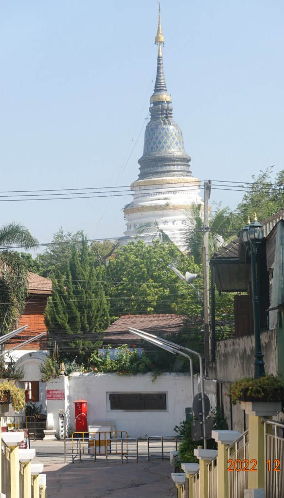
Once I got close enough to see around the trees, the tall, majestic chedi of Wat Ket Karam comes into view. The chedi was built slightly tilted “in order to avoid indecency by pointing it to the one in heaven”.
Wat Ket Karam is a challenge for the translators. On the temple grounds there are signs with three spellings of the temple’s name in English: Ket, Kate, and Gate. The actual sound is not a hard “g” like Gate, or a “k” sound as in Kate, it is really in between those sounds. The Thai alphabet has 44 consonants, 12 vowels, and 8 diacritical marks that change the vowel sounds or indicate the tone. So there are sounds in Thai that cannot translated properly with our 21 consonants. The largest sign at the back entrance closest to the walking bridge uses Ket so I’ll use that (I think in the past I have used Kate, though).
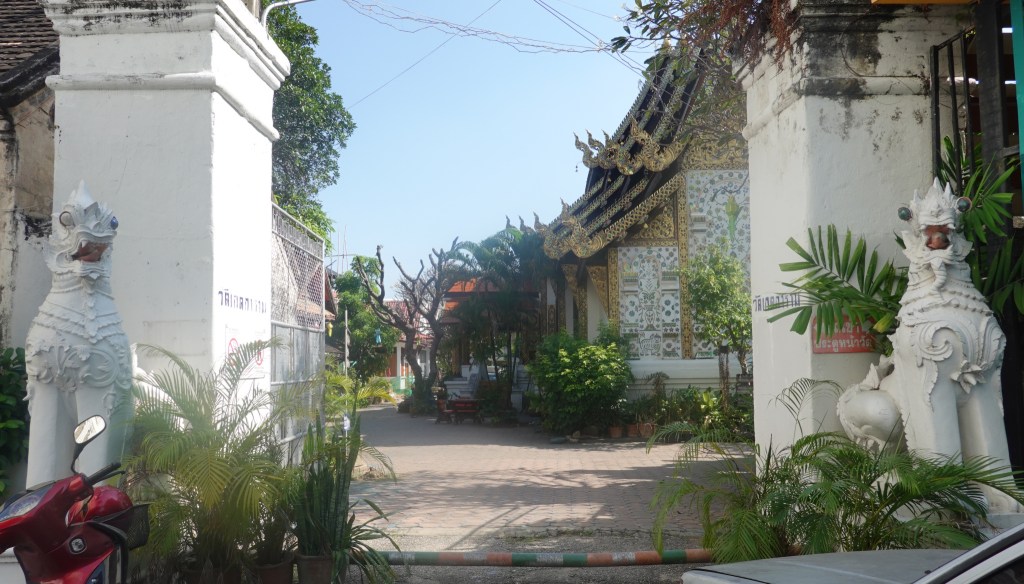
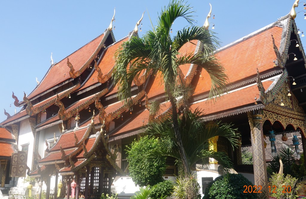
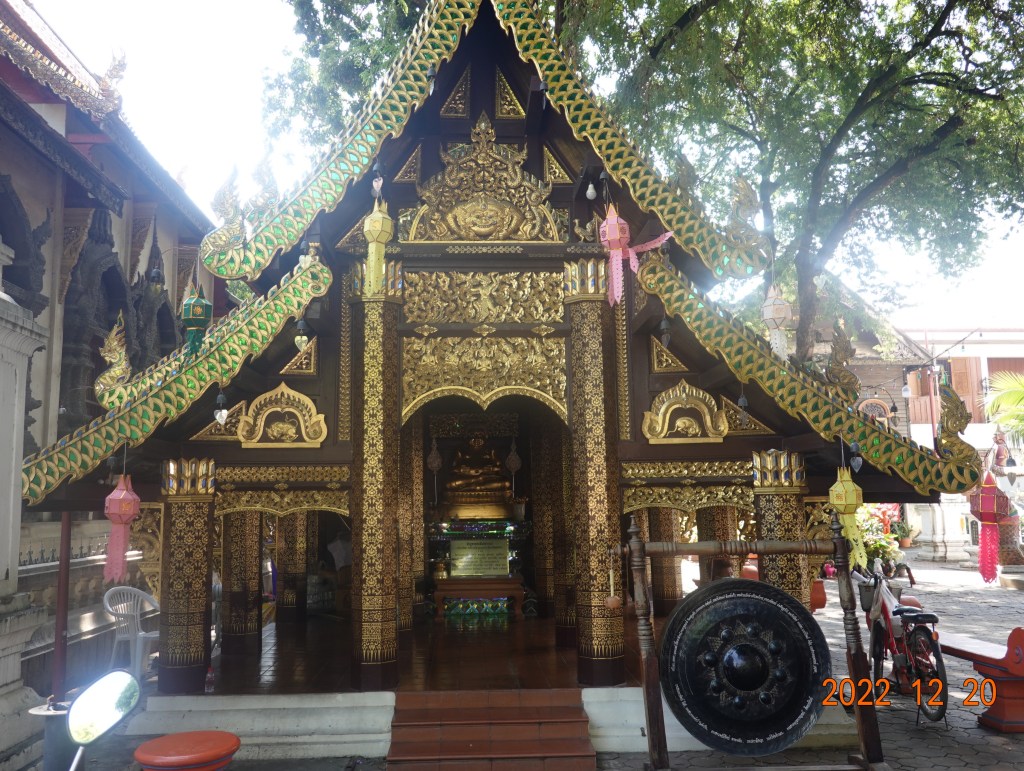
The back entrance is guarded by two cinthe mythical lion creatures (also known as singha). Inside the temple grounds is a very serene or almost park-like mood. Wat Ket Karam was originally built in 1428, on the orders of King Sam Fang Kaen of the ruling Mangrai Dynasty. The temple was constructed in a commercial area inhabited mainly by Chinese. In 1545 the chedi was destroyed by the great earthquake which also toppled the top of the chedi at Wat Chedi Luang. The Lanna styled viharn was rebuilt mot recently in the 19th century. Here is a view of the Lanna style roof with the overlapping tiers sweeping low at the sides. The five tiers are supposed to denote royal status:
Also in the Lanna style, the naga dragon-like creatures guard the entrance stairway of the viharn:

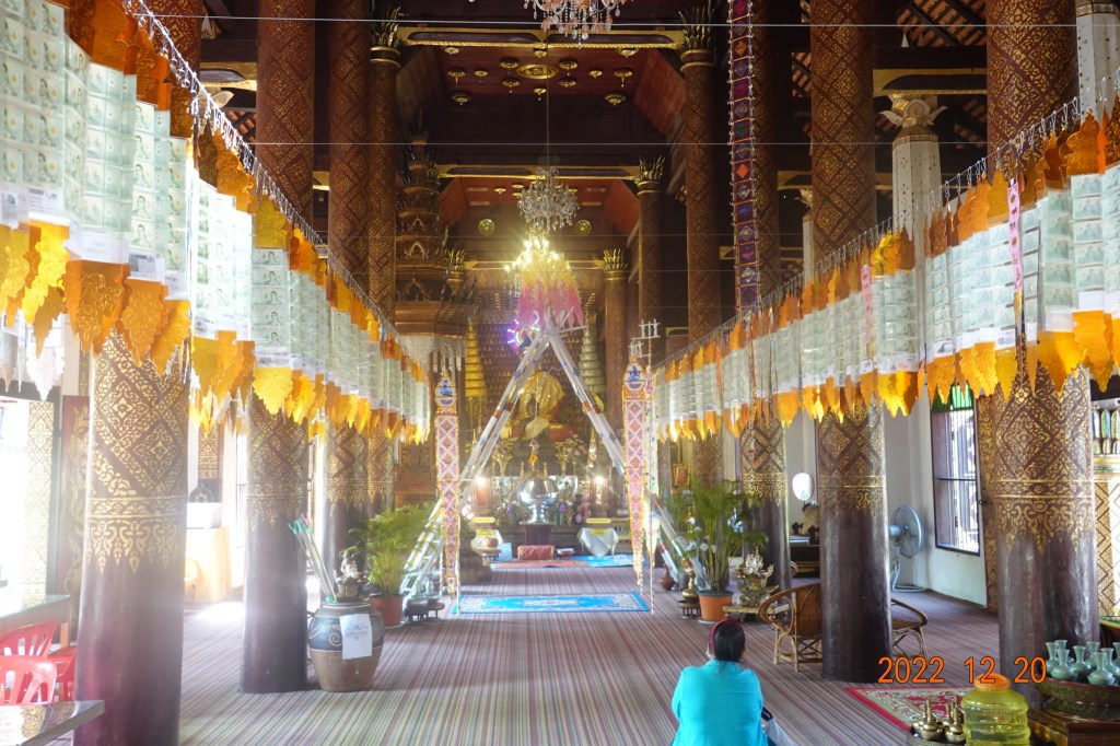
The inside of the viharn is dominated by rich teak pillars and walls, although a little difficult to see with the additional decorations for the new year celebrations. The interior is light and airy due to several large windows offsetting the darkness of the teak columns, walls, and ceiling.
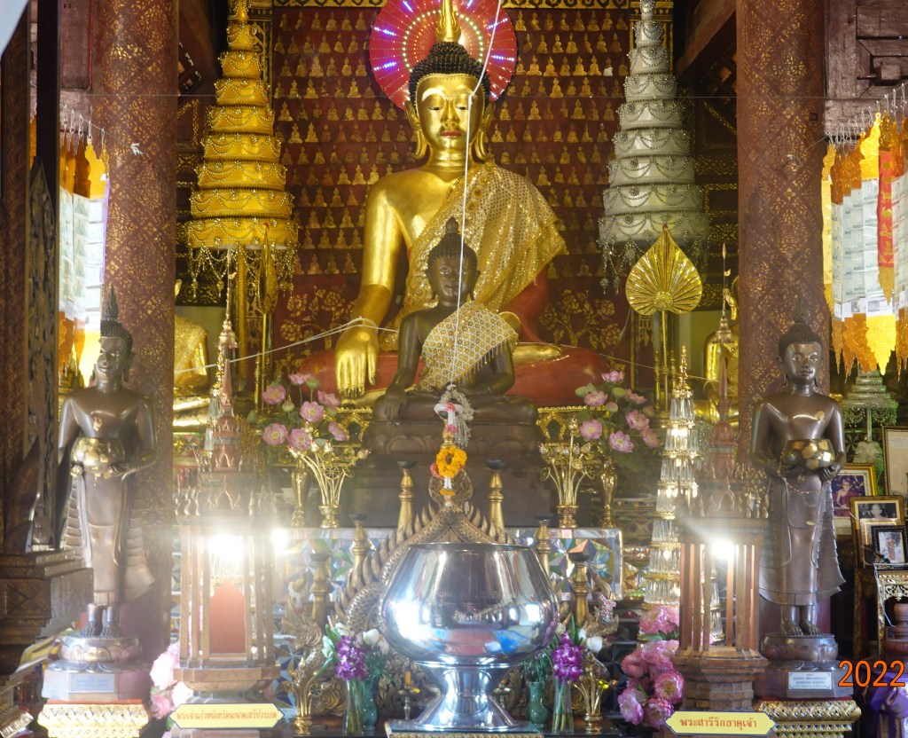
A closer view of the front of the viharn shows these Lanna style Buddha images:
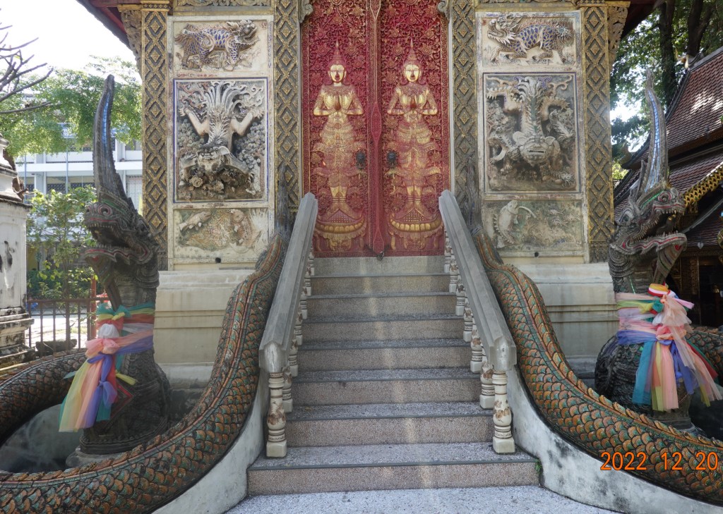
There are a few builldings at Wat Ket Karam, including this one which has always been closed when I have visited. The naga creatures at the entrance are elaborate and the very regal-looking thewada on the doors are three-dimensional. This is likely an ubosot (ordination hall).
To the right (west) of this secondary building is a relatively new pavilion structure, built 6 or 7 years ago housing an image of the “Fat Buddha”. The Fat Buddha or Budai is described in the following quotation from Wikipedia:
Budai was a Chinese monk who is often identified with and venerated as Maitreya Buddha in Chan Buddhism. His jolly nature, humorous personality, and eccentric lifestyle distinguish him from most Buddhist masters or figures. He is almost always shown smiling or laughing, hence his nickname in Chinese, the “Laughing Buddha”. As he is traditionally depicted as overweight and many stories surrounding Bodai involve his love of food and drink, he is also referred to as the “Fat Buddha”, especially in the Western world.
The pavilion is “open air” with only pilars supporting the roof but no exterior walls. Here is a closer image of the Budai:
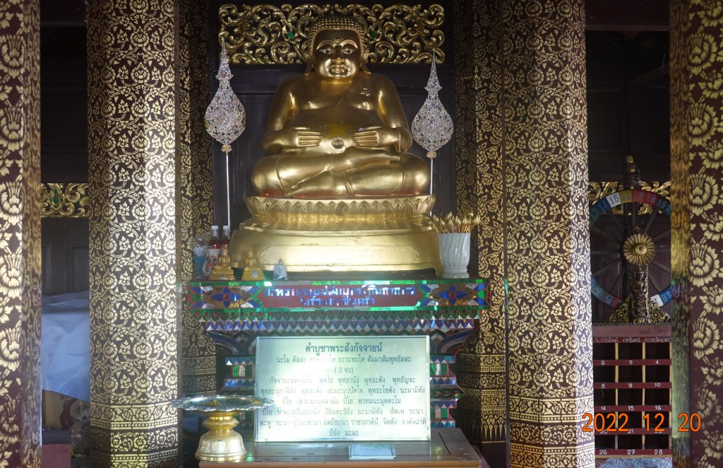
Budai does not appear to be smiling, but he does have his hands on his jolly round stomach.
South Along the Ping River
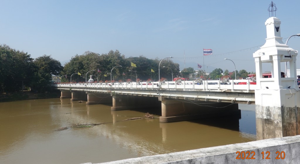
After leaving Wat Ket Karam, I walked south along Chiangmai-Lamphun Road (the road/highway that goes south to Lamphun) which is along the east bank of the Ping River. Soon came to and crossed the Charoen Muang Road, the extension of Tha Phae Road over the Nawarat Bridge, and continued south along the river.
Nawarat Bridge
The current Nawarat Bridge is the third bridge constructed at this location. The bridge connects the east and the west banks of the Ping River and is the most important bridge in Chiang Mai. Charoen Muang and Tha Phae roads are the main arteries of Chiang Mai.
The first bridge was designed by an Italian engineer and built from teak in 1920 using 600 teak logs. It was the first bridge over the Mae Ping River. A fire destroyed it, and in 1923 a replacement was built of steel. This one lasted for a time, but after deteriorating somewhat, was replaced with the current concrete structure in 1965.
The Iron Bridge
Continuing walking south, I came to the Iron Bridge. This is a one-lane, one-way outbound bridge with fairly wide sidewalks. Oddly, the western 40-50 meter approach to the bridge has no sidewalks, and there often seems to be a stream of vans on the road as I am walking there.
The Iron Bridge (Sapaan Lek) is so named because it is constructed of steel. This is the so-called “new” bridge having been built about 50 years ago. It is said the Iron Bridge was built as an homage to the formerly steel Nawarat Bridge that was replaced in 1970.
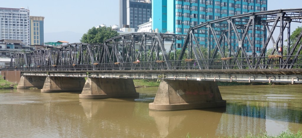
Here is a view of the Nawarat Bridge from the middle of the Iron Bridge. The river is very brown from much sediment having washed down the river from the heavier-than-normal rainy season. While fairly calm-looking, the river is definitely moving.

After my long walk, I returned to The 3-Sis, rested, worked on my blog, and planned dinner at Mush, a Thai restaurant. Another good day in Chiang Mai has ended.
Next: Local Temples
