Wednesday 15 January, 2020
Exploring Wiang Kum Kam
After yoga today, I stopped at the Amazing Alleyway for a fruit smoothie. Kuhn Sun makes the best fruit smoothies in much of the old city, and she is very friendly. Being conveniently located at the sio (lane) one takes to get to Wild Rose Yoga, it is popular with the yoga teachers and students.
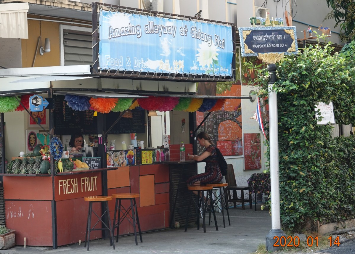
Amazing Alleyway, Chiang Mai – fruit smoothies and smoothie-bowls.
Wiang Kum Kam
Two friends, Kathy and Gordon, from Canada whom I met at Wild Rose, invited me to join them on an excursion to Wiang Kum Kam, the “older” new city built by King Mengrai. I have been there before, and wanted to return, so I joined them. We met at a dock on the Mae Ping River, then took a boat with three other people from Britain to a small dock near Wian Kum Kam, about 8 kilometers southeast of Chiang Mai. From there, we rode in horse-driven carriages to five of the more than 20 sites, two people per carriage. I was paired with a British man who lives near Bangkok and is showing his friends the country.
Before the current old city of Chiang Mai was built by King Mengrai and his two friends, in 1296, the capital was relocated from Chiang Rai to the new city located at Wiang Kum Kam in 1288. Wiang Kum Kam is about 8 kilometers southeast of the Chiang Mai old city and across the Ping River. It was a good location with proximity to the river, but was very low and because of frequent flooding, King Mengrai abandoned the site at Wiang Kum Kam and located the new Chiang Mai city on higher ground north and west of Wiang Kum Kam in 1296. Repeated flooding left the largely abandoned Wiang Kum Kam sites buried under 4 – 10 meters of mud (that is 12-31 feet!). King Mengrai’s moving the city to higher ground became understandable when in 2005 the ancient city flooded three times.
Wiang Kum Kam Rediscovery
In 1984, Thai authorities were alerted to the discovery of a number of ancient tablets found near Wat Chedi Liam just 7 or 8 kilometers southeast of the Chiang Mai metropolitan area. Archaeologists from the university were contacted, quickly moved in and uncovered the remains of the ancient lost city of Wiang Kum Kam.
Over thirty archaeological sites including many ancient temples were found within the ancient rectangular shaped city wall and just beyond. At my first visit, I learned of only 4 or 5 sites, all fairly close together. Later, learned of how extensive the building at Wiang Kum Kam had evolved when my friend Tom from Sydney and I visited about 15 or more sites on his motorbike. The area is quite spread out, and the sites are difficult to locate even with a map. I find Wiang Kum Kam fascinating. Although the ruins were largely destroyed after repeated floods and having been buried in mud for hundreds of years, there is evidence that much construction of the city was completed in the eight years before it was abandoned.
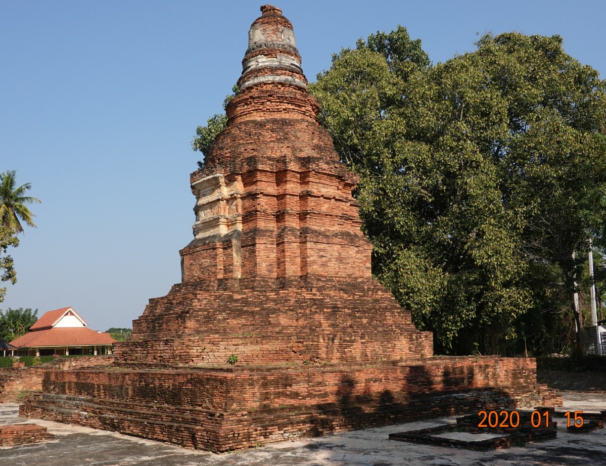
Wat Chedi Liam
On this excursion, unfortunately not narrated or guided, we started at a relatively modern temple, Wat Chedi Liam. This is a good starting point as this is where during a nearby excavation the ancient tablets were found that eventually led to the discovery of the rest of the lost city ruins. Here is the chedi at Wat Chedi Liam, looking very similar (to me) in style to the large towers at Wat Arun in Bangkok. The temple is named for the five-level chedi of Mon style, which was copied from a similar structure at Wat Phra That Hariphunchai in Haripunchai (modern Lamphun). It is apparently the only ancient temple in the Wiang Kum Kam archaeological area that remains a working temple with resident monks.
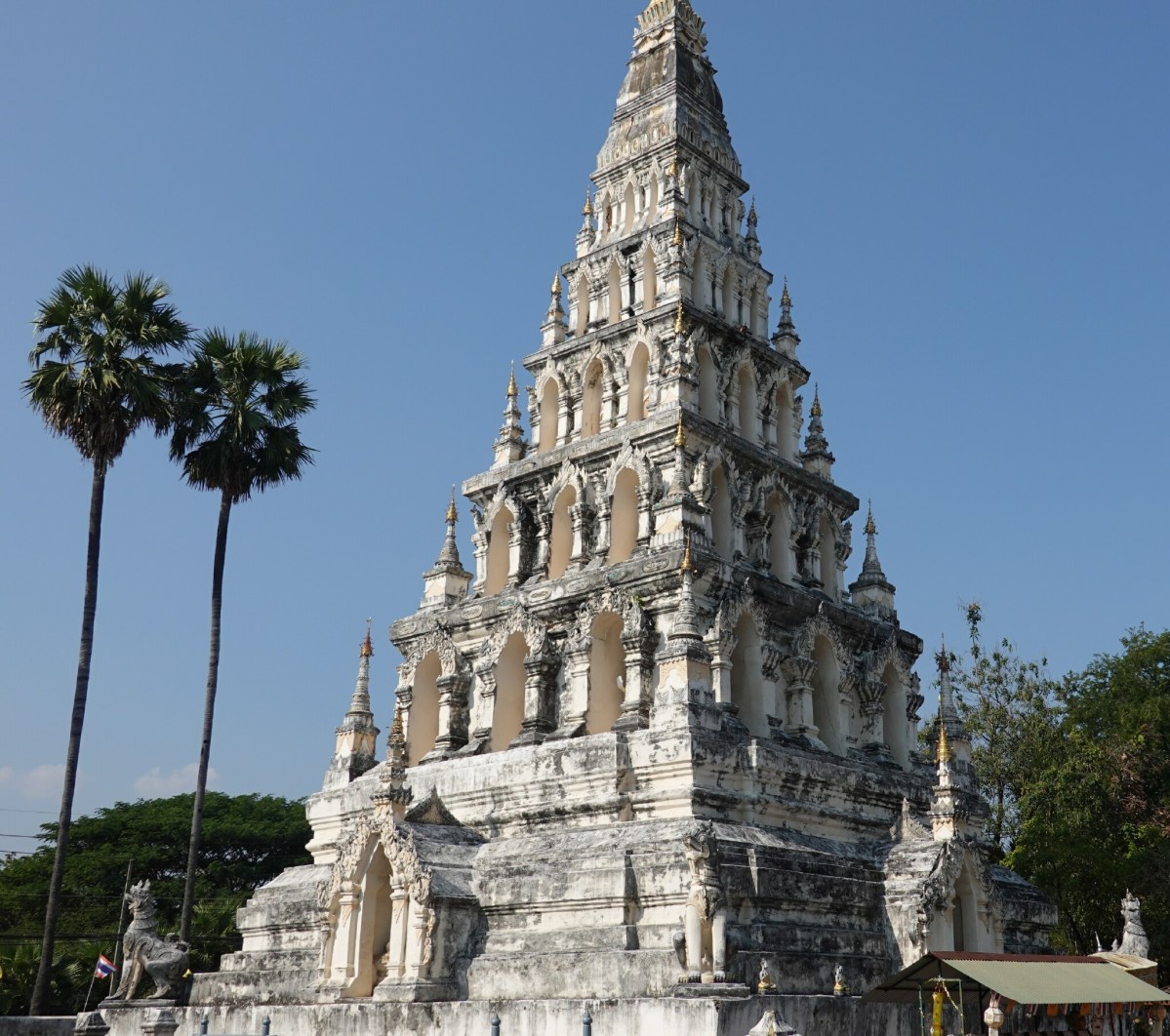
Large chedi at Wat Chedi Liam
The viharn at Wat Chedi Liam is not uncommon in style to the many Lanna-style temples in northern Thailand with the entrance guarded by the large naga serpents.
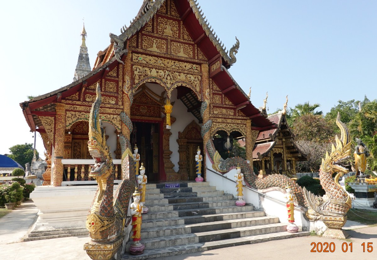
Main viharn (worship hall) at Wat Chang Kam.
Back into the carriage and on down the road to the first ancient site.
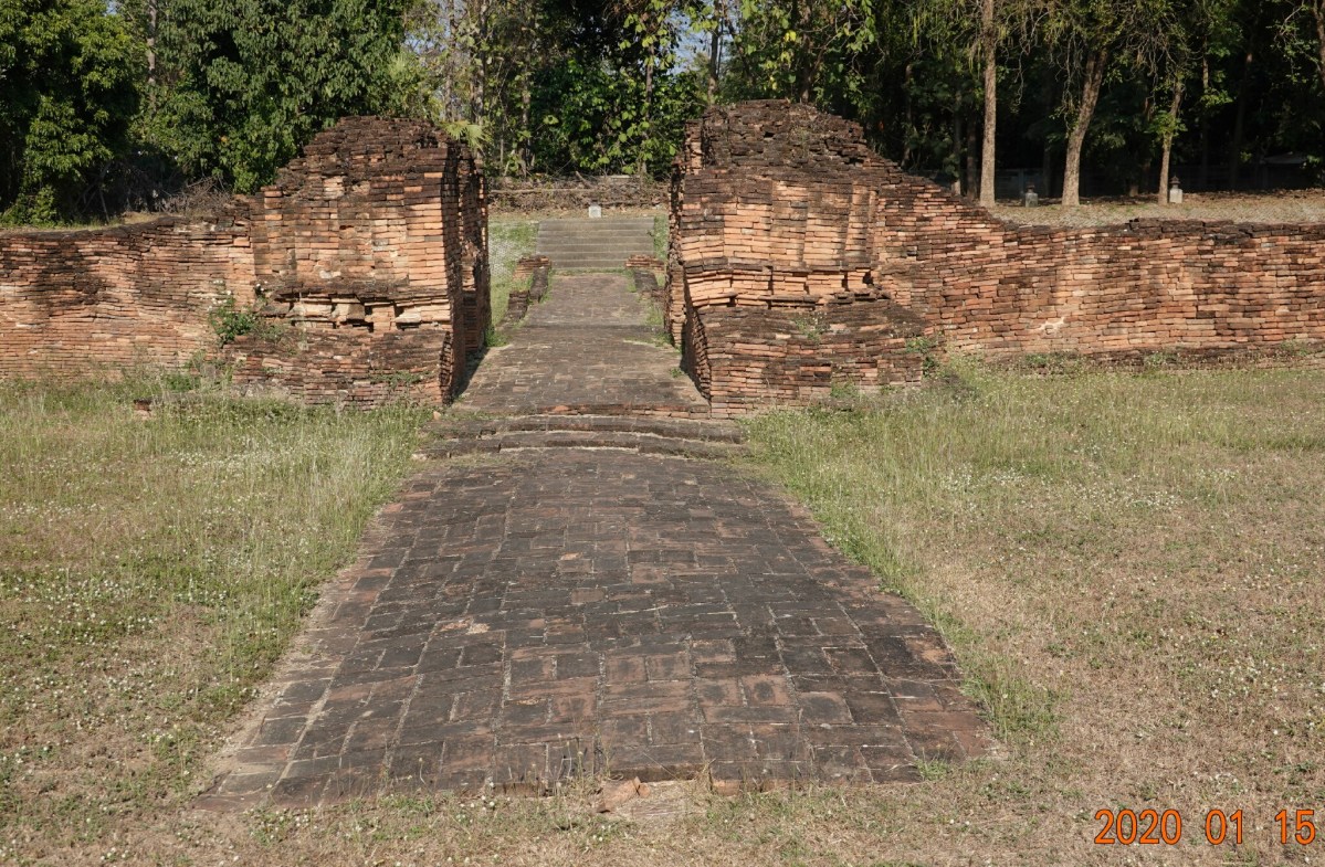
Wat That Kaow
This ancient temple is named after the appearance of the chedi which was once lime plastered with a white color (how that is known is a mystery). You can clearly see the stairs into the viharn and where the roof-support pillars and alter would have been.
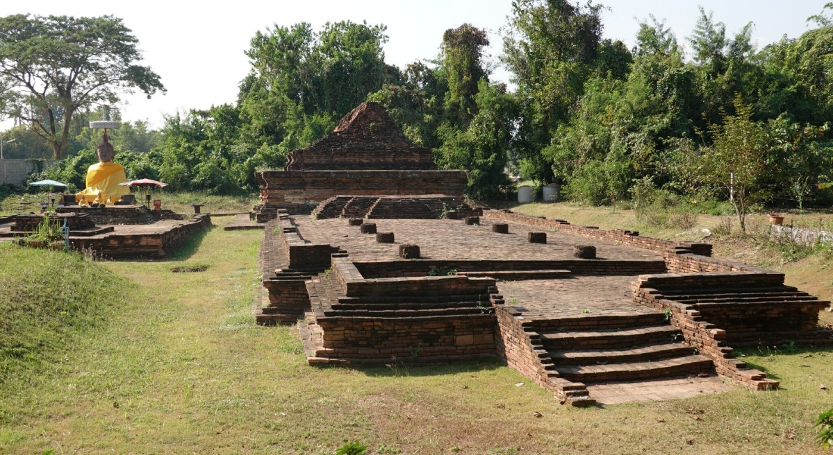
Wat That Khao
A closer view of the Buddha statue. When this temple was uncovered or excavated, there was no head to the Buddha. People in the local area raised money for a head.
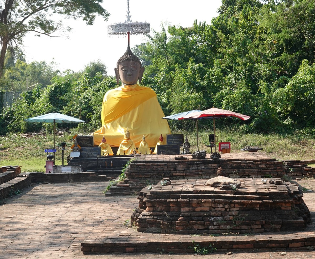
Closer view of Buddha statue.
And a closer view of the uncovered chedi at the western side of the main viharn.
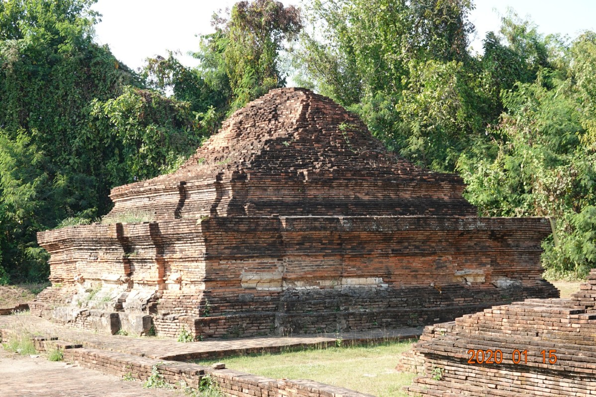
Excavated ruins of the chedi at Wat That Khao.
Wat Ku Pa Dom
This temple is named after Pa Dom, the land-owner of this site. The actual name has not been found in any records. Excavation of the site discovered a viharn, a chedi, an ubosot (ordination hall), and a boundary wall.
Overview of the excavated site at Wat Ku Pa Dom.
Additional detail of Wat Ku Pa Dom showing part of the boundary wall and the base of a chedi.
Detail at Wat Ku Pa Dom.
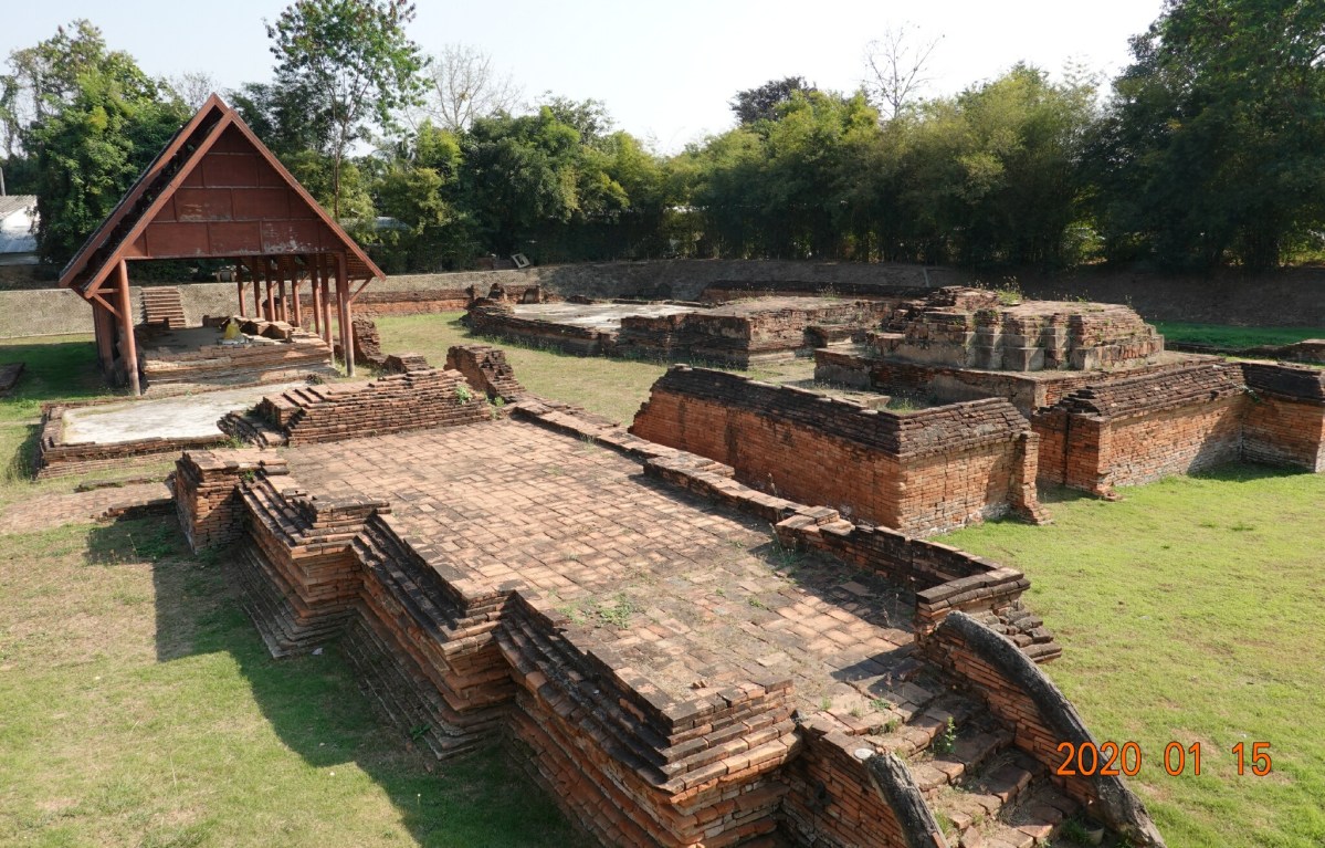
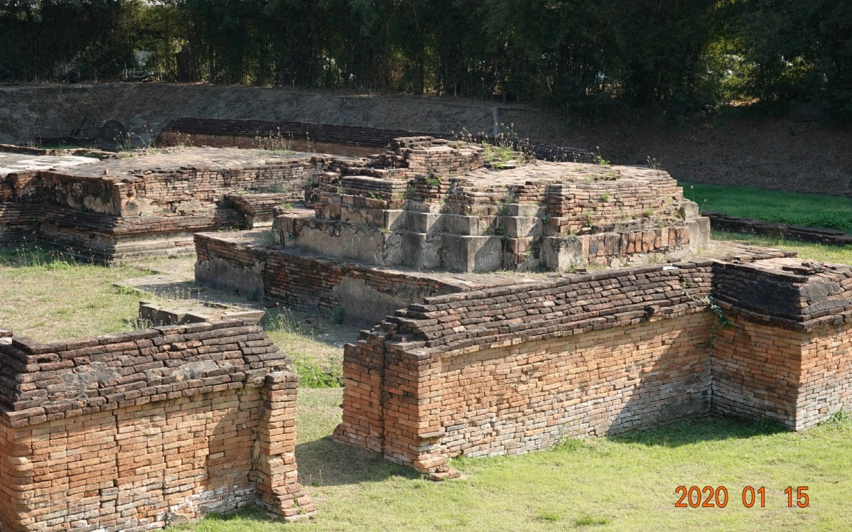
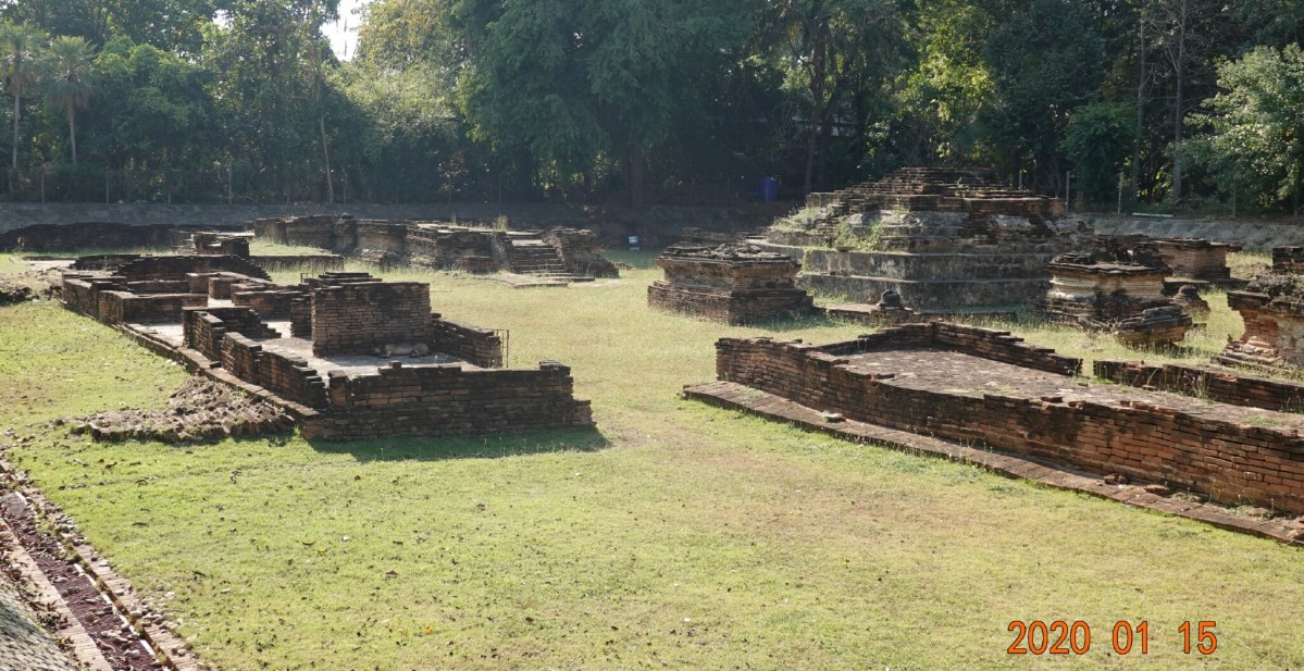
Wat Kam Thom
A site for which I have little detail. The ruins of the viharn show a more complex structure with multiple levels and many steps.
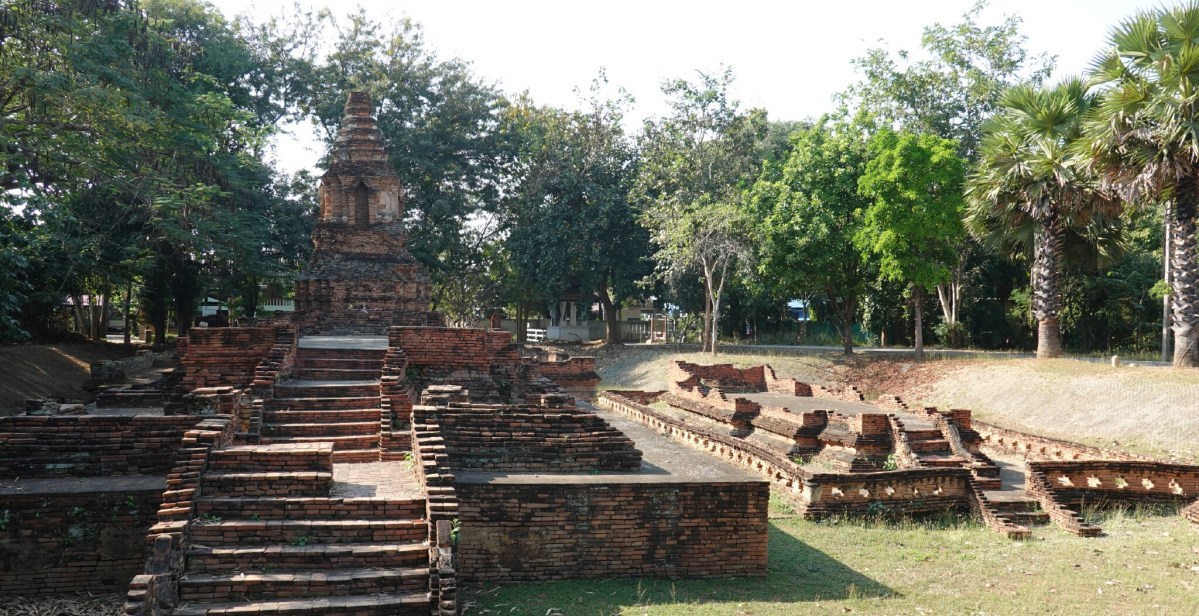
Overview of excavated ruins at Wat Kam Thom.
Notice in the photograph, the old ground level of the temple is almost 2 meters (6-7 feet) below modern-day ground level.
Here is a view of the chedi at Wat Kam Thom, a large structure that survived many floods fairly intact.
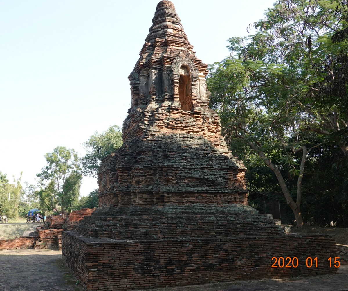
Chedi at Wat Kam Thom.
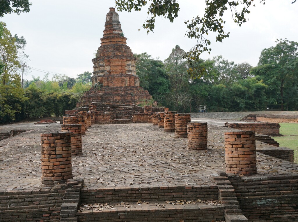
Wat Nanchang
Excavated in 2002-2003, Wat Nanchang is similar to other temples in Wiang Kum Kam, but this temple is different as evidence of two buildings of two different periods were found on top of one another. The second layer was extended from the earlier temple, and more buildings added. The name Wat Nanchang is to honor the ancestors of the owner of the land.
The viharn at Wat Nanchang opens to the north, unlike the traditional Buddhist viharn that open to the east to greet the rising sun. It is speculated that the doors opening to the north pointed to the old path of the Mae Ping River, and pointing the doors to the river honored the importance of the river to the city.
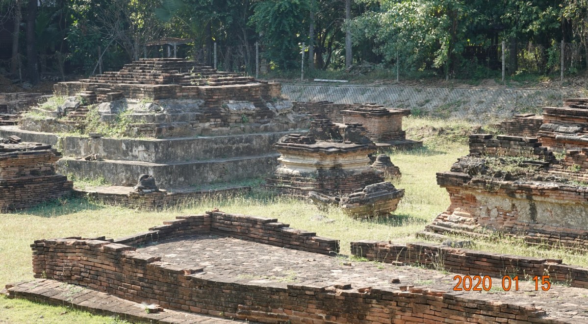
Overview of the excavated ruins of Wat Nanchang.
And a photo showing how extensive the structures had been.
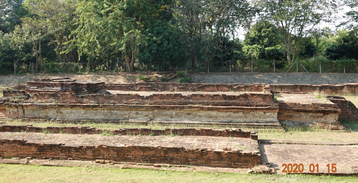
Side view of the viharn ruins at Wat Nanchang.
And another overview of the excavated ruins at Wat Nanchang.
Another overview of the excavated ruins of Wat Nanchang.
Wat E-Klang
Wat E-Klang is so called because, when discovered, the area around the site was inhabited by monkeys and in the northern Thai dialect, e-klang is monkey. This temple was one of the early excavations in 1984-1986, and then in 2003, evidence of a wall to the west of the chedi was discovered, so more excavation work is planned.
Wall and entrance to Wat E-Klang
In this photo the layout of the main viharn can be seen with the chedi to the west.
Wat E-Klang Viharn and Chedi
And detail of the chedi at Wat E-Klang
Detail of chedi at Wat E-Klang.
After this three-hour tour, we rode the boat back to the dock, and I walked back to my accommodation at See You Soon.
Dinner at Kanjana
After a shower and some rest, I headed out to Kanjana for dinner. Tonight I chose one of my favorites, pumpkin curry with dark brown rice and a watermelon smoothie. This is roasted pumpkin in a yellow curry, and it was spicy.
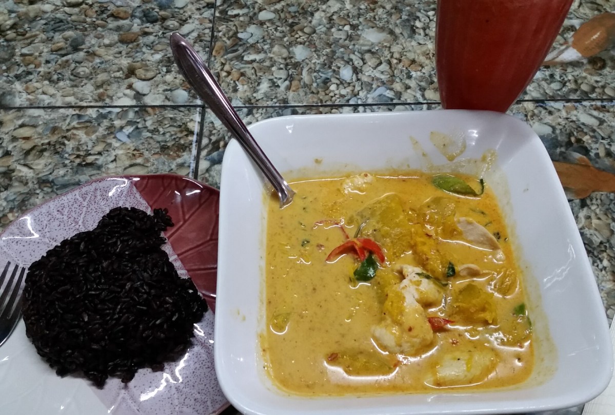
Dark brown rice and pumpkin curry at Kanjana
A nice end to a day learning about Chiang Mai history; a very good day in Chiang Mai.
Next: Wat Santitam north of the old city.
