Wednesday, January 24, 2018
Walking from Wat Nantaram to Find the Old City Earthen Wall
Chiang Mai has a long and rich history having been founded over 700 years ago. In my perusing the internet to learn more about the city’s history, I have learned that there was a second wall around much of the city, an outer wall of earth, said to be over 3 meters (10 feet) high. My guess is that after the problems with floods at the original site of Wiang Kum Kang, King Mengrai had this outer, earthen and clay wall built as a second level protection for the new city against the flooding of the Mae Ping River.
I came across notes from Archibald Ross Colquhoun of Great Britain in 1885 who visited the Chiang Mai area after Britain had annexed upper Burma to get access to the teak forests for shipbuilding. Teak is what drew foreign entrepreneurs to both Burma and north Thailand. Teak was important for British shipbuilding; it is resistant to termites and rust and could be relied upon not to splinter when hit by cannonballs. Archibald Ross Colquhoun was one of the early western visitors to Chiang Mai in 1885. At that time the town still had the Burmese name Zimme and it was part of the Shan States. Two paragraphs from his book “Amongst the Shans”:
The town of Zimme, Kiang Mai, Tsching Mai, is situated on the right bank of the Meping river, at a height of about eight hundred feet above sea level. It is the largest place in the Meping plain. There are fields between the river, which lies on its eastern side, and the town; which is said to have been built in 1294 A.D.
There is what is called an inner and outer town, each surrounded by fortifications. The inner town, where the chief resides, is a rectangle, six thousand feet (1800m) from north to south and four thousand eight hundred feet (1500m) from east to west. Each wall has a gateway in the centre, except on the southern side, where there are two, placed five hundred yards from the corners. The gates are defended with a small bastion at the sides.
Archibald Colquhoun was wrong about Chiang Mai citadel being a rectangle; it is really an almost perfect square of 1600 by 1600 meters (about 1 mile square). The Meping River is now called the Mae Ping River, and the old Burmese name Zimme has been changed to Chiang Mai. On older maps printed before 1900 it is called Zimme. The town Chiang Mai has had more than 100 names in the past; the French called it Xieng Mai, the Burmese Zimme, Zimay, Zimmay or Zam-may. In the twentieth century Zimme or Zam-may was changed to Chiangmai or Chiang Mai.
The old dirt and clay wall is called Kamphaengdin or Kamphaeng Din, and some evidence of the earthen wall can be seen along Kamphaeng Din Road. I found this map of Chiang Mai that was made in 1904, showing the second, earthen wall along the east and south of the square wall.

Shown as triangles on the map are temples. In the center at the bottom, near the Kamphaeng Din wall is a temple shown as a triangle with a square around it. From modern maps, I found this temple to be Wat Nantaram.
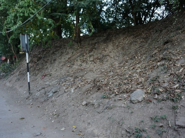
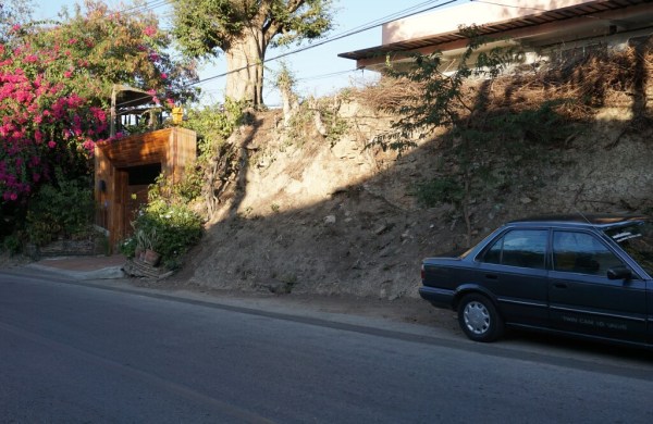
The dirt wall is said to be about 3 meters high, and here is a photo I found (I did not find this part of the old wall) showing the lowest part of the earthen wall strengthened with a stone wall.
The rest of the wall is almost invisible behind the brush and trees. Why is the old dirt wall still there whereas much of the original brick city walls have gone? Perhaps because the bricks could be reused, but nobody was interested in the old earthen walls. Only the trees found a fertile soil and started growing abundantly and covered the walls with their lush foliage.
All of this has peaked my interest, so I headed down to Wat Nantaram to see if I could find the old earthen and clay wall. It was both easier and harder than I expected.
Wat Nantaram
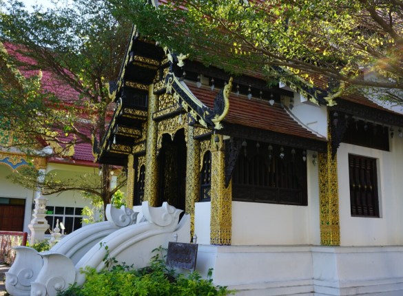
Wat Nantaram is a lesser-known temple south of the old city of Chiang Mai. There is a school on the grounds, and also a monk school. I was told that it is known for a large garden of medicinal herbs. The main viharn (worship hall) is fairly nice, a typical example of Lanna-style temples:
Wat Nantaram main viharn (worship hall)
Behind the viharn is a large chedi, also typical of northern Thai temples:
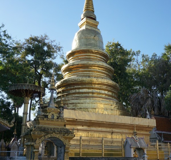
Wat Nantaram main chedi
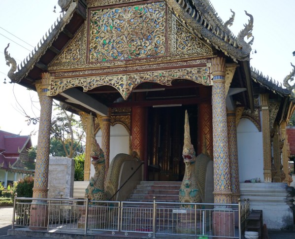
There is also a second, smaller viharn, or perhaps it is an ubosot (ordination hall).
Wat Nantaram Ubosot
Women are explicitly prohibited at most ubosots, but there was no sign here prohibiting women (and this was also the case at the ubosot at Wat Phra Singh), so it may or may no have been an ubosot.
Based on the 1904 map, Wat Nantaram is very close to the old earthen wall. I left the temple grounds and found a north-south main road. I also knew that there is a small creek, canal, or maybe it was a small moat on the outside of the old earthen wall, so I followed the road south and found this marked crossing over the creek.
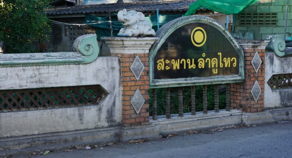
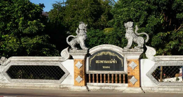
I found a soi (lane – larger than an alley, smaller than a typical street) that seemed to run parallel to what I thought would have been where the creek was. Homes and buildings are dense and built right up to where I thought the old wall might be. A few times I could see the earthen mound between and behind the buildings/homes. I continued along, became slightly lost, and then found another bridge over the creek. Different writing, but similar construction:
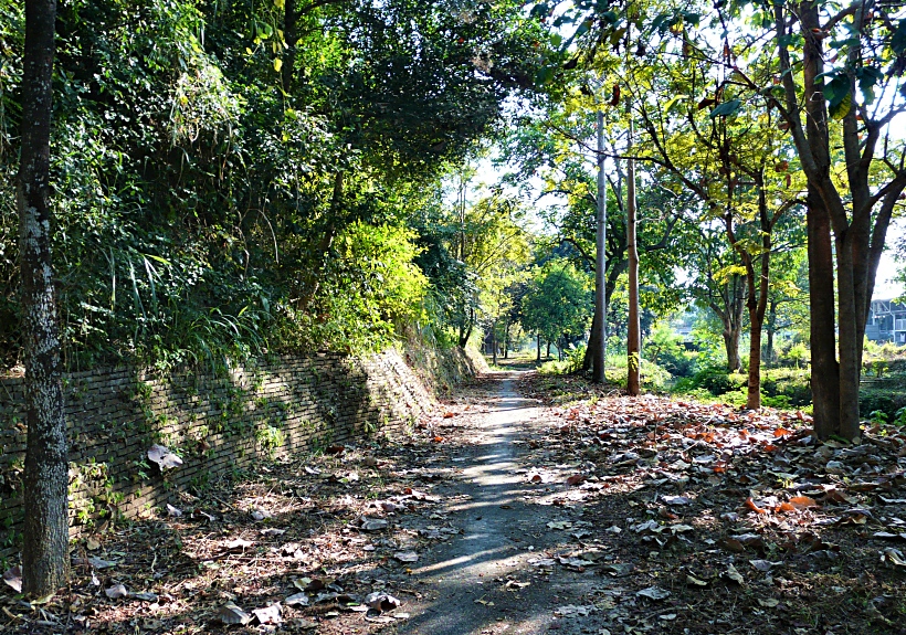
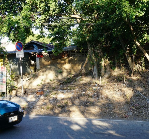
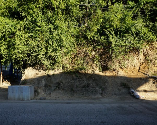
Now walking along to the north (inside) of the creek, I found clear evidence of the earthen wall. This dirt mound is the old, earthen wall:
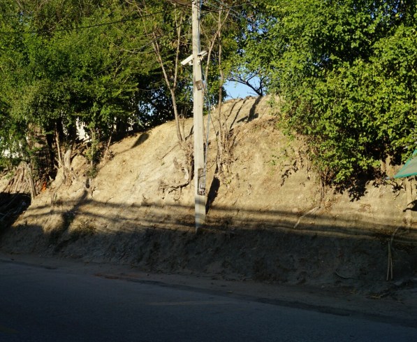
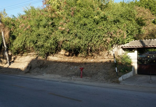
And as I continued down the soi, after a five-way intersection it became Kamphaeng Din Road and there was continual evidence of the old earthen wall:
Old earthen wall along Kamphaeng Din Road 1
Old earthen wall along Kamphaeng Din Road 2
Old earthen wall along Kamphaeng Din Road 3
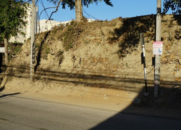
I am now walking along Kamphaeng Din Road, cross Sridonchai Road (that leads to the night Bazaar) and then to Loi Kroh Road. More evidence of the old wall is easy to see after crossing Loi Kroh Road as I am walking along Kamphaeng Din Road:
Earthen wall along Kamphaeng Din Road between Loi Kroh and Thaphae Road 1
Earthen wall along Kamphaeng Din Road between Loi Kroh and Thaphae Road 2
Earthen wall along Kamphaeng Din Road between Loi Kroh and Thaphae Road 3
This was a very interesting day; a peek at part of Chiang Mai history. As I have said many times before, another good day in Chiang Mai. My time in Chiang Mai is ending soon – I start the journey home Saturday evening in just three days. Has it been a month already?
Next: A last walk around the old city.

You learned a lot today and so did I.
LikeLike