12 October 2017
Walking Day 29:
22 kilometers
For many of the pilgrims on the Camino route today, this is their first day, since many start the Camino de Santiago pilgrimage in Sarria, 110 kilometers from Santiago de Compostela. For me, it was just another day, slightly shorter than some, and with the knowledge that I have only five days of walking to Santiago de Compostela. It was challenging, though, as the first 11-12 kilometers were all uphill, at times fairly steep, followed by a kilometer or two of flat and then another kilometer of uphill. Then we descended into Portomarín, my destination for the day.
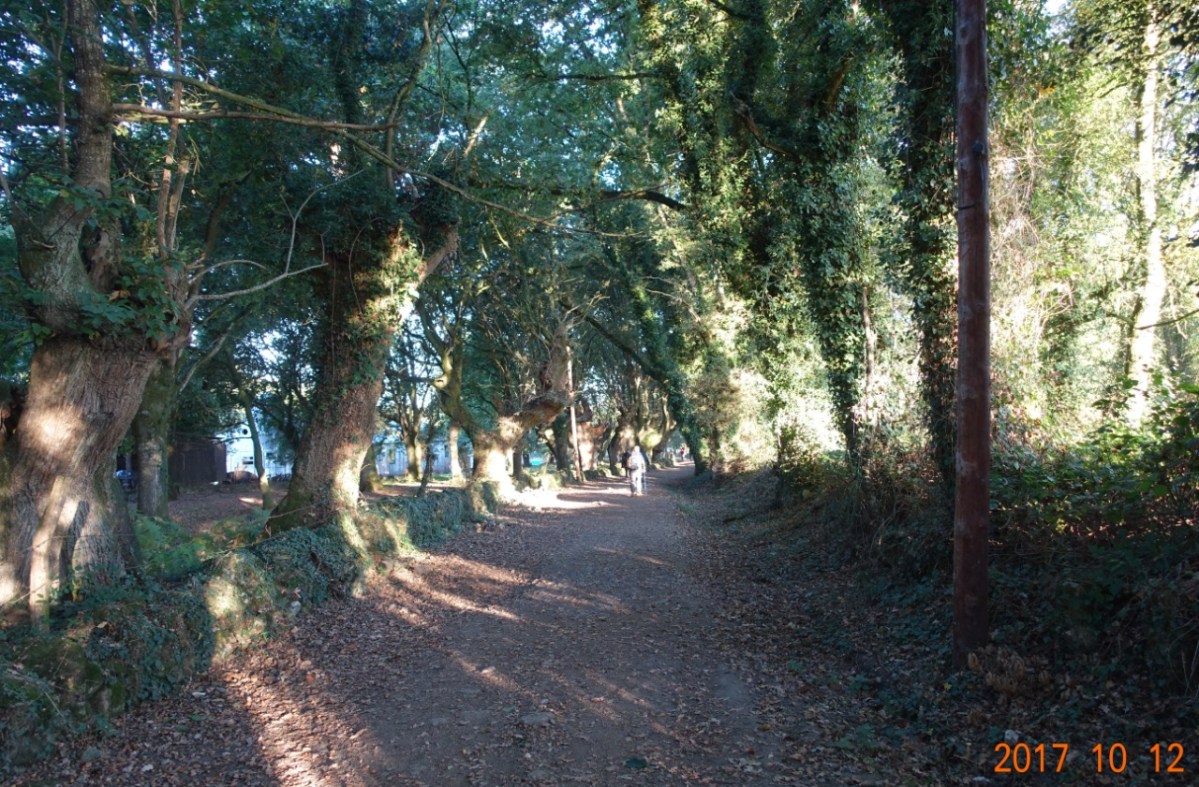
I spent about half the day walking with two young men and a young lady from eastern Spain. I have seen them several times before, and they also know Tom from some of the albergues (Tom is ahead by at least a day, trying to get to Santiago by Sunday). It was a very good day, especially after the long, long uphill stretch finished, walking mostly in the forest (bosque) or by small farms.
I left Sarria at 7:45 AM, and the sun does not rise until about 8:20, so the first part of the walk would be in whatever moonlight there is this morning. But there were many other pilgrims starting early, wanting to get going well before the day became too warm. And starting at 7:45 it was cold – about 4 C (36 F). I was wearing an extra layer, and a wool “watch” cap. knowing that the first part of the walk was to be up hill, I had a feeling the extra layer and the cap would not last, but they kept me warm as the day started.
The first 15 kilometers from Sarria are basically uphill, starting with the 64 stairs in the old city, then once out-of-town, a very steep 1.5 kilometers up to Barbadelo. Then, for the next 12 kilometers, it is more than gradually up hill to Morgade and finally up to Alto Momientos. The last 4 kilometers into Portomarín are downhill.
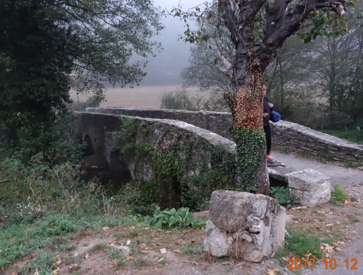
It was not until the sun rose that I was able to get a reasonable picture. And this little bridge represents leaving the Sarria town and the sort-of suburbs (there are not much in the way of suburbs when the town itself has only 15,000 in population), and the end of the steepest part of the climb.
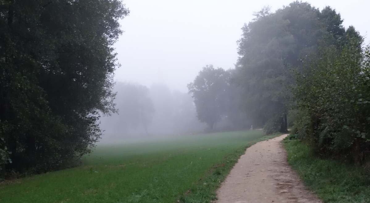
Then, as we continued the gradual climbing morning, we were walking in an almost fog up ahead. It was a bit of a challenge getting a good picture, but the mist came through in some. It was quiet and peaceful walking here today.
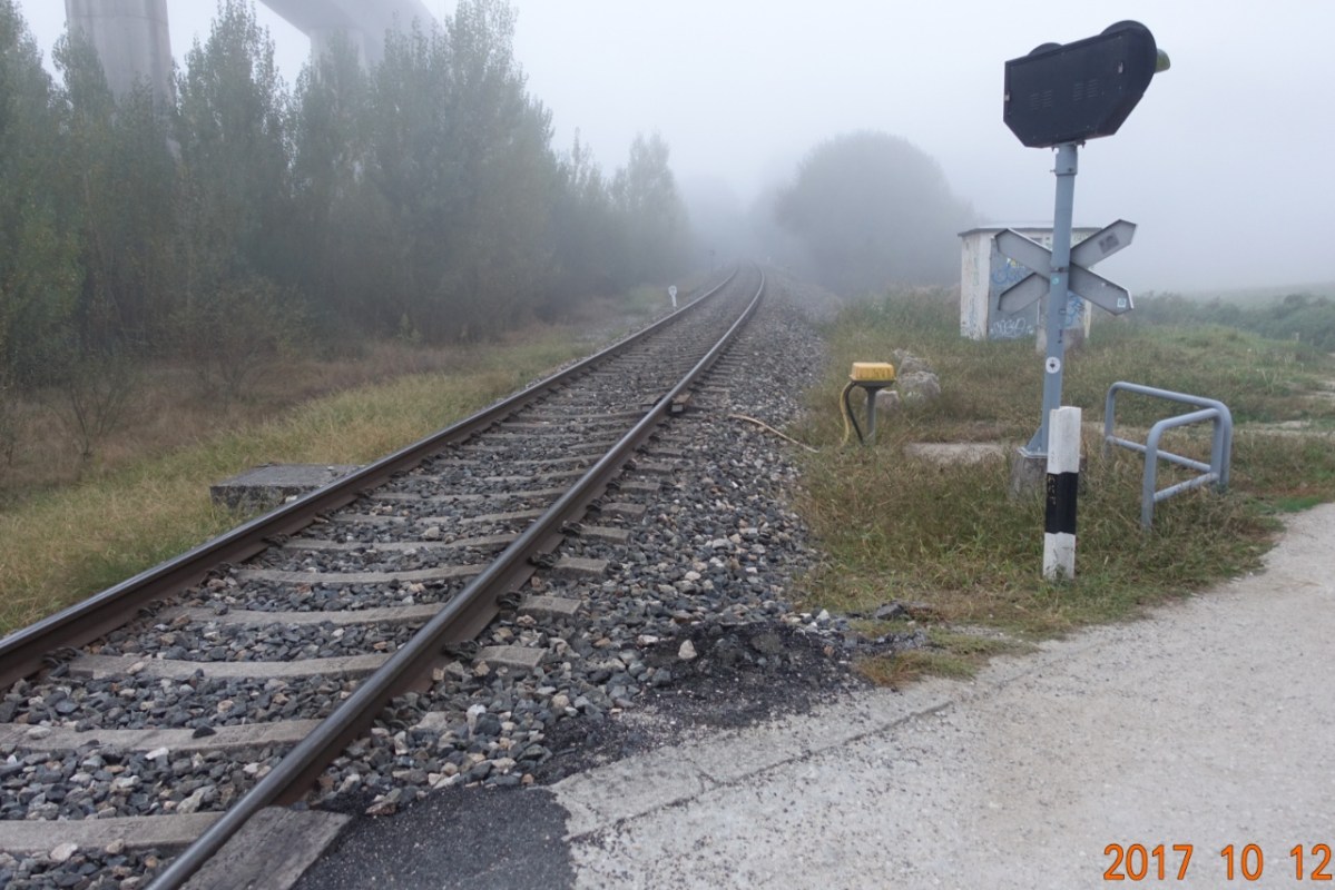
Then we came to a railroad crossing. The crossing lights are there for Camino pilgrims – there is no other pathway that crosses the tracks here, no street, road, or other walkway, only the Camino path way. No trains came by, so I did not get a chance to see how the lights worked.
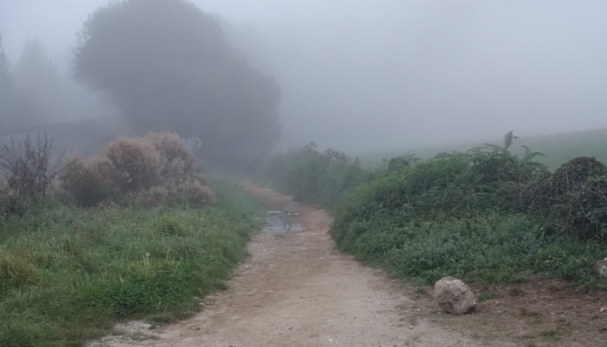
After crossing the tracks, we continued walking in the serenity of the fog or clouds.
Finally, as the sun took hold, the mist evaporated, and we were in the forest. somewhere along here I caught up to a young lady and her two male friends from eastern Spain. We all had a good time talking about eating our way across Spain in what the young lady called her gastro-Camino.
 Sometimes the forest opened to expansive fields. Not as expansive as the fields on the meseta, but expansive for here.
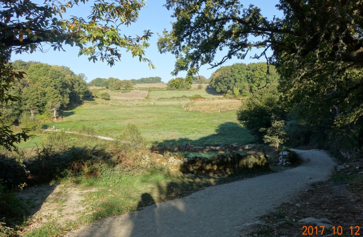
This is cattle country, and we can smell them, even if we cannot see them.
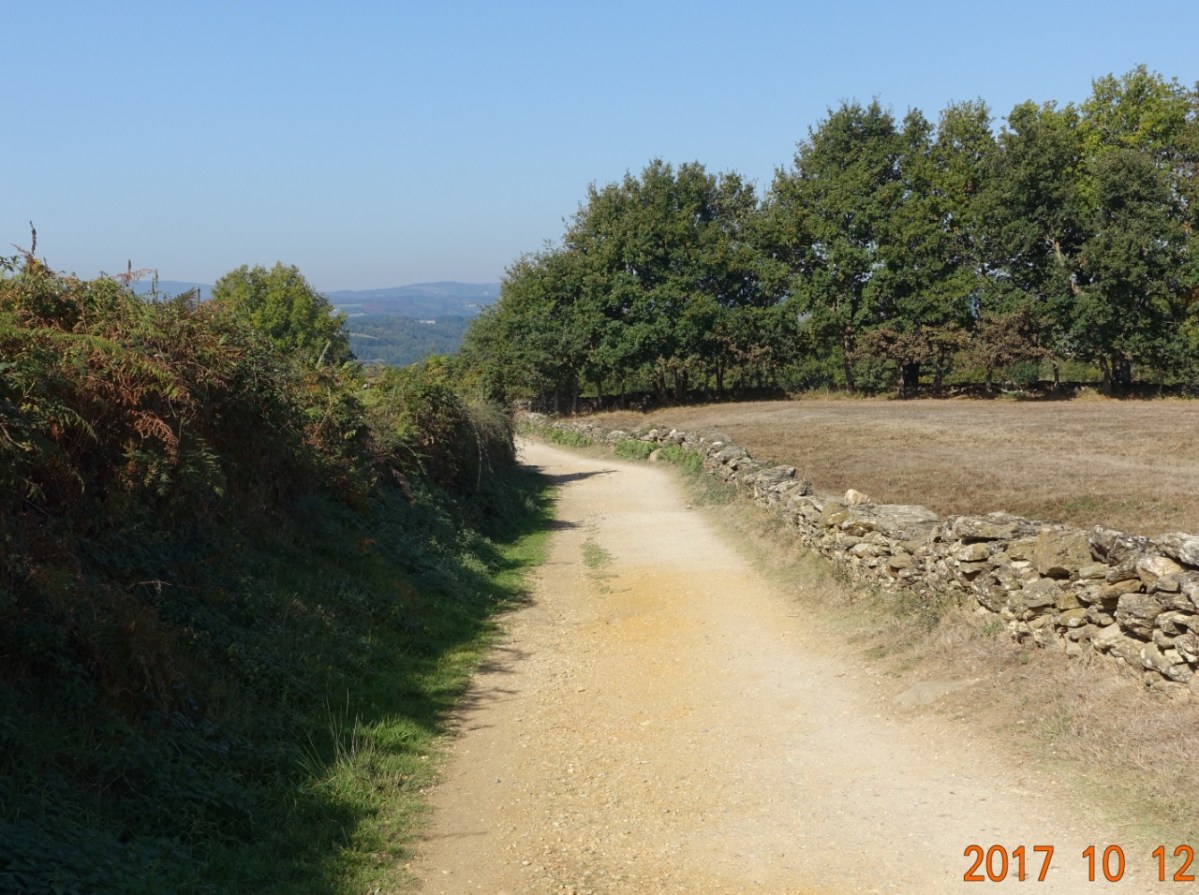
And the Camino road just continues…through the forest, through the fields, always continuing:
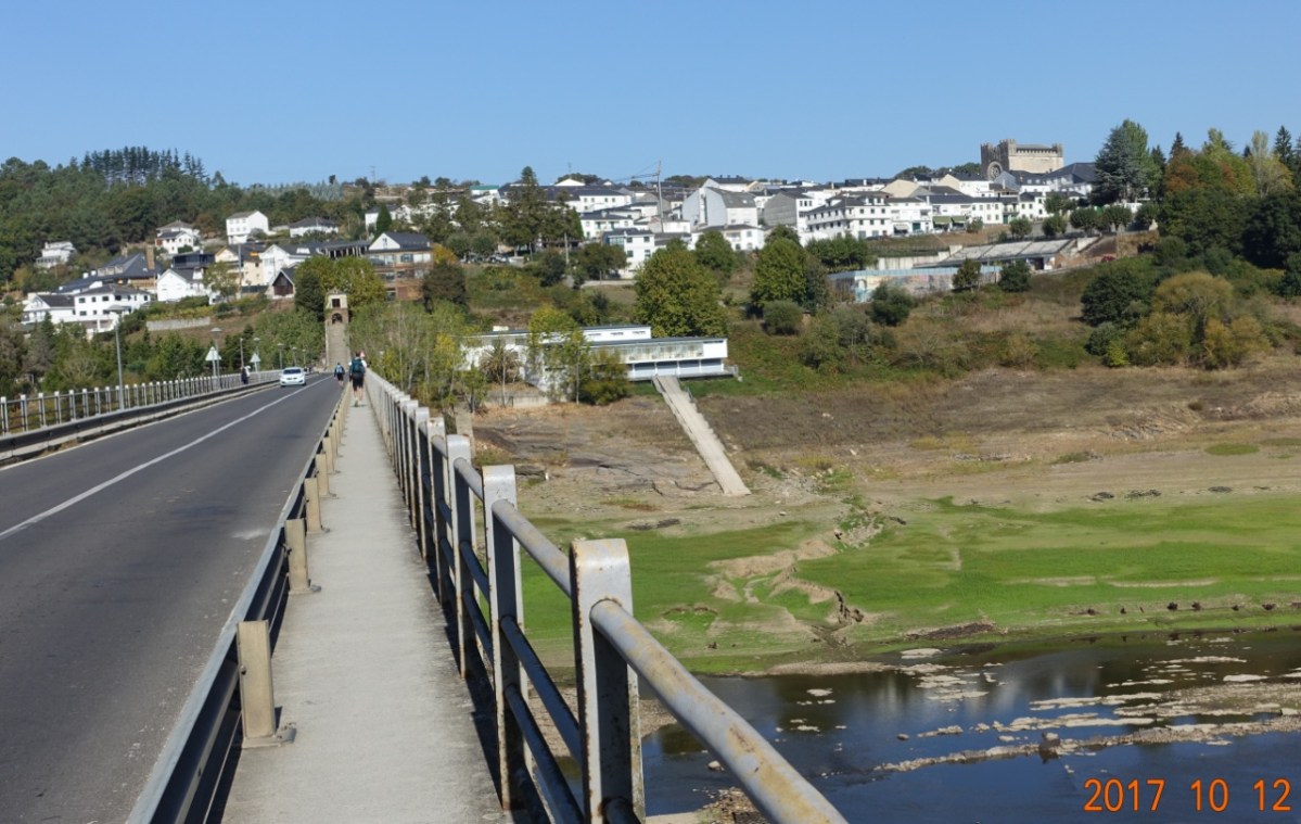
After a long downhill stretch, I arrived at the long bridge over the lake into Portomarín. In the photo, everything seen as bright green was covered by water last year. This has been a very dry year – Northern Spain is in need of rain, and the lake of very, very low.
When I got to Portomarín and the foot of the stairs into the town, I caught up to a man from Mexico I have seen in hotels several times, and some of his friends, including Rodrigo from Los Angeles. The whole group of us decided to stop for a drink before checking in to our accommodations. Several of the group were having a popular drink here, half red wine and half Coca-Cola (doesn’t sound good to me, but it IS popular here)…I had a Coke.
Here are the pictures from the stairs:


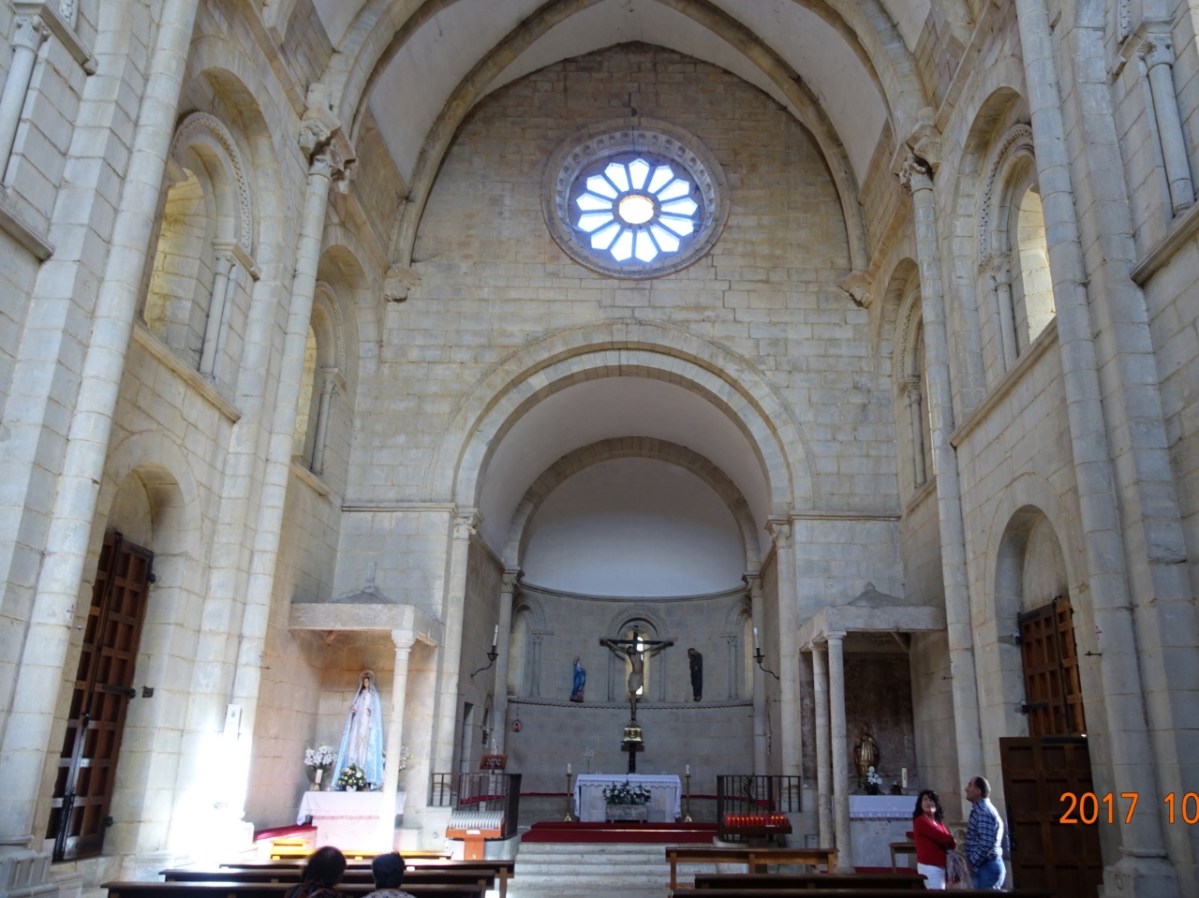
I got checked into my hotel, then walked around a little (without my backpack). The main church in the town is a very austere Romanesque fortress church of Saint John. It was painstakingly rebuild from the original site when the hydroelectric dam was built which caused the old site and town to be submerged under the waters of the reservoir. Here is a front and side view. The side door is the main entrance.


Inside, the church is elegant in its simplicity:
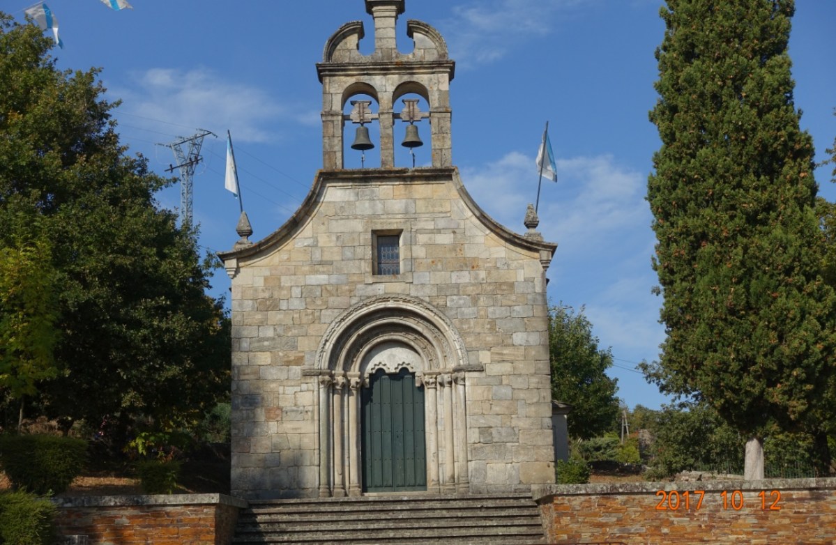
In my walking around a bit, I found another, much smaller church, but this one was not open. Also very simple and austere in its presentation.
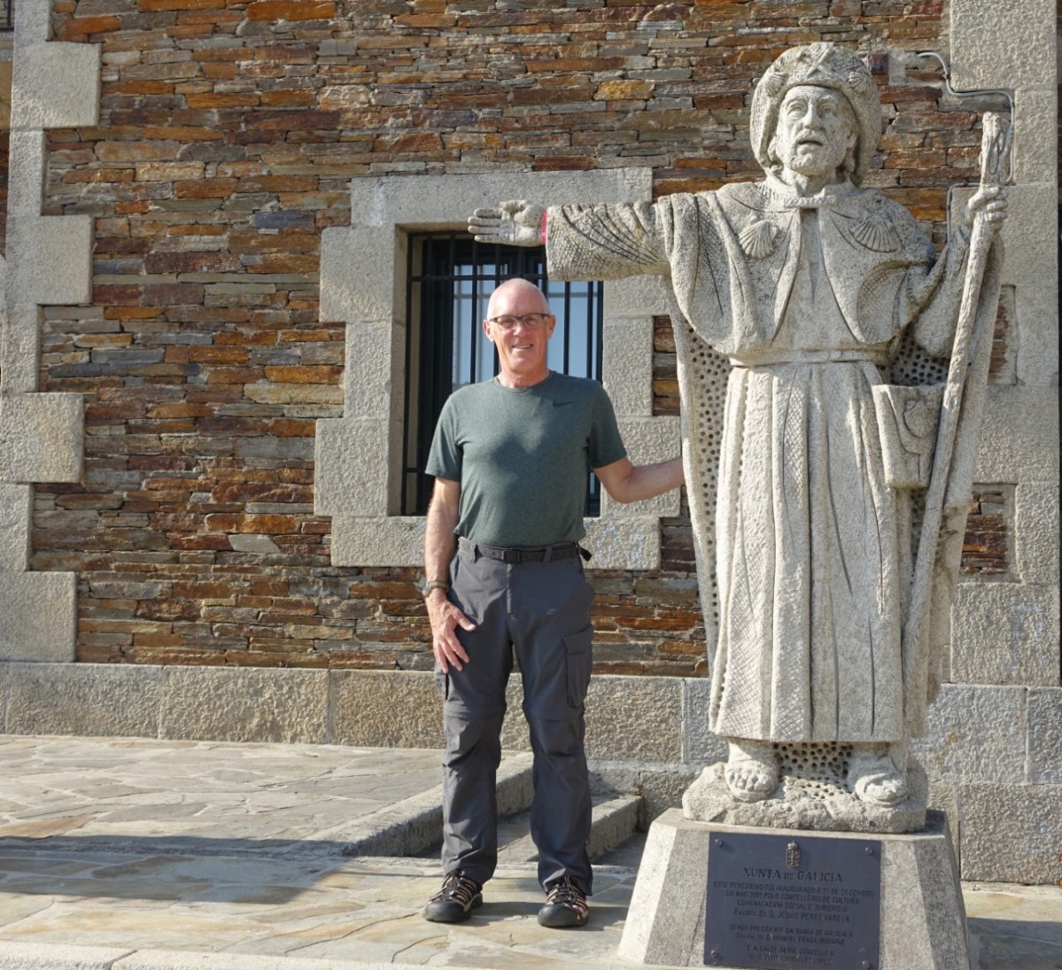
And here I am in the square in front of the church at the statue of Saint James as a pilgrim, pointing the way to Santiago de Compostela.
Another town with poor internet access, so there has been a delay in uploading the pictures.
Next: Another 15 kilometers uphill on the way to Palas de Rei. I’m hoping to have time tomorrow to divert 5 kilometers (2.5 each way) to see an old church at Vilar de Donas. Vilar de Donas is a historic monument and once the seat of the Knights of Santiago. The church itself is from the 14th century, but the origins go back to the formation of a convent here in the 10th century. Getting there depends on how my feet feel.

No weather report today, Jim?
LikeLike