Monday May 23, 2016
Walking out of Santiago to Negreira Walking day #32
I have very poor internet access here, so I will up load the pictures and write the text tomorrow. Walking out of Santiago was interesting, because there are very few pilgrims walking to Finisterre, so it is much like the Camino was nearer to where I began in France.
I did make it to Negreira, and will walk three more days to reach Finisterre, historically known as “the end of the earth.”
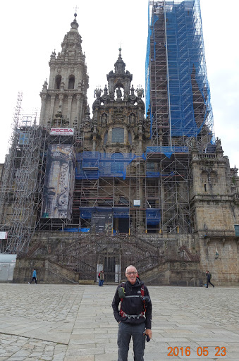
A picture of me in front of the Cathedral in Santiago de Compostela. The scaffolding is for a multi-year cleaning of the cathedral structure. A group of five from Portugal took this picture, and I walked about half the day with them. (I thought I had pictures of them, so I’ll have to review my source photos.)
Right on the way out of town, the route to Finisterre is evident. There are not as many Camino way markers for th Camino Finisterre as there are going to Santiago de Compostela, but there are enough.
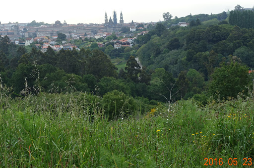
Looking back to Santiago de Compostela we get our last view of the cathedral. Very soon, we will disappear into a forest.
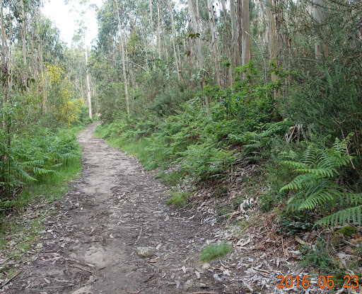
And here we are, barely out of the city (Santiago de Compostela is the capital city of Galicia, and the metropolitan area has a population of about 200,000), and we are in the forest, with the traffic noise almost gone.
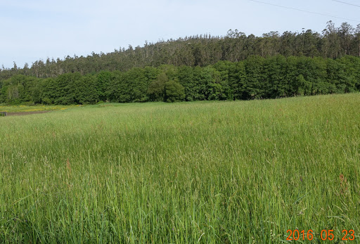
And soon we are in farmland outside Santiago. Quite green, quite beautiful.
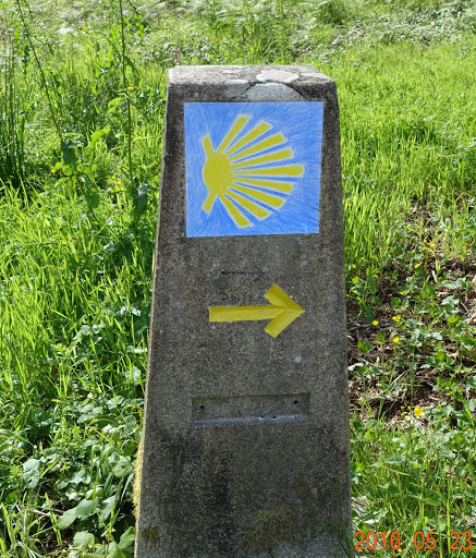
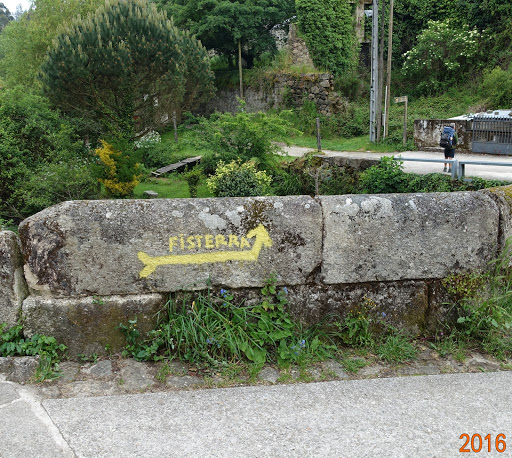
The Camino Finisterre way markers are very consistent in their treatment of the shell graphic. It is commonly said that on the shell, the point where the lines converge represents Santiago de Compostela, so if we are going away from Santiago, we go away from that point, or in this photo, to the right, just as the yellow arrow shows. This idea is not consistently followed going towards Santiago on the Camino Frances (the route I followed), but on the Camino Fiinisterre, the Camino way markers are very consistent.
In the forest, going up a rather steep hill. We traverse six large and small river valleys today on our way to Negreira. Each river valley means descending into the valley, and ascending back up the other side.
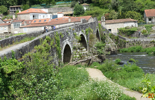
Here we cross a fairly large river on this old stone bridge. This bridge has the same look as others that are said to have been built by the Romans. Regardless of who built it, it is very old and very strong.
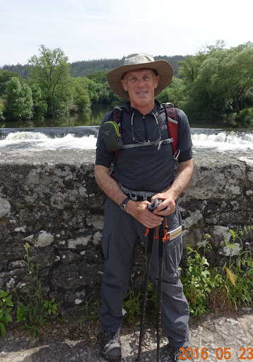
Here I am on the bridge with a small rapids in the background. It is a warm day, sunny and for the first day on this entire trip, I have my sleeves rolled up.
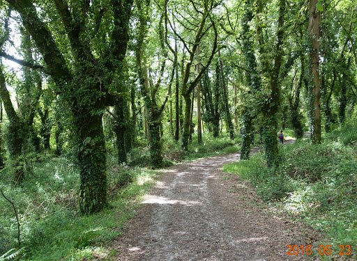
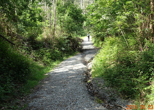
Back into what appears to be an old-growth forest. The path is good, with very little mud. These more dense forests are quite dark; it is hard to tell that from the photo, because the camera tries to lighten the shot, but it is much darker than being out of the forest in the sunshine.
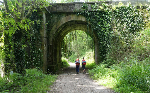
Getting closer to Negreira, we go under this bridge crossing the adjacent river along which we are walking. This bridge is modern (relatively), but still quite old.
I will need to review my pictures…I seem to be missing some. There was a 3 kilometer (almost 2 mile) long steep uphill we had to climb, and it was a long, long unrelenting climb. I walked that climb on my own, having left the Portugese group behind at a coffee-con-leche break.
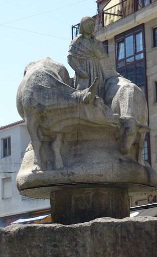
I do not exactly understand this status/sculpture in Negreira. It appears to be a pilgrim with two bulls coming around. Interesting enough to take a picture.
Next: Walking to Olveiroa 33 kilometers in likely rain.

hi jim –tom here, must be difficult departing Santiago after all the hype surrounding this town and it pilgrim,for you its less a destination and more part of the journey, bravo the coast beckons!!!!and warmer weather . my question is it better to walk 5-10 kms before 10am breakfast then continue to late lunch rather than breakfast and commence the day?
LikeLike