Wednesday 14 January 2015 The Wall and The Moat
The word “chiang” in the city name Chiang Mai, is thought to mean “city”. Historically, however, it meant “walled city,” a city with a wall around it. King Mengrai build a city named Chiang Rai farther north of Chiang Mai, but it was close to Burma, and the Burmese too often fought with his people.

So King Mengrai and two neighboring kings (there were smaller kingdoms then), laid out and built a new walled city, also surrounded by a moat to help keep out the Burmese.
These are the three kings who founded and laid out Chiang Mai in the late 1100s. King Mengrai in the center, King Ngam Muang of Phayao on the left, and King Ramkhamhaeng of Sukhothai on the right. I just love the attitude of the Three Kings in this statue; they look proud and confident.hai, the work “new” is “mai”, so Chiang Mai properly translated is the “new walled city.”
Today, I decided to walk the entire circumference of the wall/moat and take pictures. The wall is almost 2 km or about 1.25 mile approximately square. The wall is now mostly gone. The four corners and the five gates had restorations in the 1800s, and again in the 1960s. Large parts of the wall itself was taken down by the Burmese during the times in history when they occupied the city.
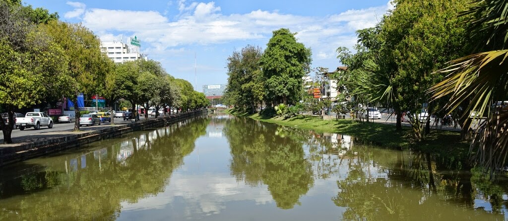
The moat was once more than double its current width. I have heard that in the early 1900s, when the perimeter road was built, to get the land needed, about one half of the moat was filled in.

I started this walk at Tha Phae Gate, the gate or entrance on the east side of the wall. The moat outside Tha Phae Gate has been filled in and the large square is used for celebrations, like New Year’s Eve, and for various markets some evenings.
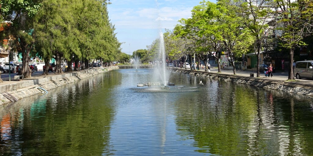
Looking north from Tha Phae Gate along the moat up to Si Phum Corner. From this far away, Si Phum corner is not yet visible. And for a long stretch here, there is no wall along the moat.
Gotta get hiking.

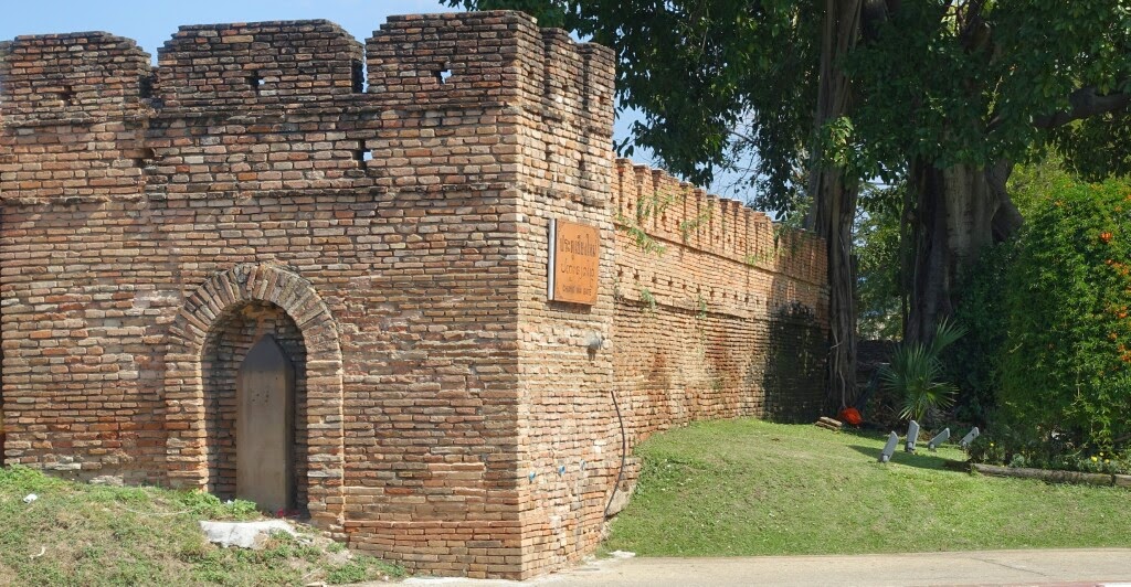
The corners of the wall were built with rooms for the soldiers who watched out for the city. In the distance is Si Phum Corner, the northeast corner of the wall.
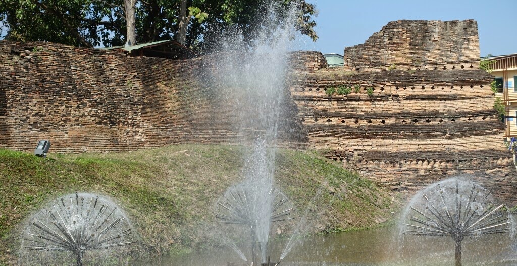
Another view of Si Phum Corner through the fountains in the moat.
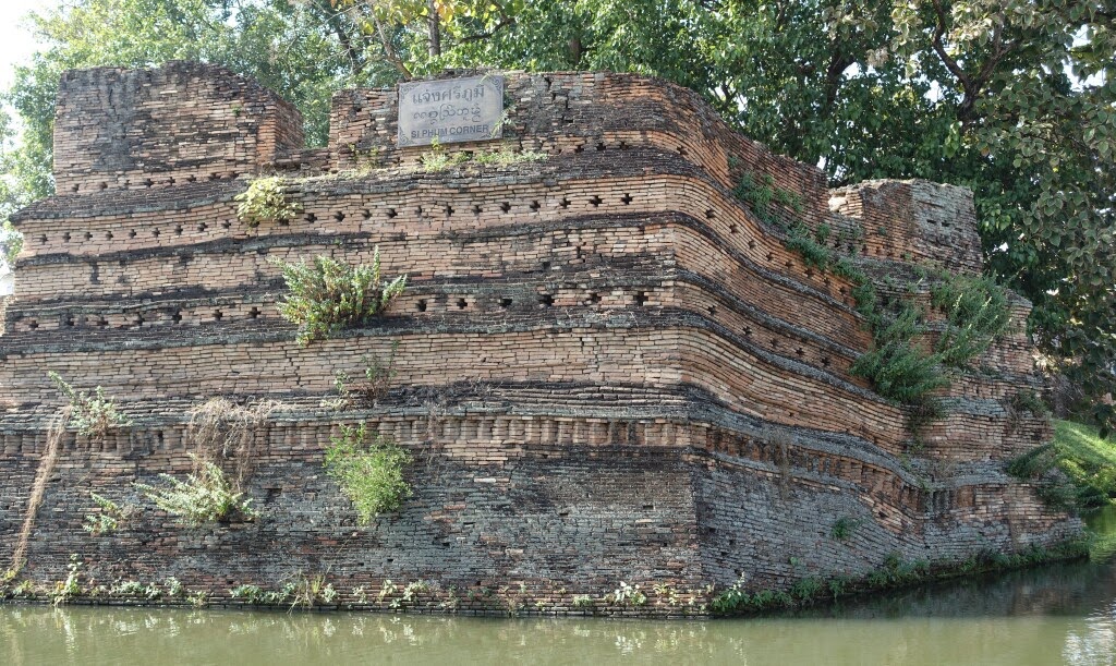
A more direct view of Si Phum Corner. Of the four corners, this is my favorite. Hard to saw why, as they are all very similar looking, but I like Si Phum Corner.
Approaching Chang Phuk Gate, the gate on the north side of the wall. In early times, each gate had one primary purpose. Chang Phuk Gate was for royalty only to enter and leave the city.

About in the middle of the north side of the wall/moat on the outside perimeter road is something of a surprise, the 3 Little Pigs Soul Kitchen. In Chiang Mai. Serving BBQ ribs, creole, and gumbo. Chiang Mai is definitely international!
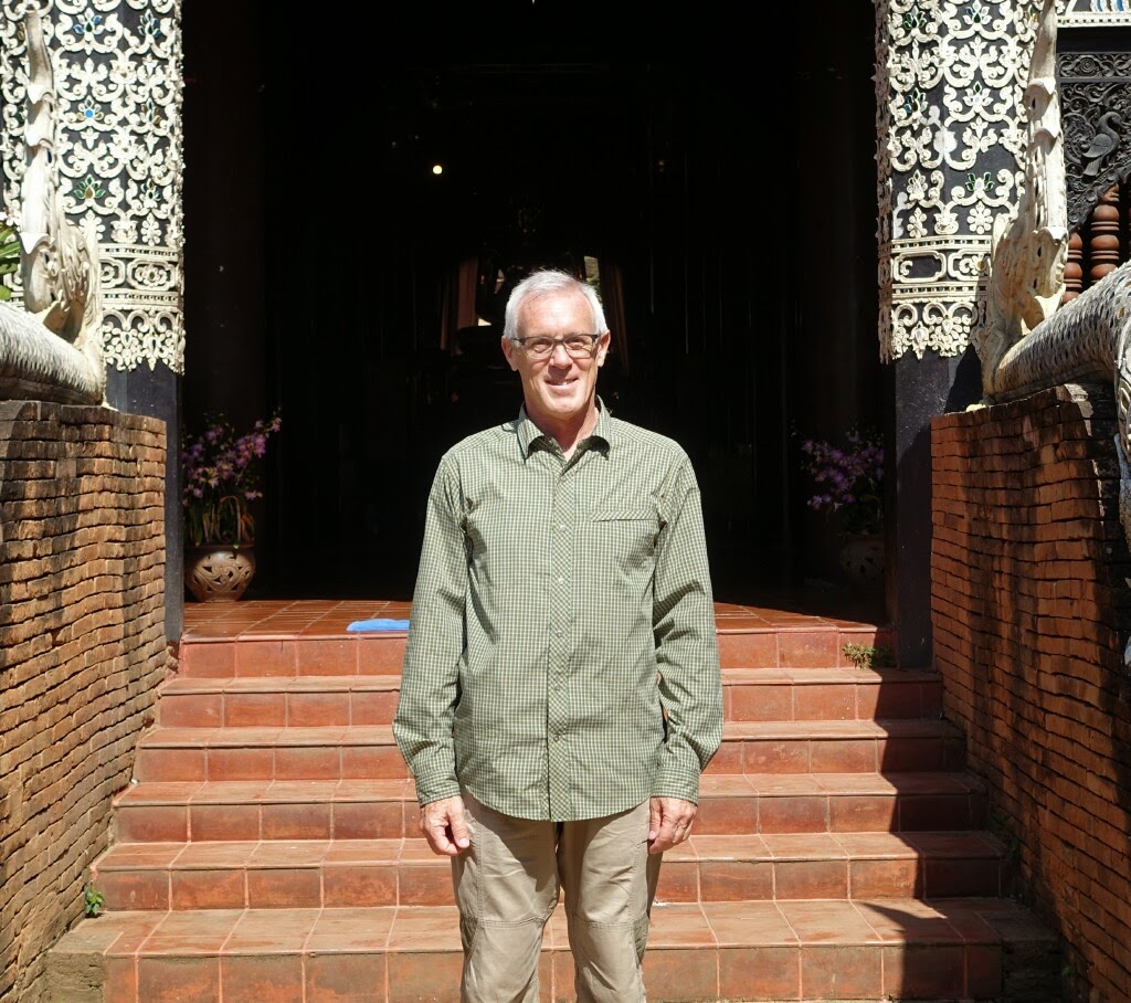
I stopped in to look at Wat Lok Molee, and a nice Chinese lady offered to take my picture. I am really in Chiang Mai – this is not a set in Hollywood.
(More on Wat Lok Molee another time; it is one of my favorite temples,)

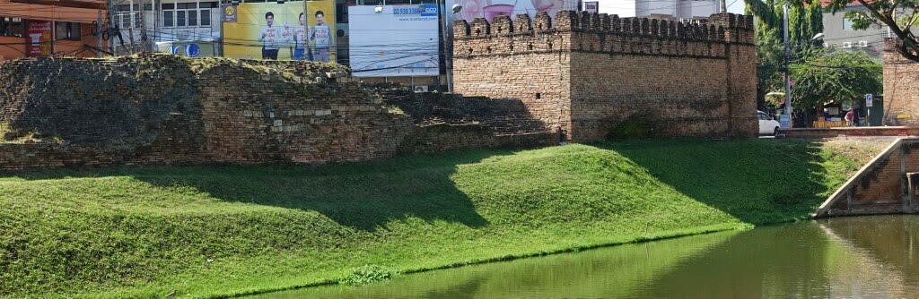
Approaching Hua Lin Corner, the northwest corner. The wall here is fairly short, maybe only 6 or 10 feet above the ground.

Closer to Hua Lin corner, and the wall is much taller which is hard to see through the trees (and looking into the sun).
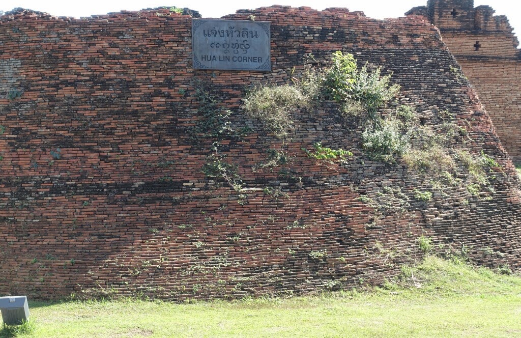
The large rampart at Hua Lin Corner. This corner was where originally, water flowed into the moat from a nearby small river. Water then flowed along the north to Si Phum corner and then south along the eastern side, as well as south and then east, meeting and exiting at the southeast corner, Katum Corner.
Looking south from Hua Lin Corner towards Suan Dok Gate. another stretch with none of the wall left.

This is part of Suan Dok Gate. The area on the west of Suan Dok Gate was the king’s flower gardens. And Suan Dok translates to “flower garden”. A fitting name for the gate to the flower gardens…flower garden gate.
Another view of Suan Dok Gate (avoiding the cars and trucks on the road).

Ku Huang corner, the southwest corner of the wall.

Then I walked along the south end of the moat. There are two gates on the south. the first gate I passed is Suan Prung gate, which was originally used for cadavers to be moved out of the city for cremation. Even after hundreds of years, some Thai people believe Suan Prung gate to have bad energy, and do not use that gate much. It looks much like the other gates to me.
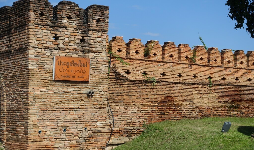
The second gate on the south is Chiang Mai Gate. (And it also looks essentially like the other gates.) This was the gate used by most people, as it connected with the road to Lamphun, a city closely connected historically to Chiang Mai. Both Lamphun and Chiang Mai were at different times the seat of the king of the Lanna kingdom.
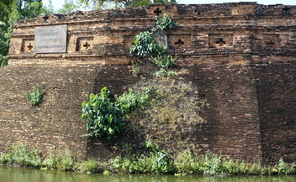
At the southeast corner is Katam Corner. This is where the water from the two sides flowed together and left the moat. In the pool, fish accumulated, and people used traps to catch the fish. A small fish trap is a “katam” thus the name Katam Corner.

Then walking north along the eastern side and I arrive back at Tha Phae Gate. A young man from Australia took my picture. I walked with him and his friends to Wat Chedi Luang, and told them of a few of my favorite temples. They really liked Wat Chedi Luang (as do I).
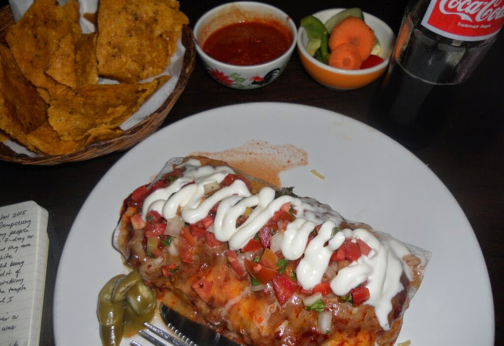
Now it was time for dinner. I was told that better than Loco-Elvis is a place right across the moat called El Diablo Burrito. So it seemed fitting to check this out. The chips and salsa are better than Loco-Elvis, and the pork burrito was quite good. I also had a Coke (as can be seen in the picture…Coca-Cola…same emblem.)
A good meal to end a day of walking.
Next: Nimmahaemin Road, Shopper’s Paradise
